TYLER, Texas — Something unique and fascinating is happening right before our eyes this week and it will help to forecast the upcoming winter.
The upper level steering currents or jet stream winds across North America are becoming reenergized. This means a new and unique weather pattern is developing and will continue to develop as Oct. unfolds and turns into Nov. Now is the time to watch where storms develop and take note of their movement and track their strength.
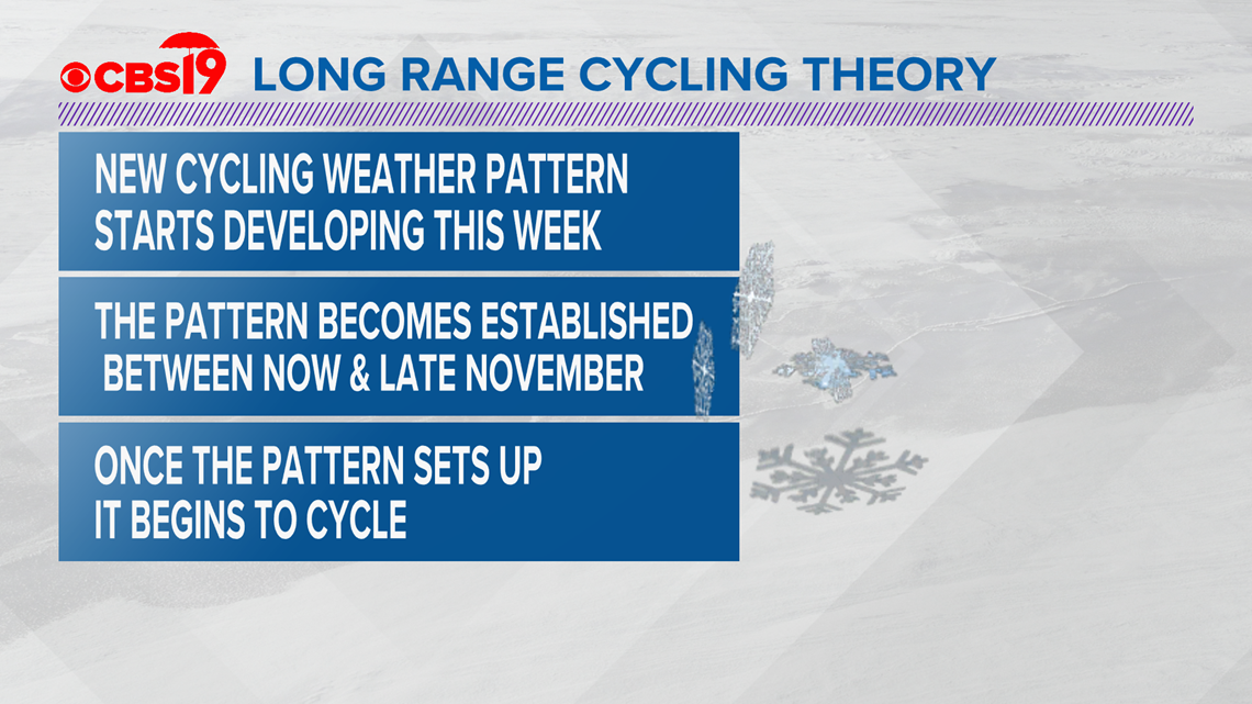
You'll recall, our research, published in a January 2018 article, in the Journal of Climatology & Weather Forecasting, shows a new weather pattern sets up every autumn and begins to cycle. This is starting to happen.
The article, Cycling Weather patterns in the Northern Hemisphere, 70 years of research and a New Hypothesis, details how signature storms within the cycling weather pattern can be used to help prepare you for cold blasts of air and for snowstorms. We had both last year.
My goal is to use the Lezak Recurring Cycle (LRC) in conjunction with the regular suite of forecast models to bring you the most accurate forecast in East Texas. If we plug the LRC into the equation, we can get a better feel for what will happen.
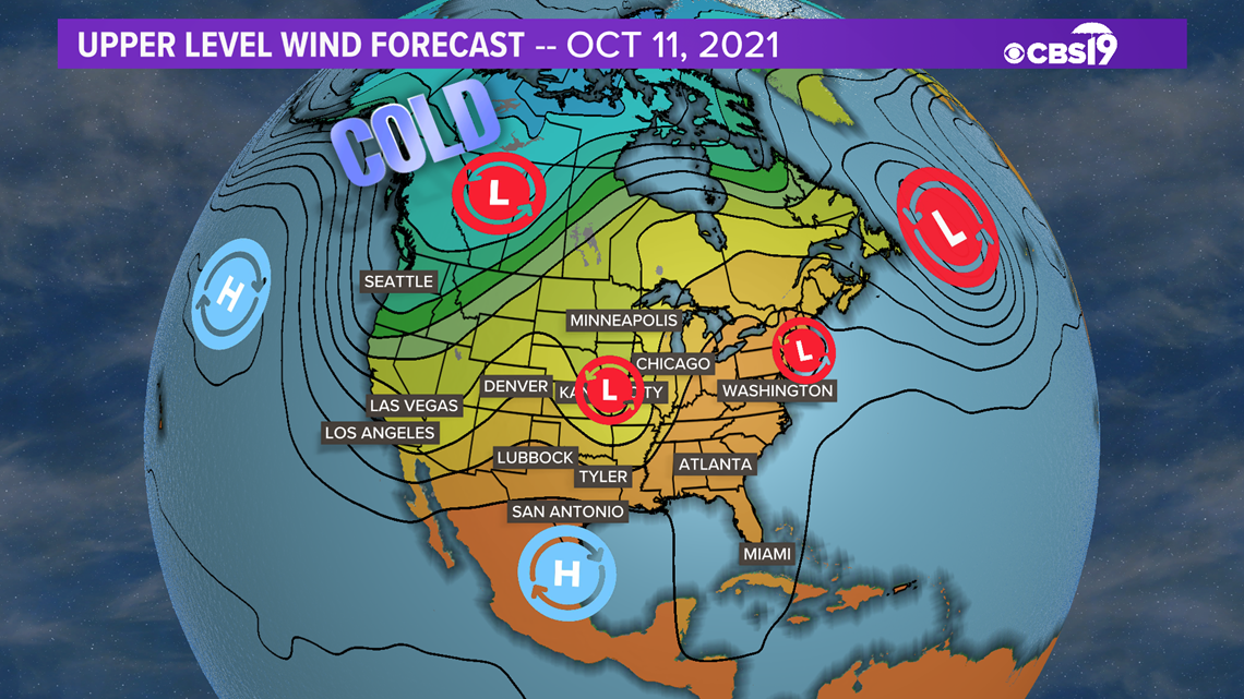
For instance, there is a storm forecast to move across East Texas early next week. Below is a look at the 500 millibar forecast map for the morning of Monday, Oct. 11. Look at the center of the image below and pick out the "L" north of Tyler. This small, quick-moving storm is forecast to move a weak cold front into North Texas. It's not a strong storm but we know from year's of forecasting and research that this storm will likely repeat sometime in the future.


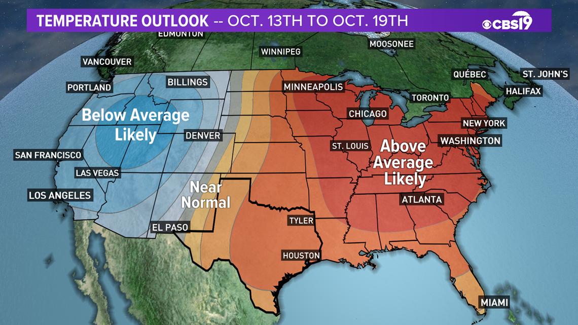
We don't know yet when this storm will repeat. That's because it takes several weeks for the new pattern to become established. If you look at the above graphic again, you'll see an area of high pressure near San Antonio. This is a ridge of higher heights. When air has a higher height it will sink and can create warmer than average weather. It often results in high pressure at the surface which is typically associated with clear, dry weather. The medium range forecast through the middle of Oct. calls for warmer than average temperatures over much of the United States with below average temperatures forecast for the western half of the nation.


Once the pattern becomes established we will be able to better forecast an above average warm spell during winter. We will also be able to forecast whether we see a repeat of the record cold we experienced last Feb.
So, to recap here's how the LRC works.


Keep checking CBS19.tv as we update the evolution of this year's LRC. This will be the first full year I use this state-of-the-art, long-range forecasting method here in East Texas.
Make sure to follow me on Twitter, Facebook and Instagram, as I will provide links on those social media sites to articles and other blog entries regarding the LRC.
As always, if you have any questions, please email me BAnthony@cbs19.tv
RELATED: Texas senators blast regulator for power grid winterization loophole lawmakers wrote into law


