TEXAS, USA — Christmas is just three weeks away, but our area is already getting a feel for what kind of holiday weather we'll experience.
How can we predict the weather in advance? We use something called pattern recognition and apply the principles of the Long Range Cycling Weather Pattern theory.
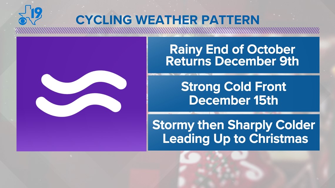
The Long Range Cycling Weather Pattern theory operates on the premise that every autumn a new and unique weather pattern develops. It usually happens between the first week of October and the last week of November. We pick out signature storms within the cycling weather pattern and make extended forecasts based on when those storms return within the cycle.
We are seeing one example of that this weekend. An unsettled weather pattern developed at the end of October and it gave us a rainy, if not stormy period right before Halloween. A similar-looking weather pattern is forecast to develop this weekend. There are differences between the October storm and the December version, but enough similarities that we have high confidence it will rain this weekend.

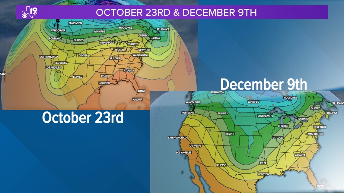
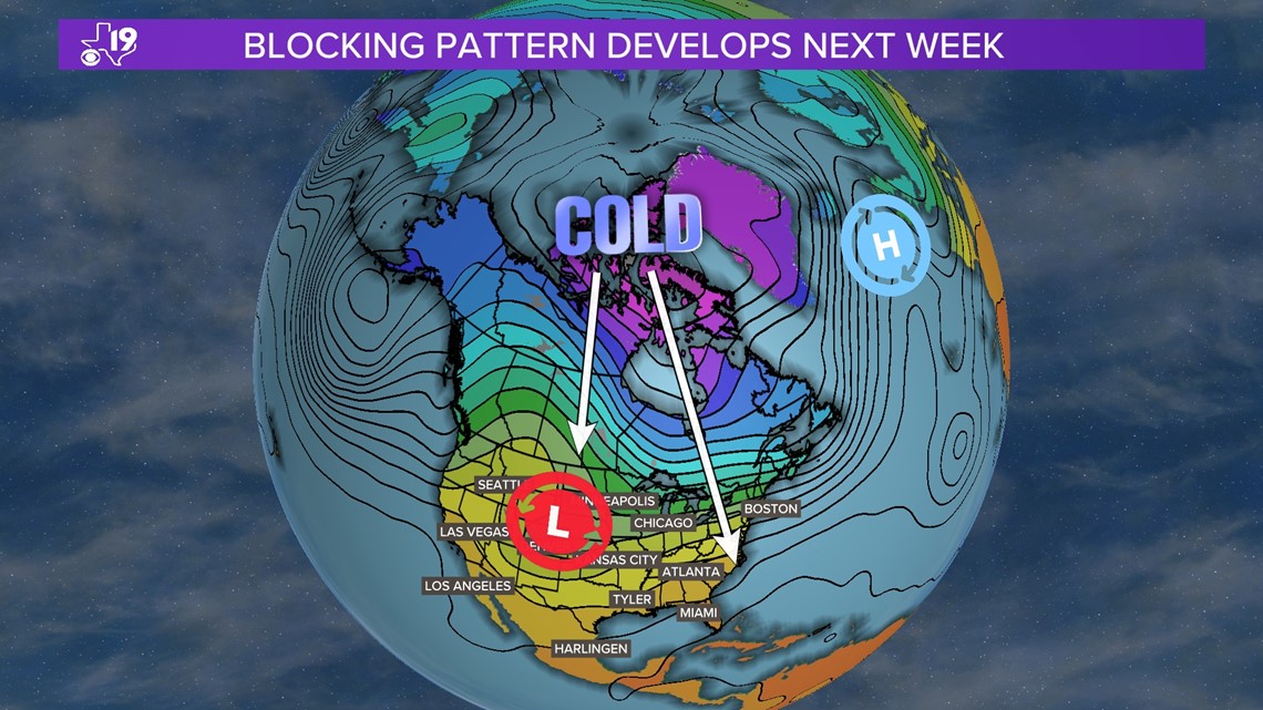
On October 26, this storm provided East Texas with nearly two inches of rain. You might also recall that in the wake of the storm, we saw our first frost and freeze of the season in early November. That happened when a strong high-pressure system developed near Greenland. That blocked up the wind flow aloft and forced the jet stream to flow almost north to south across the United States. That brought a chunk of cold air down from Canada and pushed it all the way to the Gulf Coast. We will see that again next week, so look for a chilly stretch of weather between Dec. 10 to Dec. 15.

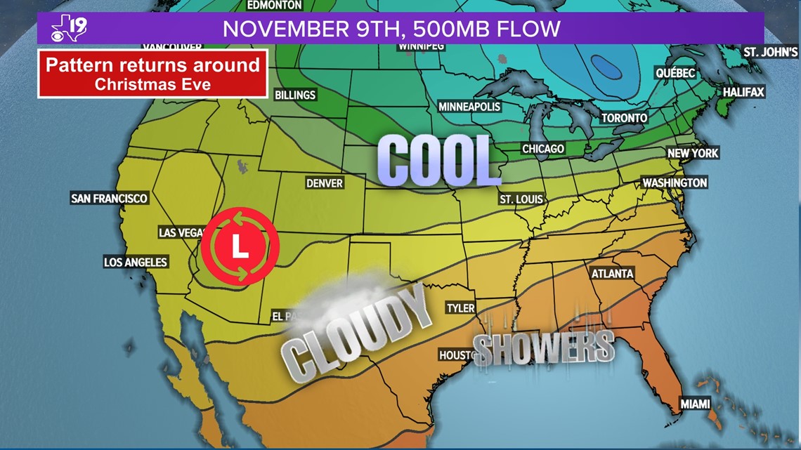
This won't be the only colder surge of air. There should be another surge of cold air around December 21. Unfortunately for snow lovers and those dreaming of a white Christmas, the pattern modifies right before Christmas and a southwesterly wind develops bringing in some mild and damp air around Christmas Eve and Christmas Day. This is a similar weather pattern that first developed around November 9.

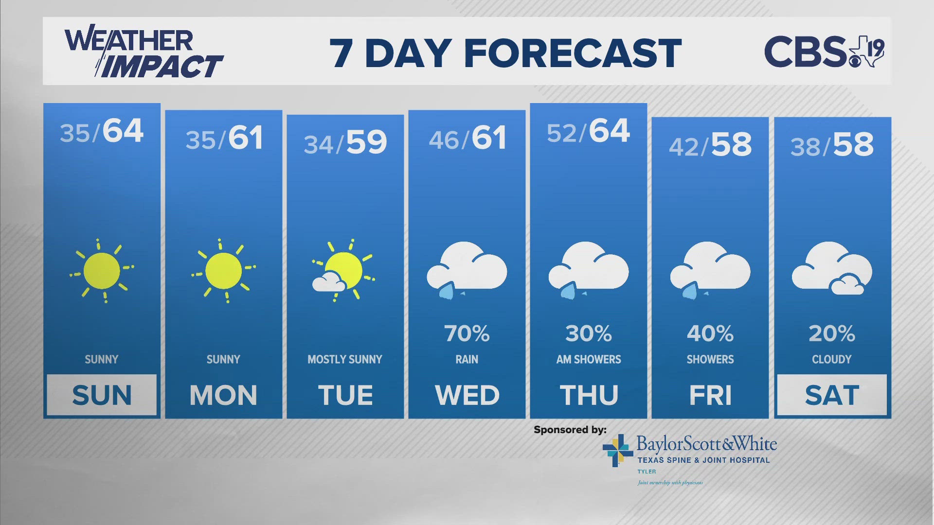
Right now, Christmas Eve and Christmas Day appear cloudy, cool, and damp with a chance of rain showers. The temperature in the morning will be in the low 40s and afternoon highs in the low 50s.
So much for a White Christmas, but don't worry kids that's never stopped Santa from flying his reindeer and making his rounds.
So to recap, expect a very wet storm around December 9. A shot of cold air between December 10 and December 15. And a warmer but wetter weather pattern for Christmas Eve and Christmas Day.

We hope this weather blog helps you plan for the holidays. If you want to do activities such as out up your tree or hanging up the lights, wait until this weekend, Sunday preferably.
At this point, make sure you ask Santa for a new pair of windshield wipers because you might need them on Christmas Day.
Any questions about the forecast email me at BAnthony@cbs19.tv. Have a happy holiday season!