

TYLER, Texas — They say what's goes around comes around. Well our weather pattern continues to cycle and that means it's time to look for some cooler than average air to return to East Texas.
This year's unique weather pattern set up way back in October and has been repeating about every seven and a half weeks. Signature parts of the pattern brought cold shots of air to East Texas in early December and again in late January.
To identify these signature features we look at 500 millibar charts. Five-hundred millibars is roughly 18,000 feet above the surface of the earth and about halfway up through the atmosphere.
Examining winds at this level can tell us the location of high pressure systems and low pressure systems. In other words, fair skies or stormy skies. And we can tell which way these weather systems are moving. In December, there was a large area of low pressure over the central United States.

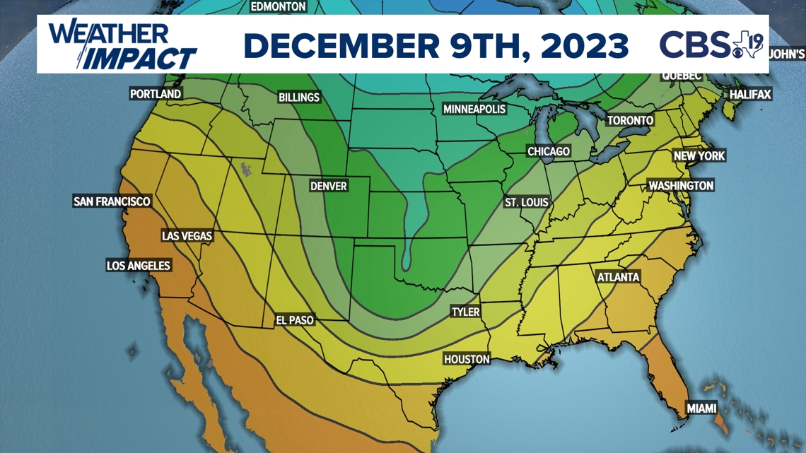
This weather pattern produced cooler than average temperatures and repeated in late January. That time around it brought nearly two inches of rain and much cooler than average temperatures to East Texas. This pattern repeated three more times in March, April and June and now it returns the second half of July.

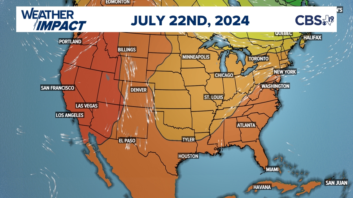
It's important to point out there are seasonal differences when these weather patterns repeat. For instance, when this pattern rolled through in December and January we had freezing temperatures. In fact, the part of the January pattern produced our coldest morning temperatures of the winter. However, we're not going to have temperatures in the teens in July but we will have below average temperatures likely through the rest of the month of July.

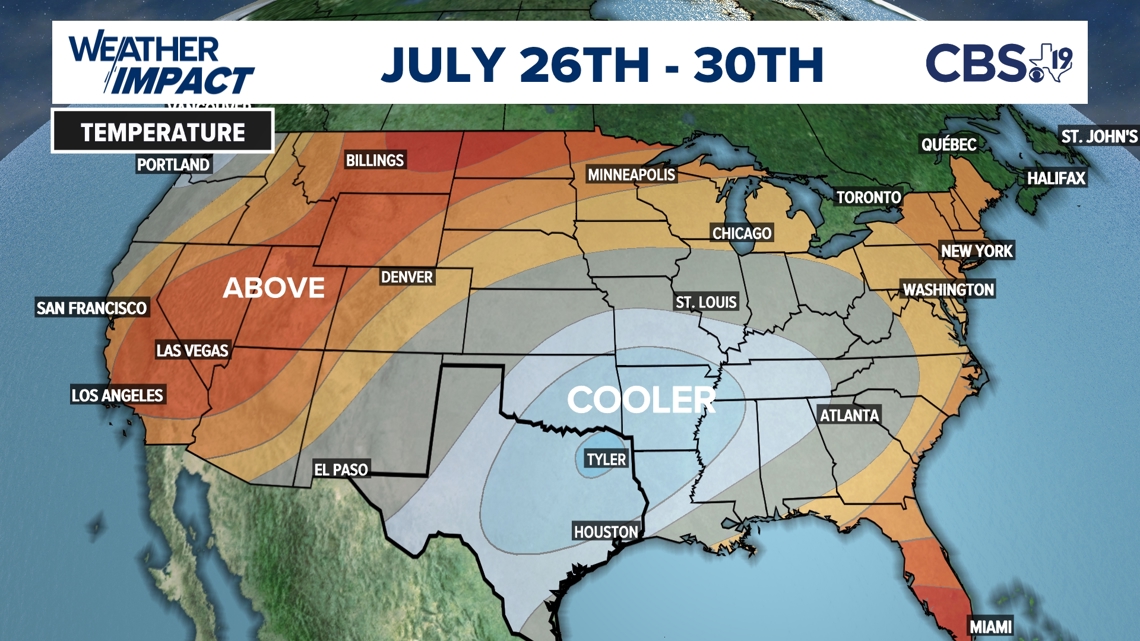
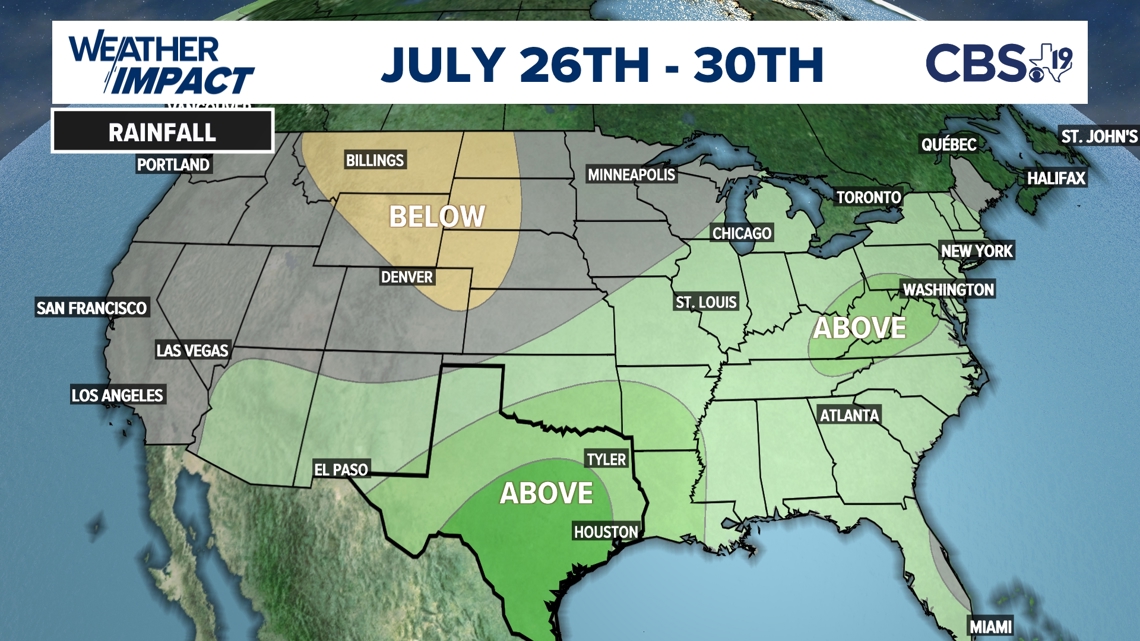
We all remember what happened the night of June 3, East Texas got blasted with 70 to 90 mph winds during thunderstorms that knocked out power and damaged several homes. Many large trees fell into homes near Lake Tyler and in the Andy Woods neighborhood of Tyler. We won't see storms like that again but this part of the pattern will help produce above average rainfall through the end of the month.

The Long Range Repeating Cycle is primarily responsible for these storms and the weather patterns repeating but the change from El Nino to La Nina is also playing a role. El Nino was officially declared over earlier in June. That leaves us with a neutral weather pattern before La Nina takes over either in August or September. When the weather pattern is neutral, East Texas tends to have more variable weather. So as we head into August can we expect the cooler than average weather and above average rainfall to continue? The short answer is no.

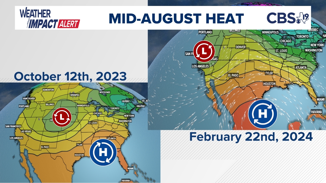
All we need to do is point to the repeating weather pattern. In the middle of October and again in late February, an upper level high pressure system produced temperatures that were 10 to 20-degrees above average. It didn't last long but if we see temperatures 10-degrees above average in mid-August, then we will see a couple of 100-degree days. So, between August 12 and 22, expect a few very hot, dry days with highs between 98 and 102.
Oh, and the first Friday of high school football in late August could get interrupted by thunderstorms.
We hope you enjoyed this CBS19 Weather Blog and learning more about how our repeating weather patterns help us accurately produced long range forecasts. Let us know if you have any questions.
