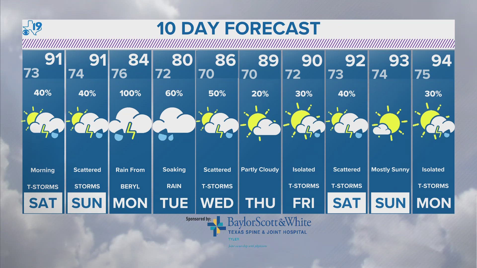
TYLER, Texas — Just when we thought the summer of 2022 was unbearable, along came the summer of 2023. Climatologically, 2023 was the second hottest summer in East Texas on record. So what about the summer of 2024? Could we possibly see another record breaking summer?
Anything is possible but shattering last summer's impressive heat will be a challenge. Why? The biggest reason may the changing of a global weather pattern.
The El Nino weather pattern that dominated our weather since the spring of 2023 is transitioning toward La Nina. There is an almost 70-percent chance La Nina develops between July and September. La Nina's can mean East Texas experiences great variability when it comes to the weather. What does that mean?
It means more rain chances and more days with thunderstorms and potentially much colder air similar to February of 2021. Scary right? We were in a strong La Nina in the winter of 2020 and 2021. El Nino and La Nina is just part of the puzzle.
We can also use the Long Range Cycling Weather Pattern Theory, otherwise known as the L-R-C to predict some key features to our summer forecast.
For instance, a weather pattern that brought a severe weather set-up in January and a warm spell at the end of February will return and bring us a heat wave around July 4.

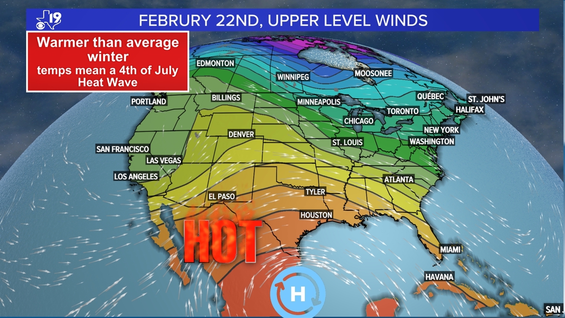

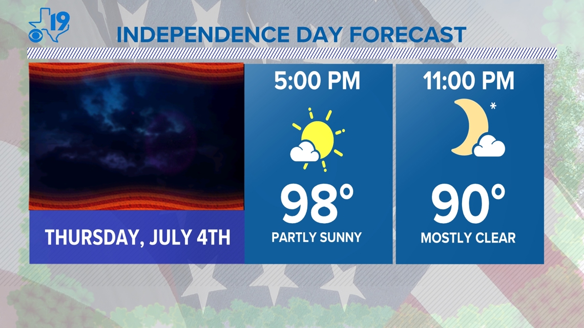
This pattern will likely produce our first 100-degree day of the year. The heat wave is expected to last into the middle of the July when a summer-time cold front will make a rare push to the Gulf Coast.
This will bring much welcomed relief from the intense summertime heat and humidity and will drop our highs into the upper 80s and low-90s with noticeably lower humidity. If you look back at early December you will see an almost 50-degree temperature drop behind the strong autumn cold front.

We won't see that kind of temperature drop in July but highs will probably fall from near 100 into the mid or upper-80s and the humidity drop will make the air feel much better for a few days.
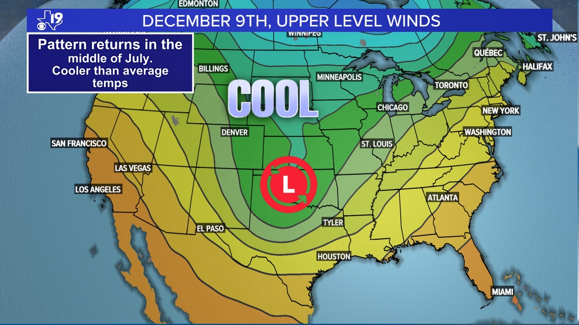
The heat will gradually build through the second half of July and into the start of August. Early August is the time of year when the jet stream reaches its weakest point of the year. Coincidentally this time of the year lines up with a part of the weather pattern that produced a slow, closed off low in December.

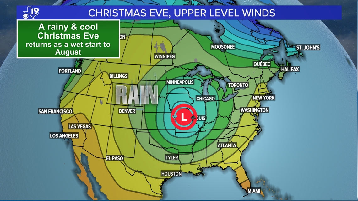
It will be August so it won't be as cool but the repeating weather pattern suggests a rainy start to the month of August, perhaps with a daylong rain that will feel more tropical in nature, complete with some gusty winds and a much needed soaking.
But don't put away the beach towels and flip-flops, the heat wave we see in early July is due for a comeback in the middle of August and last until some heat busting thunderstorms arrive for the first Friday of Under the Lights in late August.