TYLER, Texas — WEATHER ALERT:
A Tornado Watch has been issued for the following counties:
- Anderson County
- Angelina County
- Camp County
- Cherokee County
- Franklin County
- Gregg County
- Harrison County
- Henderson County
- Houston County
- Marion County
- Morrison County
- Nacogdcoches County
- Panola County
- Rusk County
- San Augustine County
- Shelby County
- Smith County
- Titus County
- Trinity County
- Upshur County
- Wood County
A Flash Flood Warning has also been issued for northern Franklin and Titus Counties. Remember, never drive through flooded roads.

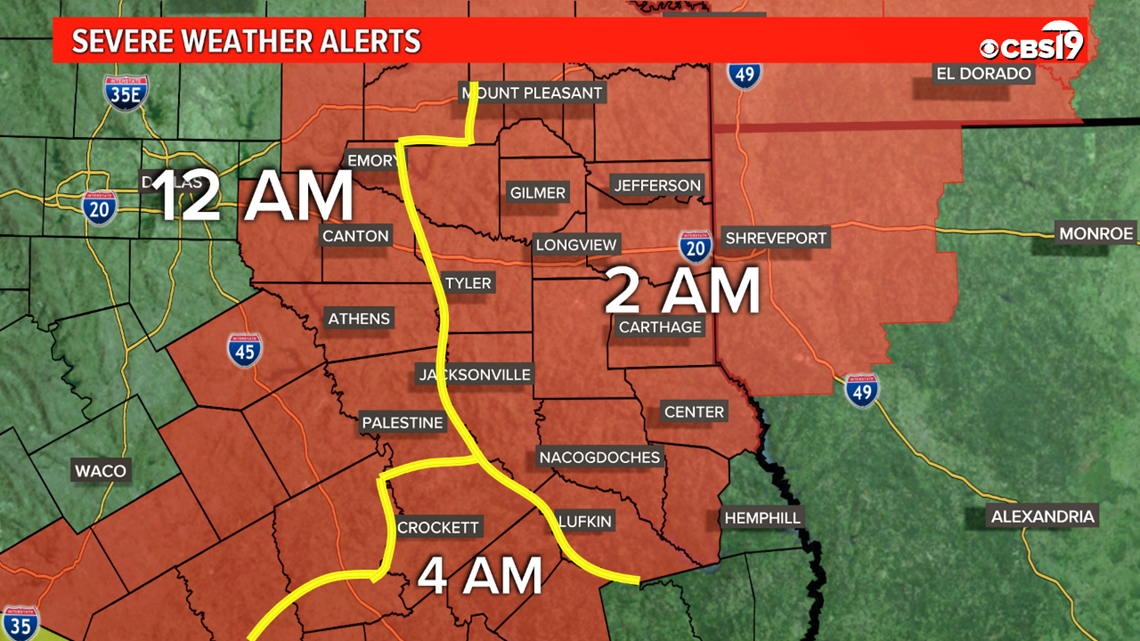
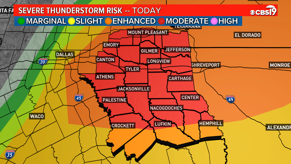
A significant severe weather outbreak is possible for this evening into Saturday morning across East Texas. The Storm Prediction Center is concerned with our area for possible severe weather, including the potential for tornadoes and widespread damaging winds.
Most of East Texas is currently under a "MODERATE RISK" for severe weather, a level 4 out of 5, with areas from Crockett to Hemphill and to the south still under an "ENHANCED RISK," level 3 out of 5.

Here's what we know so far:
TIMING
Storms this evening will continue to grow stronger as we head into tonight. The storms are coming ahead of a strong cold front moving through East Texas Friday evening into early Saturday.

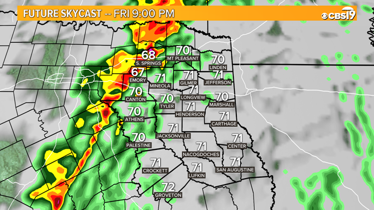
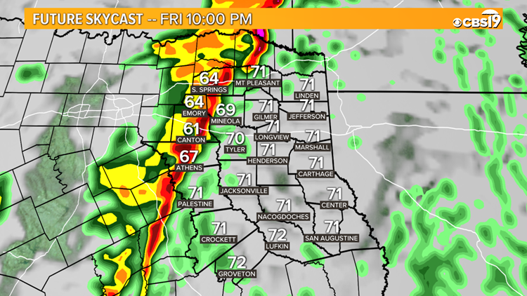
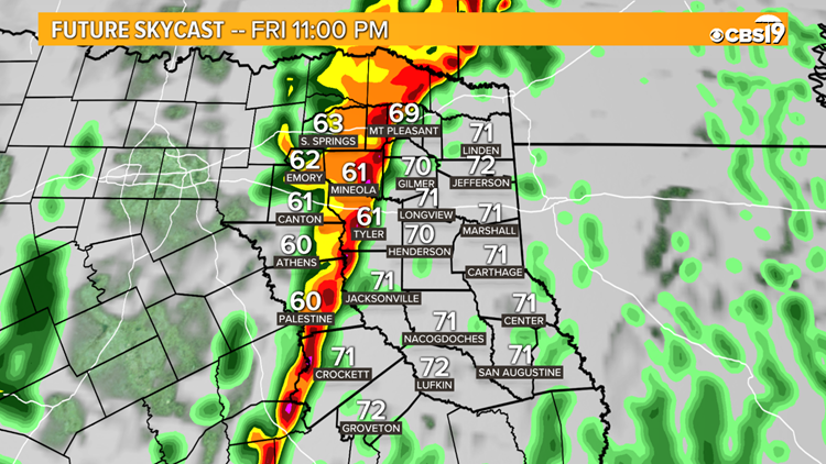
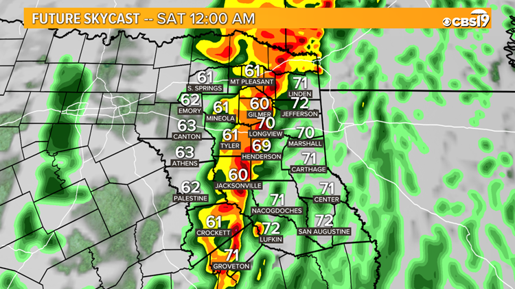
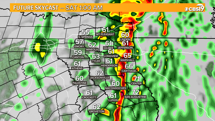
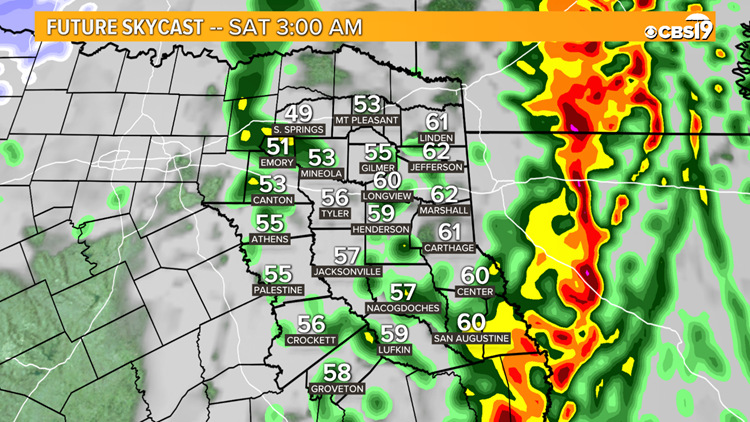
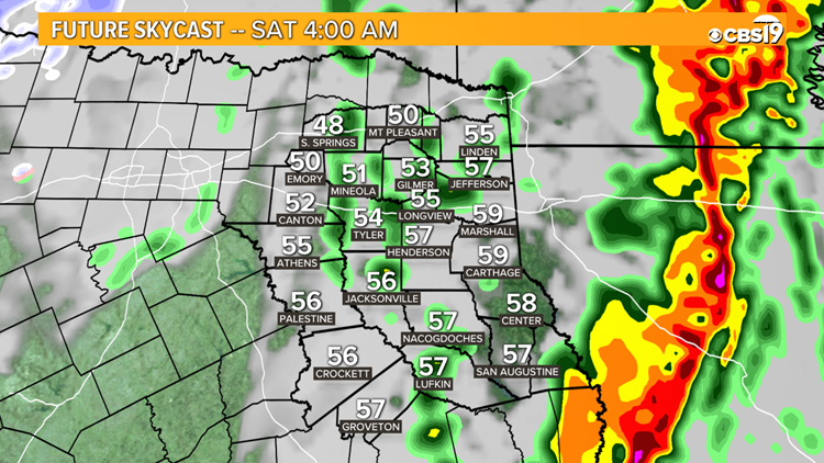
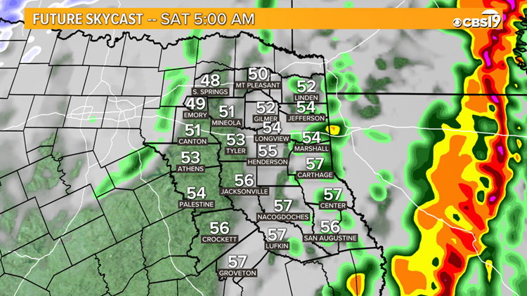
As the front continues through East Texas, it can still bring the threat for severe weather to the entire region. The line will likely reach the Tyler-Longview between 11 p.m. and 2 a.m. The storm will exit our eastern counties in the early am hours of Saturday.
With regards to timing, the line will continue to move through East Texas with the time many are heading to bed. Make sure you have a way to get weather alerts, be that your phone or a weather radio, before Friday night.
You can track the forecast as it sits right now with our CBS 19 Future Skycast in the gallery below.
Future Skycast Timeline Friday 1/10 into Saturday 1/11
THREATS
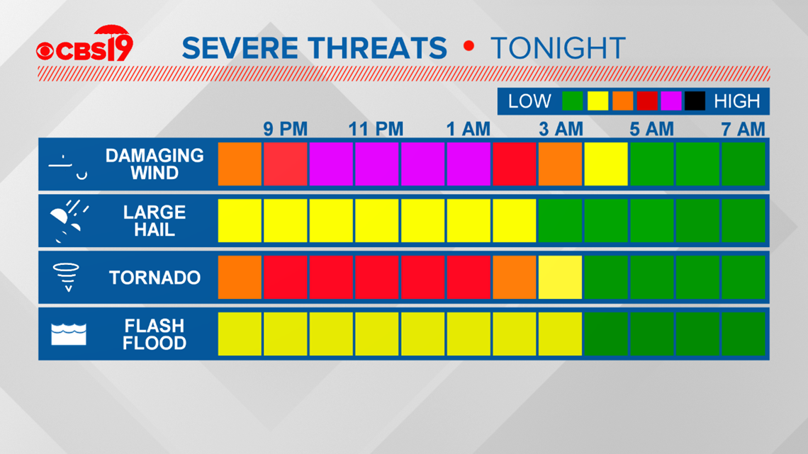
All types of severe weather threats appear to be possible on Friday, including hail, tornadoes, damaging winds and flooding from rain.

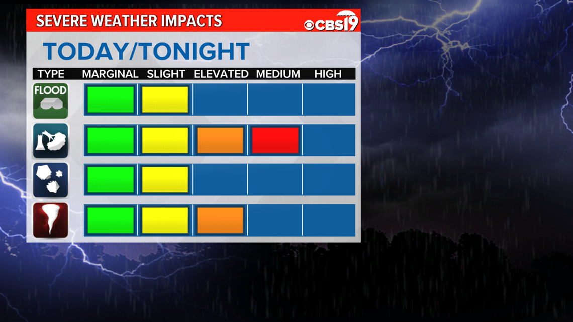
As the line continues to move through, the primary risk factors will change, but all severe weather types still remain possible. The line will bring a primary threat of damaging winds, but the environment will also be supportive for tornadoes and large hail. With the line staling now we are looking at the risk of Flash Flooding. The risk for damaging winds will be widespread and long-lived. Be ready for widespread power outages around East Texas.
Prepare now by making sure you have multiple ways to get weather information, have your device charged, and batteries ready to go.
In addition, heavy rain will remain likely with these storms tonight.

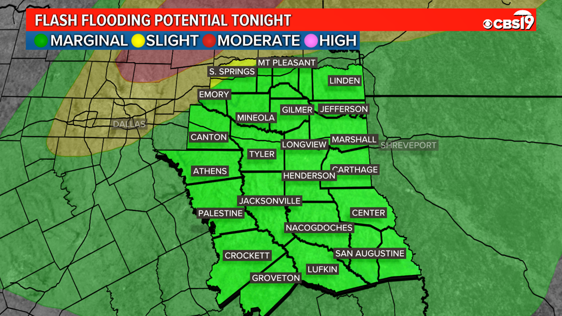
Anywhere from one to three inches of rain could fall around East Texas through Saturday afternoon. Flash Flooding could be a concern for some areas as the line moves through.
The following areas are under a Flash Flood:
FINAL THOUGHTS
Make sure you stay weather aware as we head through tonight and have your severe weather plan ready to go! CBS 19 will have you covered before, during and after the storms!
Connect with CBS 19 on social media:
Do you have a weather report or pictures you would like to submit to the CBS 19 Weather team? You can email news@cbs19.tv and visit our Facebook or Twitter pages.
Stay weather aware with the CBS 19 mobile app.
- Click here to download the iPhone app.
- Click here to download the iPad app.
- Click here to download the Android app.
Stick with CBS 19 everywhere you go. And don't worry, we've got you covered!


