TYLER, Texas — We're closing the April book with typical Springtime rain showers this weekend.
Our storm chances are fairly isolated to Saturday afternoon as a surge of moisture being delivered via Southerly winds sits on top of our region. This, tied with a stationary front, will allow the occasional rainstorm to fire up bringing a rumble of thunder to quick pour. There will be plenty of rain-free, humid hours so don't cancel any plans.
Sunday's rain chances look even lower with a few clouds blended into the forecast, too. Both days will feature warm mornings and muggy afternoons with daytime highs in the mid to upper 80s.
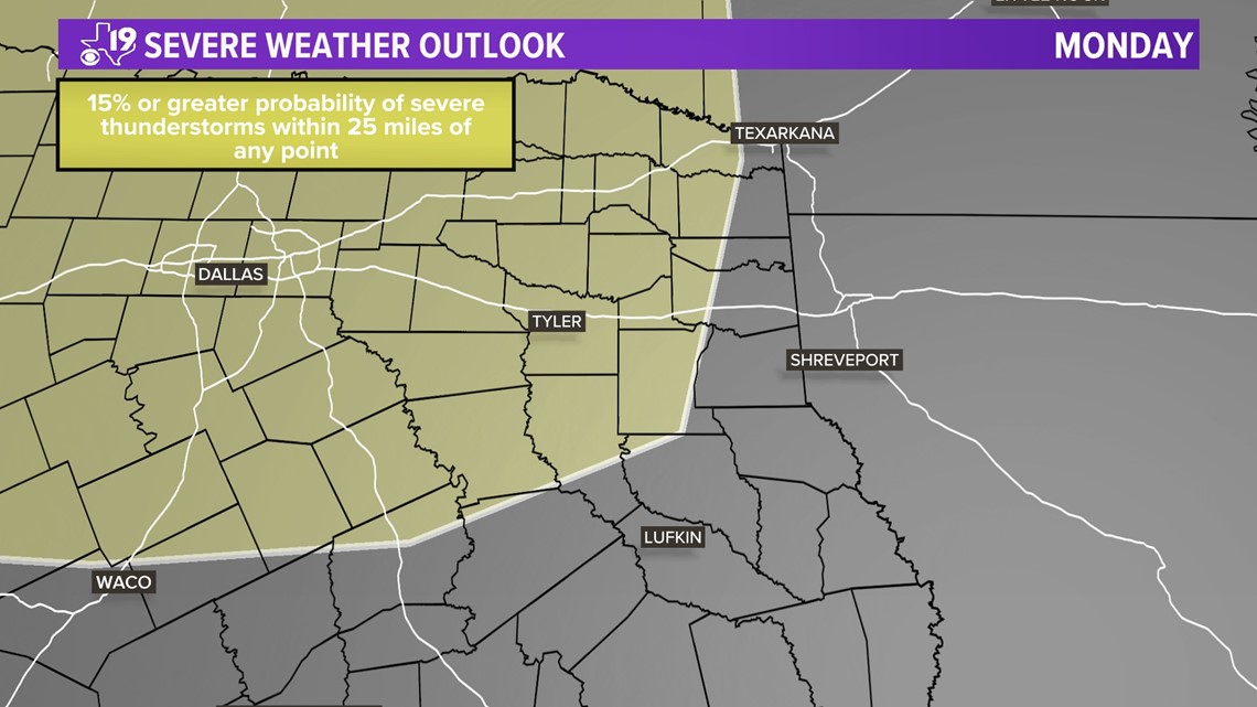
A series of disturbances will ride out of the Rockies into the Midwest into our first week of May. This is paired with warm, humid air driving in from the Gulf of Mexico which can be great fuel to thunderstorm development.
In the near-term forecast, our next opportunity for strong to severe storms looks favorable for Monday evening into Tuesday morning.


Following that, we will have a few more days of unsettled weather into mid-week with a mini "cool front" sweeping through Thursday.
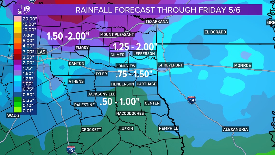
Although our first week of May won't be the driest, it will be beneficial for areas stuck in drought conditions. Two inches or more of rain are possible throughout the week for areas along and North of I-20


