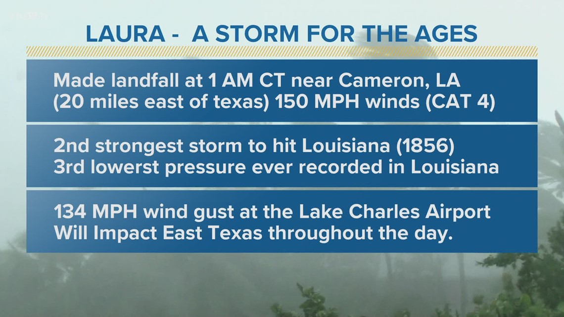
TYLER, Texas — On Thursday morning at 1 AM CT near Cameron, LA, Laura made landfall with winds up to 150 MPH as a category 4 hurricane.

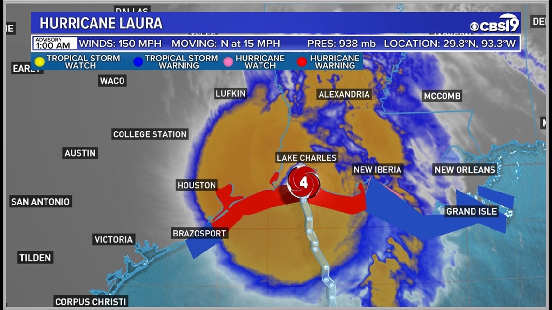
All of the Hurricane Warnings have been removed from counties in our area, but those of us along the TX/LA border are still under a Tropical Storm warning, and will remain under a warning for the rest of the day, until Laura moves out of the area.

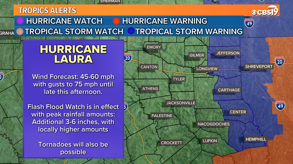
Here is what you need to know:
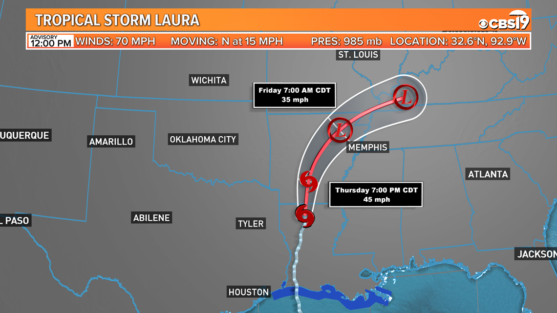
Laura is a Tropical Storm with max sustained winds of 70 miles per hour.

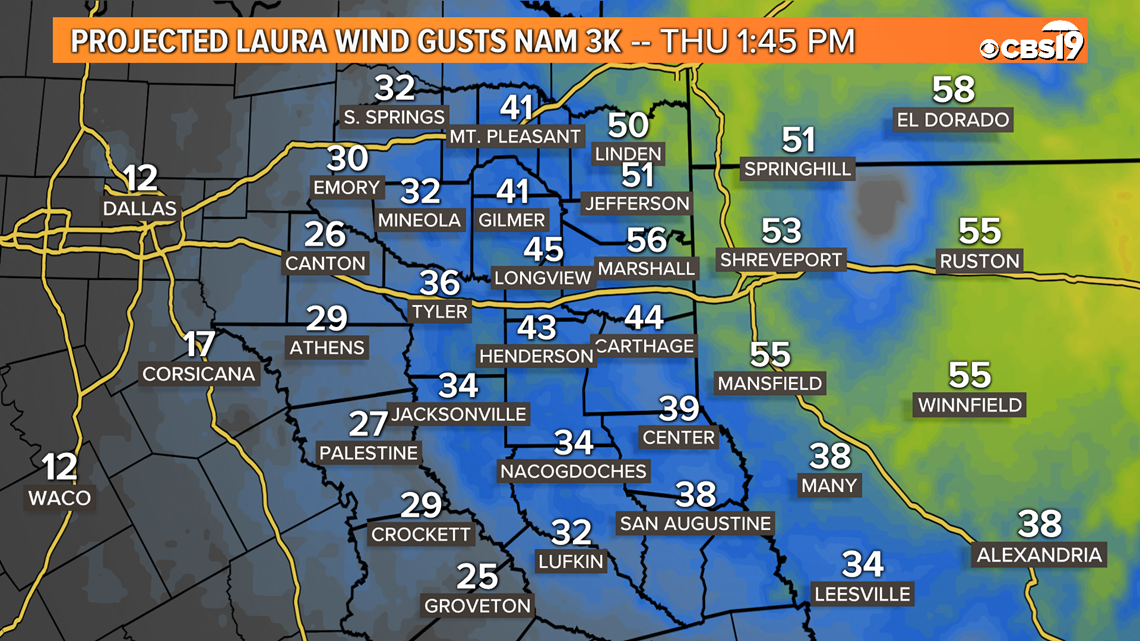
East Texas Wind Gust Forecast today near 2 PM

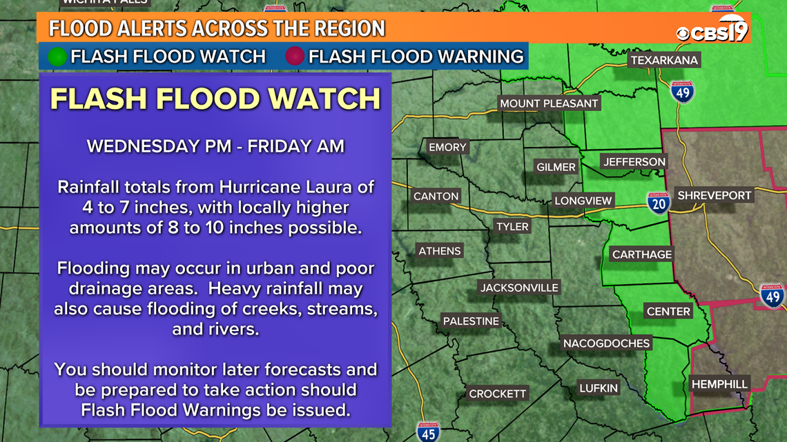
A Flash Flood Watch has been issued from the National Weather Service in Shreveport. Flooding may occur in urban and poor drainage areas. Heavy rainfall may also cause flooding of creeks, streams, and rivers. A Flash Flood Watch means that conditions may develop that lead to Flash Flooding.

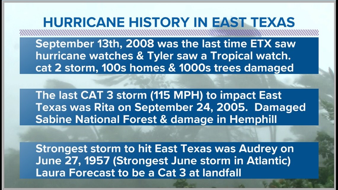
2008 was the last time East Texas was impacted with hurricane force winds and that was from Hurricane Ike. Having a hurricane this strong in August to impact East Texas is quite rare. The strongest storm to impact East Texas on Record was Audrey back in June of 1957.


The last time we had a year close to being as active as 2020 was back in 2005 — the year Hurricane Katrina devastated New Orleans. It was also a year when La Niña developed in the fall.
Hold on to your hats, folks. Things could get very dangerous during the next two months along the gulf coast.
Connect with Chief Meteorologist Joel Barnes on social media:
Keep up with the latest news, weather and sports by downloading the FREE CBS19 mobile app:
- Click here to download the iPhone app
- Click here to download the iPad app
- Click here to download the Android app

