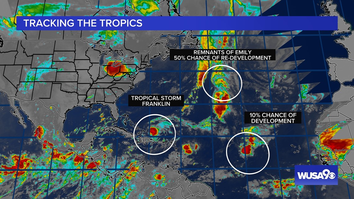
WASHINGTON — Tropical Storm Franklin made landfall Wednesday morning and will continue to bring heavy rain to the Dominican Republic and Puerto Rico over the next several days. Winds will not be a big problem as it remains a tropical storm.
RELATED: Rain from Tropical Storm Hilary lashes California and Mexico, swamping roads and trapping cars


Tropical Storm Franklin
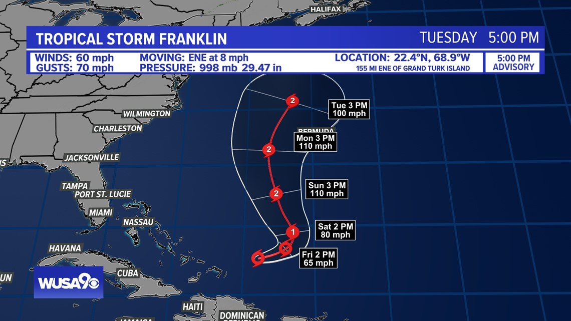
Franklin made landfall early Wednesday morning as a tropical storm and will continue to bring heavy rain and gusty winds to parts of the Dominican Republic, Haiti and Puerto Rico. Tropical Storm Warnings are in effect.
This storm had a significant impact on parts of Puerto Rico. Heavy rainfall fell across parts of Puerto Rico and Hispaniola through the middle of the week. The heavy rain may produced some flash and urban flooding.
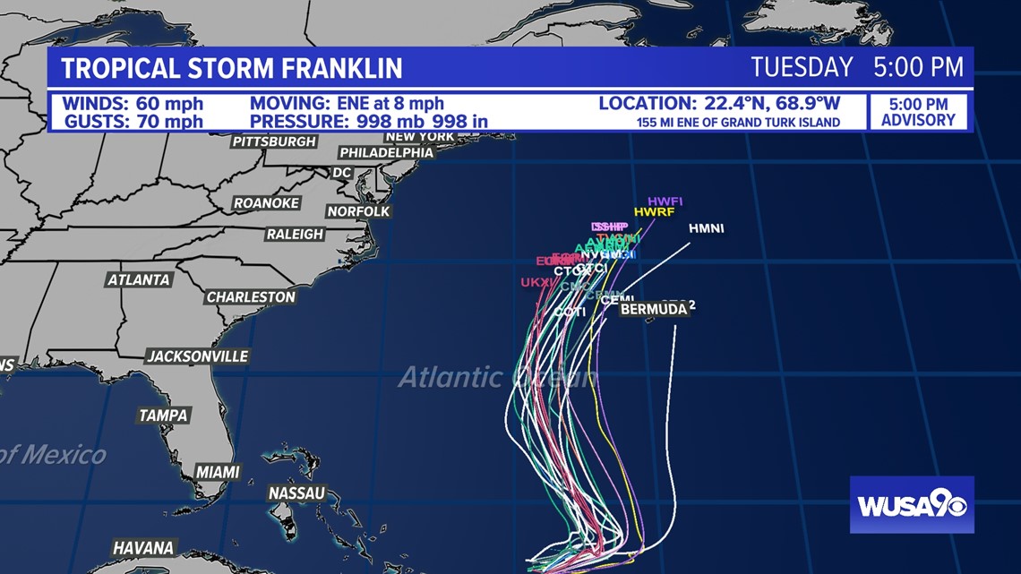
As Franklin moves into very warm water, the storm is expected to strengthen into a hurricane by Saturday morning, passing to the southwest of Bermuda as a Category 2 hurricane. Looking at the long range forecast, the storm should kick back out to sea to the northeast before getting close to the United States. We'll be monitoring Franklin's track closely. Even if it stays out to sea Franklin could generate some rip currents along the east coast beaches.


Remnants of Emily
The remnants of Tropical Storm Emily are trying to redevelop over warm Atlantic waters. There is a 50% chance of development in the next 48 hours. If the remnants do re-strengthen, the storm would receive a new name.

