TYLER, Texas — At this point, it's a matter of watching and waiting as we continue to monitor severe weather today.
As the afternoon got underway, the atmosphere was primed with lots of humidity.
But we need a spark to fire off the thunderstorms and at this point those sparks are many miles away.
So, for the next couple of hours, expect a few showers and maybe an embedded thunderstorm but the severe weather threat is expected to arrive this evening.
The threat level in our area remains the same. It continues to be a moderate risk or level four out of five.

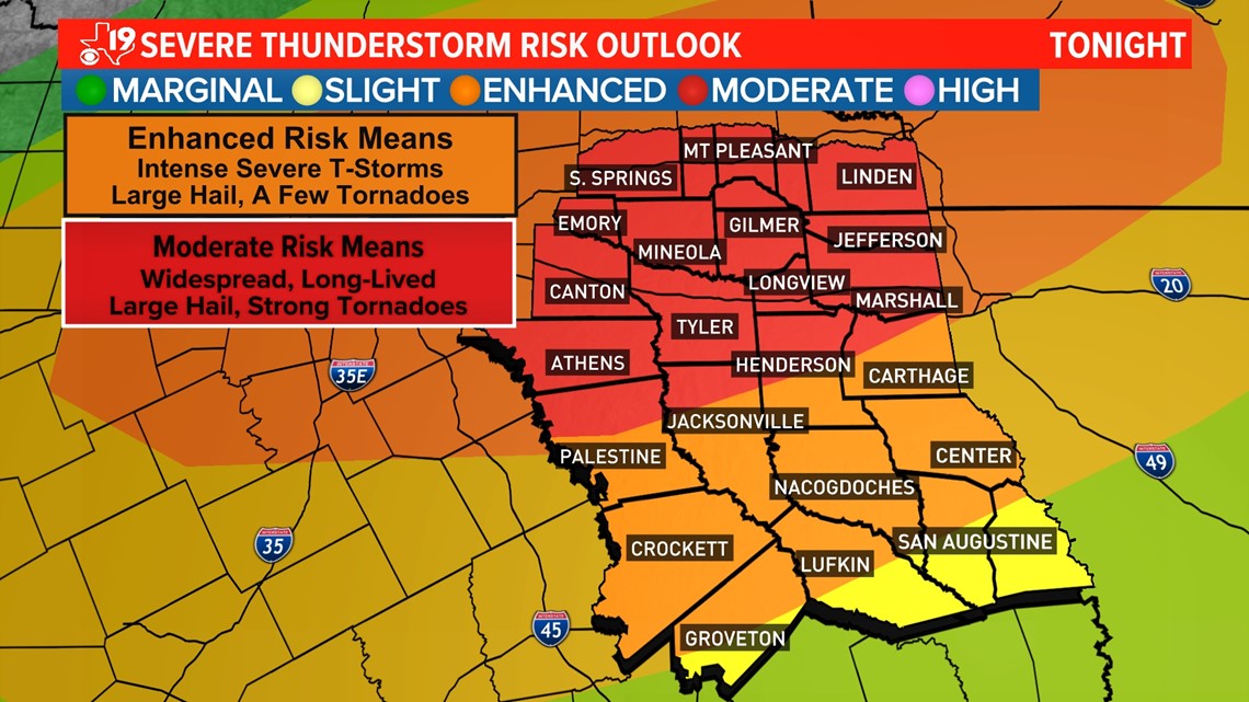
Within the moderate risk, there is a 10% chance for tornadoes and a 45% chance of severe winds greater than 58 mph and a chance some of the winds could be hurricane force or 74 mph or higher.
There is also a 45% of large hail and some of the hail stones could reach the size of hen eggs or bigger.
Where is the storm right now? As of early afternoon, the center of the storm was still over New Mexico but a cold front, out ahead of the main storm, stretched across the Big Bend of Texas.
This is where a line of showers and thunderstorms is gaining strength. This is the line that will move into East Texas later this evening.

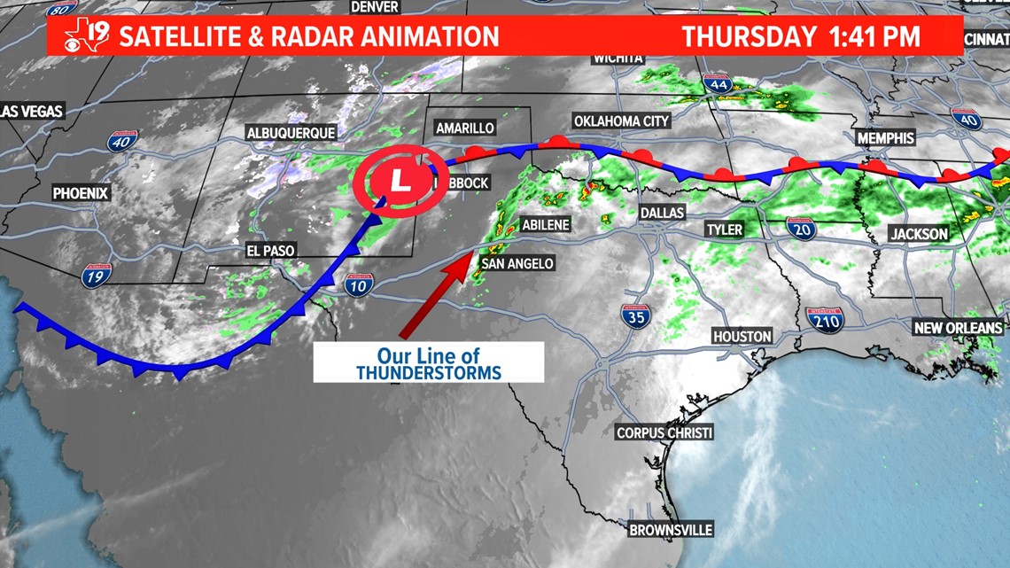
There might be a discrete supercell that forms just east of Dallas late this afternoon. If a supercell can form, it could quickly become tornadic.
Otherwise, a large cluster of showers and thunderstorms appears to form near or north of the DFW and then marches east.
Forecast model guidance shows these storm segments forming into a line just west of I-45 this evening and moving toward East Texas.

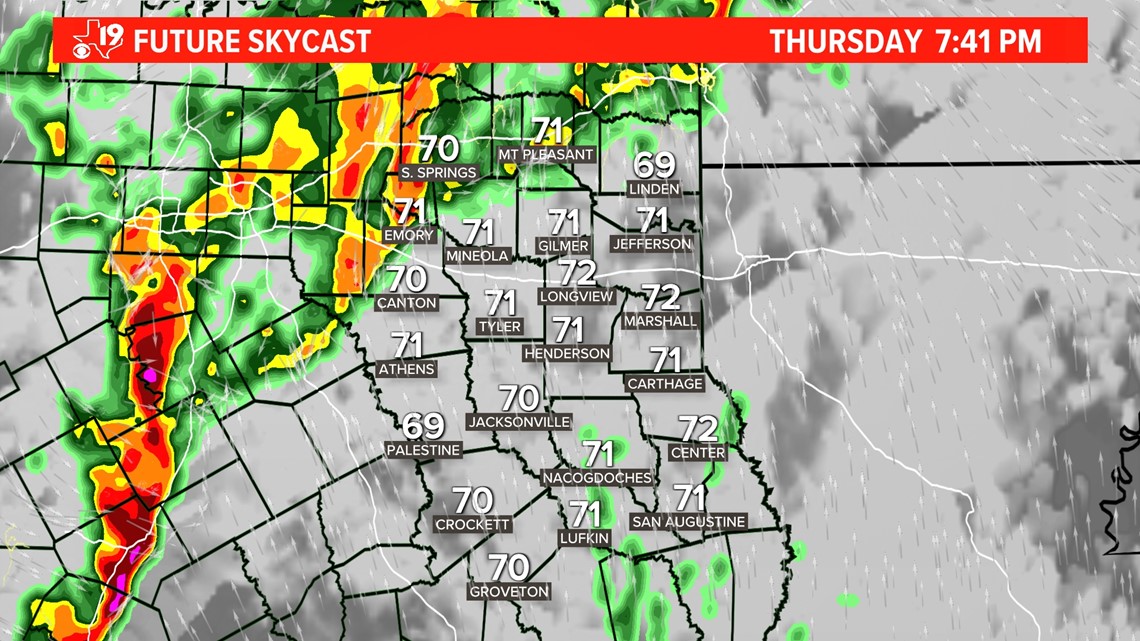
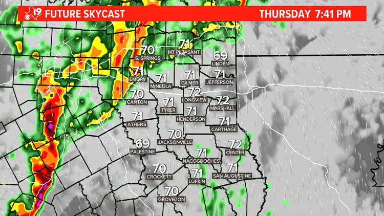
At this point, it appears a line of heavy rain, and thunderstorms will move through East Texas between 8 p.m. and 1 a.m.
The storms will move from west to east, first appearing in Anderson, Henderson, and Van Zandt counties between 7:30 and 9 p.m.. Then the storm will move into Wood, Smith, Cherokee, and Houston counties between 9 and 10 p.m., before moving into Upshur, Gregg, Rusk, Nacogdoches, and Angelina counties between 10 p.m. and 11 p.m..
The storms will exit into Louisiana between midnight and 1 a.m.
We should be ready for damaging wind gusts of more than 70 mph, large hail, and potentially a strong tornado or two.
Plan ahead of time and know where you will be sheltering if a tornado warning is issued.