TEXAS, USA — The fall season's first true cold front arrives this week and it comes with the threat of flash flooding! We need the rain, but as you already know, too much of a good thing can sometimes be bad. Just think of the last time you ate too much Halloween candy.
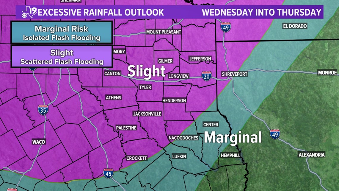
The Weather Prediction Center looks for hazardous weather across the United States and the WPC has outlined an area of East Texas for "Excessive Rainfall." Isolated to scattered flash flooding is possible across the region.

Meteorologists identify the purple and blue areas as a risk for flash flooding by looking at a few parameters that will be in place as we head into the middle and latter half of the week. One piece of data that reveals a clue to possible heavy rainfall is called "precipitable water." This shows potential rainfall amounts over a given area. Precipitable water or PWATS is defined as the amount of water vapor contained in a column of air if its condensed at once and fell into a rain bucket. In this situation, the Precipitable Water values indicate high moisture content over East Texas.

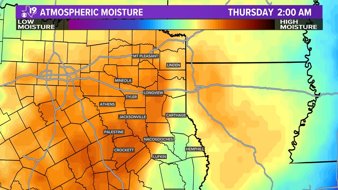
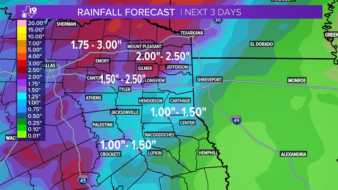
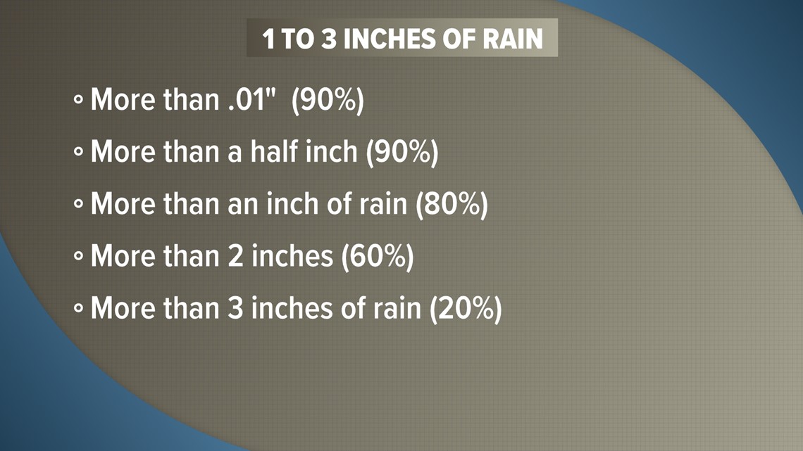
The precipitable water values in this case, could equate to one to three inches of total rainfall between Wednesday and Friday morning. The heaviest rain appears to fall, just to the northwest and north of Tyler and Longview, from a Canton to Marshall to Texarkana line. The heavy rainfall tapers over Deep East Texas. It appears a generous one to one and a half inches of rain could fall over cities such as Jacksonville, Rusk, Henderson, Carthage and Nacogdoches.

Heavy rainfall like this can occur as a result of strong or severe thunderstorms. There will be ample energy in the atmosphere for isolated severe weather to occur. Sometimes we can judge the strength and scope of the thunderstorms by looking at lightning intensity. There will be pockets of intense lightning, especially on Wednesday, overnight into Thursday morning.

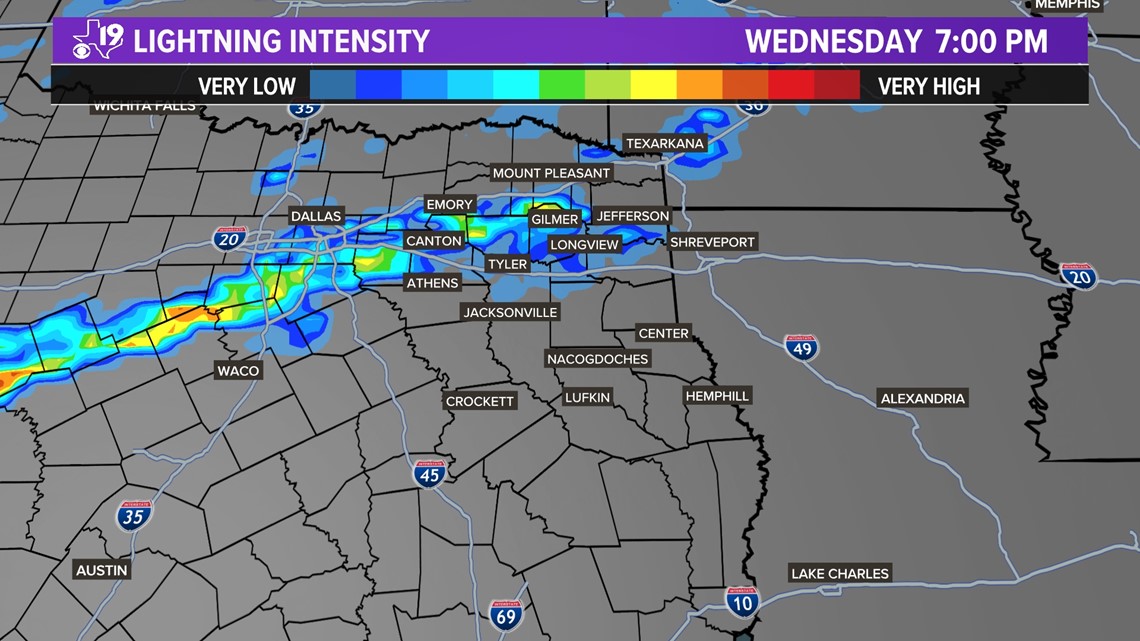
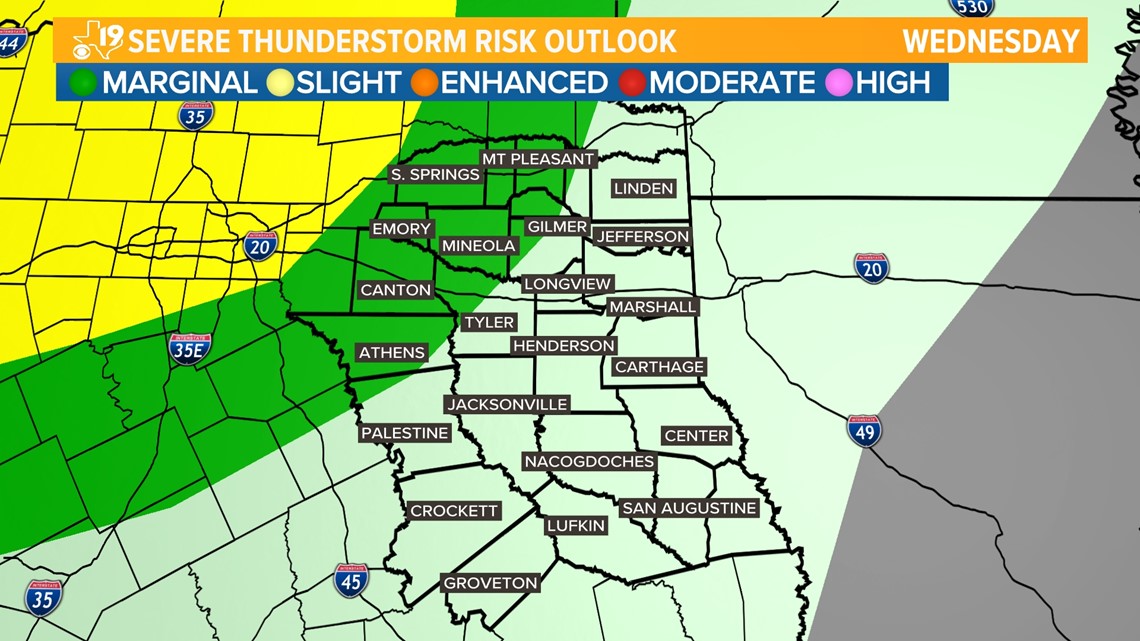
The lightning intensity closely mirrors the Storm Prediction Center's severe weather outlook for Wednesday and Wednesday night into early Thursday morning. There is a slight risk of severe weather over much of North Texas with a marginal risk of severe weather extending into East Texas. A slight risk means scattered severe thunderstorms are possible, while a marginal risk means isolated severe weather thunderstorms are possible.

Rain and thunderstorms are expected to start Wednesday morning. They may be widely scattered Wednesday morning but will become more widespread Wednesday afternoon as the strongest cold front of the season moves into East Texas. One to three inches of rain is possible across East Texas. How much will fall in your backyard? The most likely scenario is for one to two inches of rain to fall but there is an outside chance you could fill your rain bucket with up to three inches of rain.

Once the first cold front clears the area Thursday night, a second cold front sweeps across East Texas Friday. This second front will scour out the clouds and bring the coolest air so far this season to all of East Texas. Expect highs in the 70s this weekend with morning temperatures in the 50s. This will have many of us saying, "Fall-lelujah!