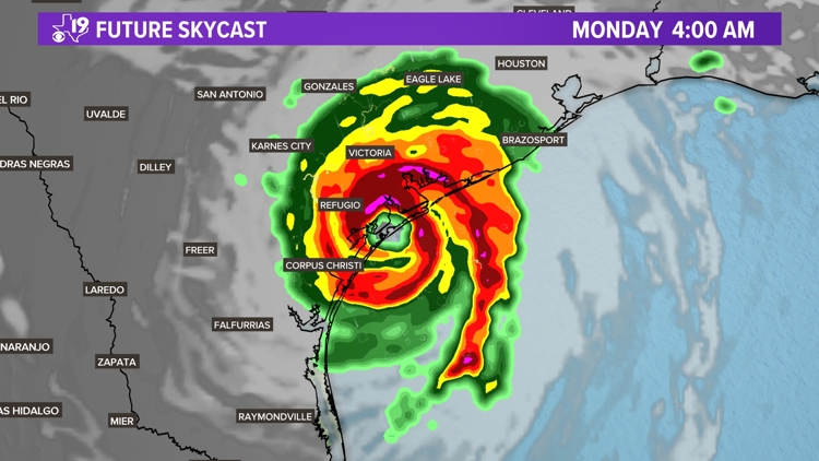
TYLER, Texas — Major Hurricane Beryl has defied the odds and has taken some not surprising, but unlikely turns as it has plowed through Caribbean and over Yucatan Peninsula. The latest twist in Beryl's path now brings a more likely scenario where Beryl reaches the Texas Gulf Coast Monday morning.
Meteorologists use a tool called "Spaghetti Plots" to view the various outcomes of the path of a system. Most of the models pushed Beryl into Central Mexico, but a couple of the possible solutions offered a more northward track that pointed Beryl closer to Corpus Christi or Houston. Those outlier models now appear to have been on to something.

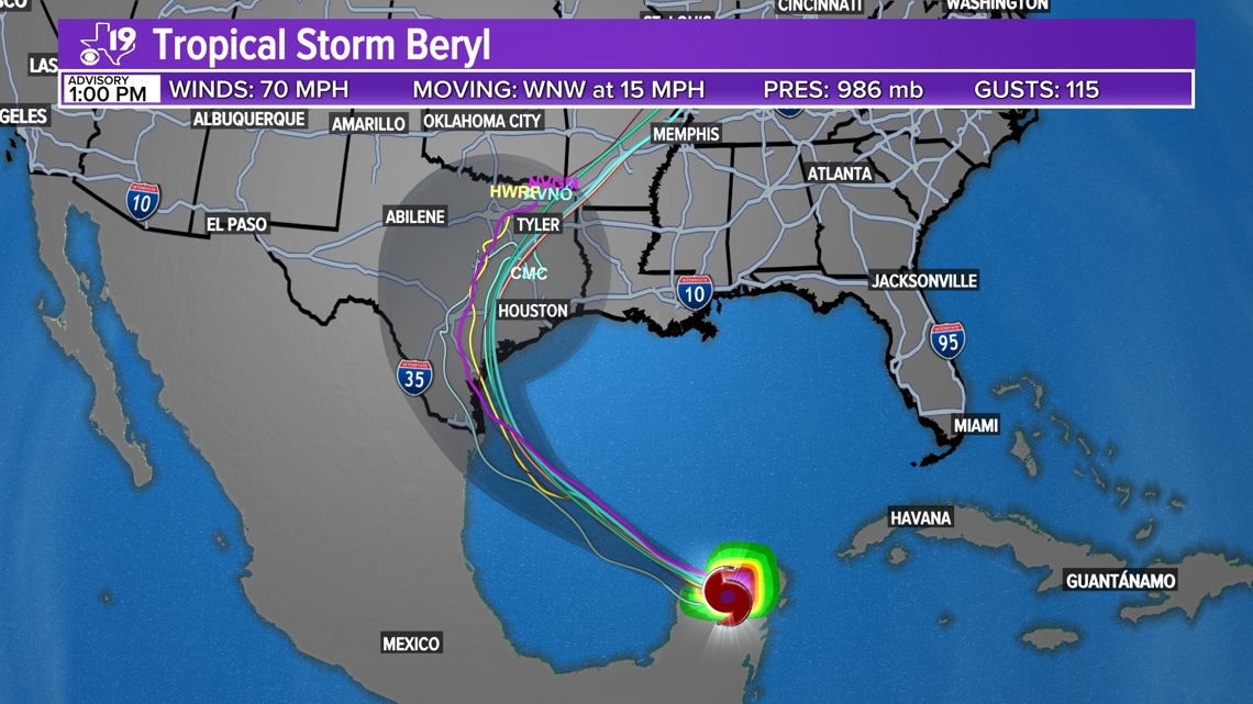
Our in-house computer model, the Global High-Resolution Atmospheric Forecasting System as early as Thursday night, showed a more northerly track with Beryl making landfall between Corpus Christi and Houston.


The well-defined eye indicates Beryl should reach Category 1 hurricane strength just prior to making landfall. Hurricanes are given a category strength based on wind speeds.
Beryl is forecast to have sustained winds of 85 miles per hour before reaching the coast. The winds will be stronger on the northeastern side of the storm. For instance if Beryl comes ashore at 15 miles per hour than the winds on the right side of the storm could be as strong as 100 mph.
But as I said Beryl has been defying odds and could end up stronger than a Category 1 storm. As of Friday evening, Beryl was heading out into the Gulf of Mexico and into an area of shear.

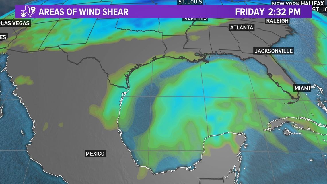
Areas of shear are shown in light green or light blue. This is where the winds higher up in the atmosphere are stronger, shearing off the top of the storm and prevent the tropical system from getting stronger.
That was supposed to have happened to Beryl when it was in the Eastern Caribbean and right before it made landfall in the Yucatan Peninsula. But Beryl overcame the shear and either remained as strong or got stronger before eventually doing what was originally predicted. Over the weekend, Beryl will into an area of low to no shear and this is where the tropical storm is forecast to regain its hurricane strength.

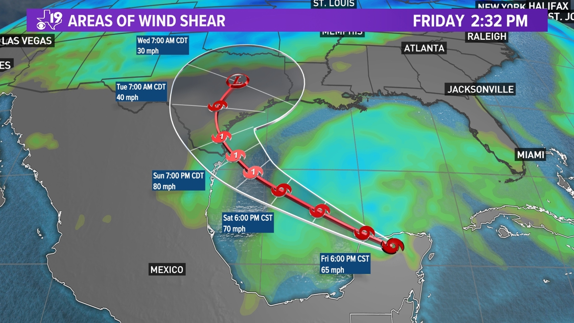

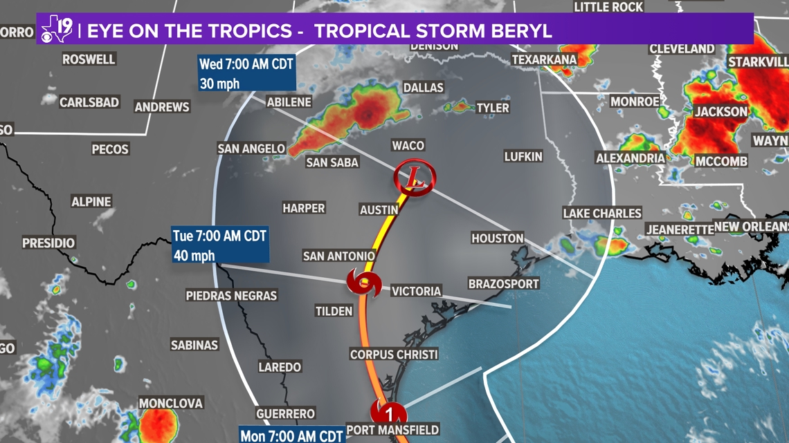
The consensus forecasts is for Beryl to make landfall somewhere along the Texas Coastal Bend and move inland, spreading its rain and wind as a tropical storm all the way into the Hill Country before weakening further into a tropical depression as it approaches East Texas.
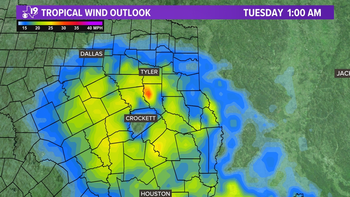
Tropical depressions are defined as a tropical system that has winds at 38 mph or less. Parts of East Texas could see wind gusts close to tropical storm force or just under that Monday evening into overnight Tuesday.

So what are we looking at here in East Texas?
1) Beryl will be either a tropical depression or an extra-tropical cyclone when it reaches East Texas Monday afternoon.
2) Rain will start Monday, no later than 3 p.m. and it could rain off and on for up to 30 hours.
3) Winds gusting up to 45 mph could knock down trees weakened by past wind events or the heavy rain that comes with the remnants of Beryl.
4) Forecast models suggest between 2 and 7 inches of rain will be possible over parts of East Texas.

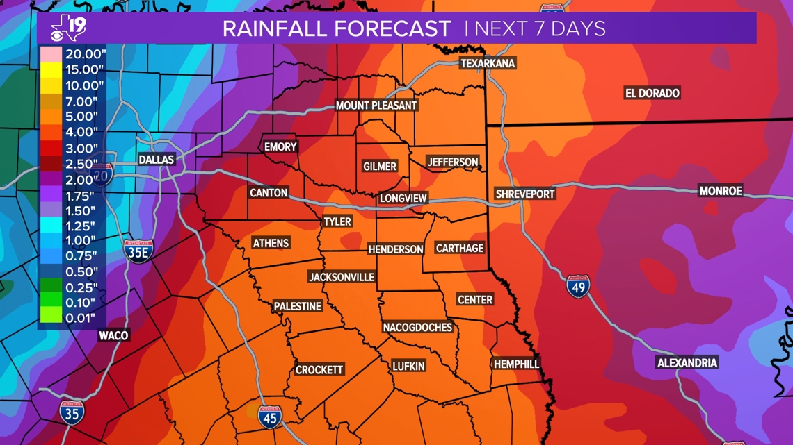
Whatever is left of Beryl will move into Louisiana by early Wednesday. The remnants of the storm could move all the way to the middle-Mississippi River valley by the end of next week.
But Beryl's path has involved a lot of twists and turns so far.
We will see how it all plays out this weekend. Stay tuned to the CBS19 Weather Experts for updates on Beryl's path and impacts on East Texas.

