TYLER, Texas — Severe weather chances returned to East Texas Wednesday.
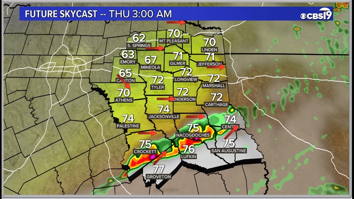
Storms will be possible in the overnight hours. Large hail, extreme winds, and tornadoes will all be a threat during that time period. The storms should clear out by Thursday morning.
Here's the latest.
The Threat:
We are currently expecting an 60% chance for showers and storms through Wednesday night. Wind, hail and the risk for tornadoes will all be possible.
A cold front will approach from the northwest sparking up another round of storms tonight.

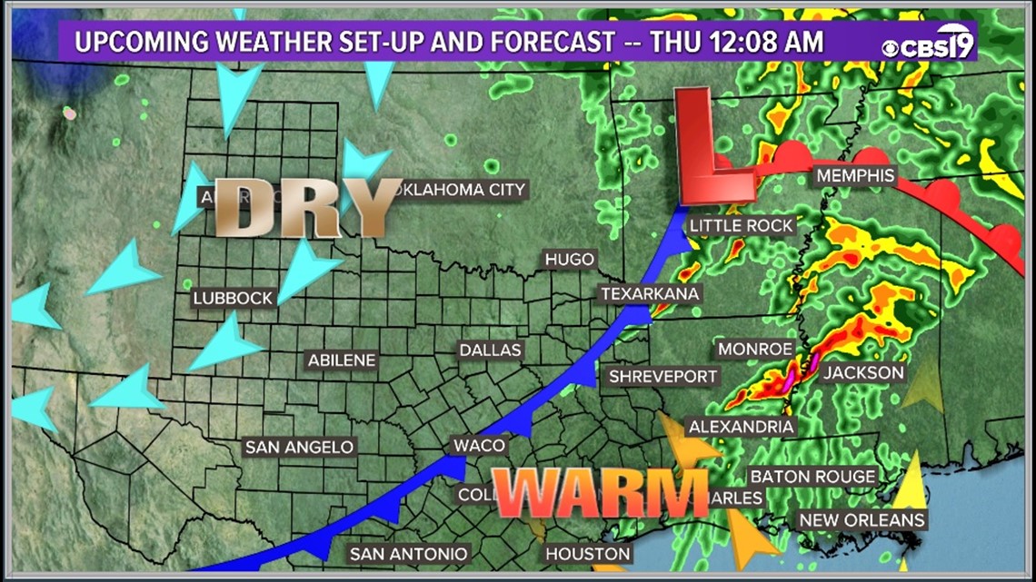
The threat exists just east of Dallas, south of little rock and all across Louisianan and southern Mississippi.


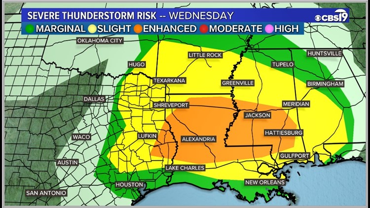
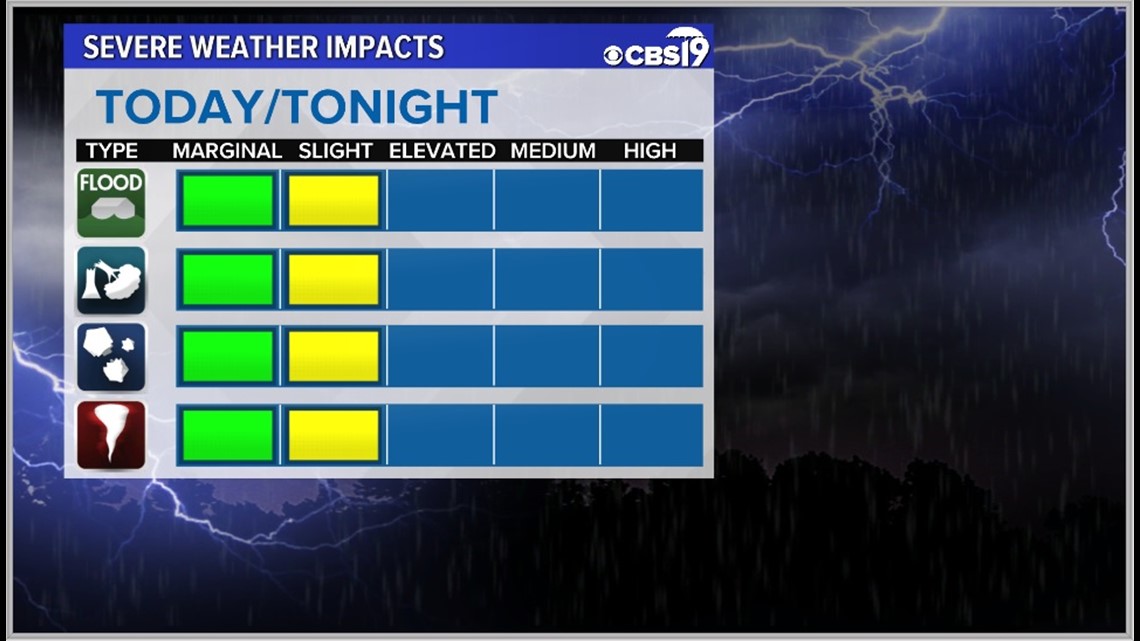
As of now all of East Texas is under an Slight Risk, or level 2 of 5, for severe weather Wednesday night.

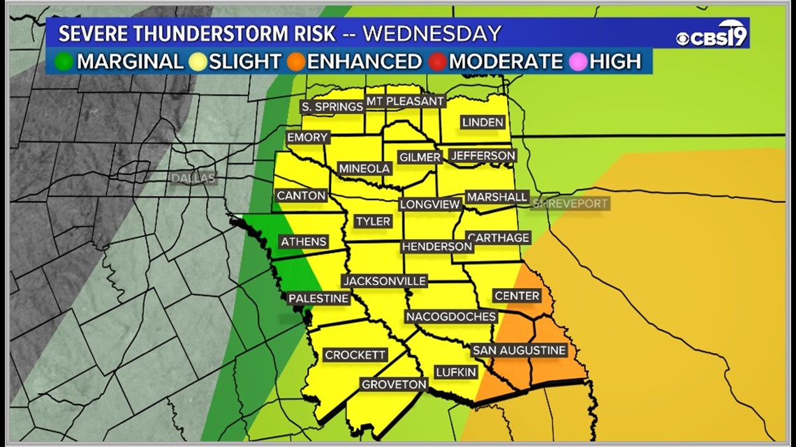
All severe weather types are possible during Wednesday's storms.

Just because one round of storms has passed you by doesn't mean you can let your guard down. You will sill need to stay weather aware!
The second wave, which is a bit less certain to form, will come with a line late Wednesday evening into Wednesday night.
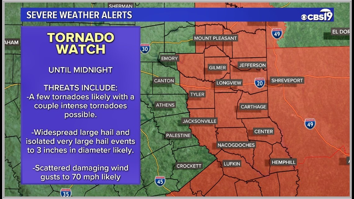
Models are hinting at strong energy remaining after the first wave, especially south of I-20. This could lead to another round of wind, hail, and tornadoes.
Midnight:

Tornado Watch

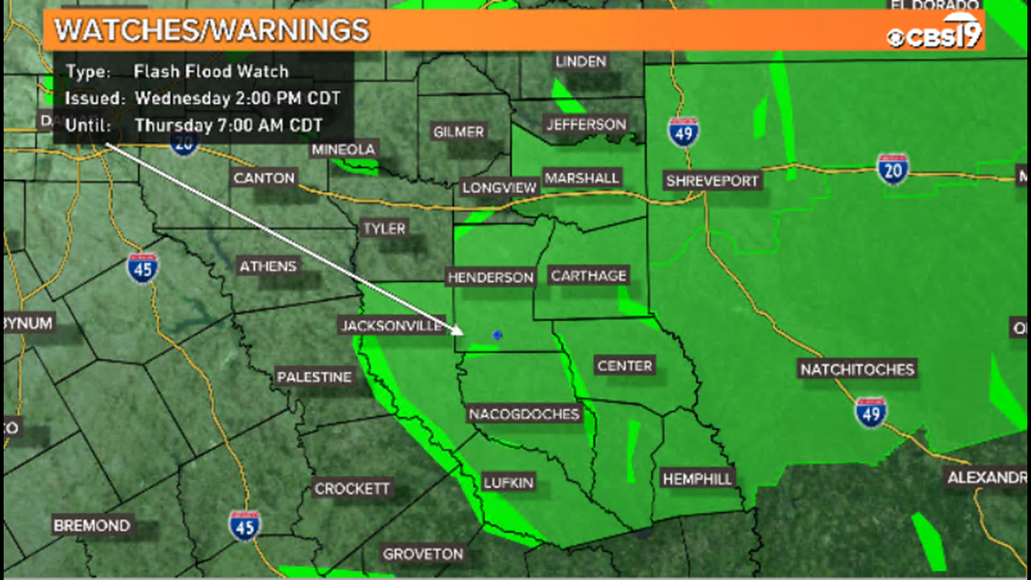
Flash flooding could also be a concern as the evening goes on in Deep East Texas. Many locations in that area picked up heavy rainfall on Sunday and the ground is quite saturated; 1-3 more inches of rain could fall in that area leading to a flood threat.
The National Weather Service in Shreveport has put Sabine, Shelby, Harrison, Rusk, Panola, Cherokee, Angelina, Nacogdoches, and San Augustine counties under a Flash Flood Watch until 7 am Thursday.
Remember turn around don't drown.

Final Thought:
Storms could pop up and be strong until sunrise Thursday across East Texas!
You can get the latest alerts sent right to your pocket with the KYTX CBS 19 mobile apps!
Connect with CBS 19 Chief Meteorologist Joel Barnes on social media:
Do you have a weather report or pictures you would like to submit to the CBS 19 Weather team? You can email news@cbs19.tv and visit our Facebook or Twitter pages.
Keep up with the latest news, weather and sports by downloading the FREE CBS19 mobile app.
Click here to download the iPhone app.
Click here to download the iPad app.
Click here to download the Android app.