TYLER, Texas — The phrase “April showers bring May flowers” may have been created in rhyme and song, but weather statistics suggest it really does rain more in April.
For instance, here’s a look -- historically -- at how many days in the month of April feature record rainfall of more than three inches for Tyler, Longview, and Lufkin:
- Tyler - 10 days with 3"+ of rain (Most rain – 4.42” on Apr. 21, 1957)
- Longview - 12 days with 3"+ of rain (Most rain – 6.95” on Apr. 9, 1944)
- Lufkin - 10 days with 3"+ of rain (Most rain – 4.96” in on Apr. 8, 1968)
So, a third of the entire month can feature drenching rains. But what about this year? What lies ahead when it comes to rain and severe weather chances for the next 30 days?
Using our one-of-a-kind Long Range Cycling Weather Pattern (LRC), we are able to see into the next 30 days. We identify key weather features going back to Oct. 2021 when, every year, a new and unique weather pattern sets up. This pattern then begins cycling. We use key storms within the pattern to identify potential cold snaps, dry spells and severe weather set-ups.
This year is no different. The East Texas tornado outbreak from Mar. 21 is related to a similar weather pattern that first set up in mid-Nov. Compare the upper level wind pattern on both days.

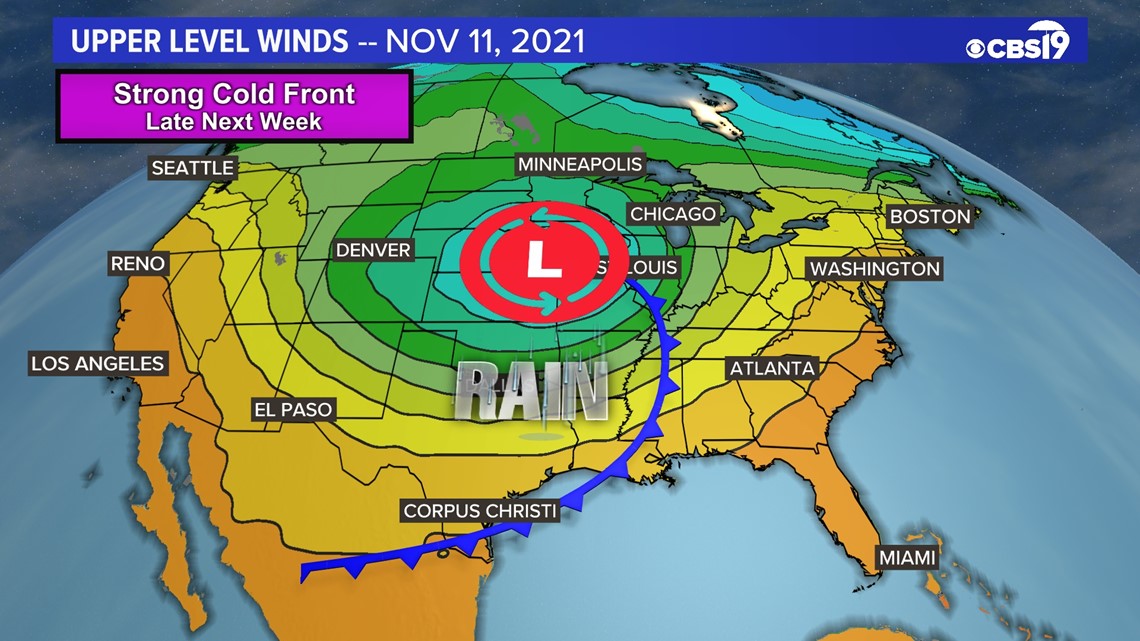

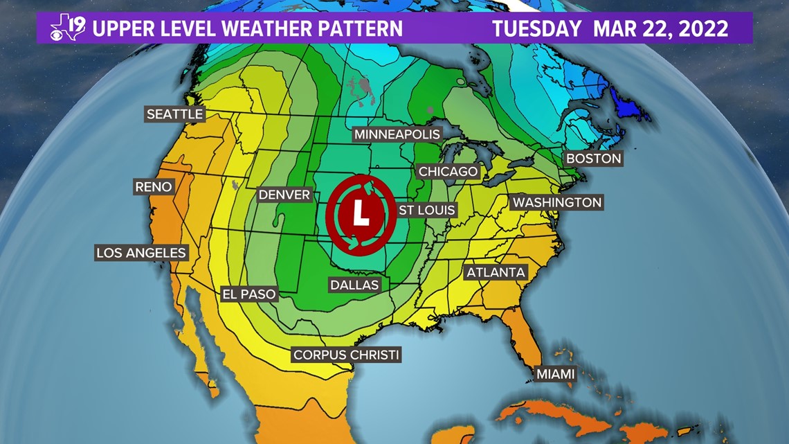
This is a picture of the middle part of the atmosphere. It shows the wind field, thickness of the atmosphere and temperature. We primarily use this level to identify the signature storms that make up a part of the LRC.
Can you see the similarities? Now compare the severe weather reports. Both days featured a tornado in Harrison County. Subsequent surveys by the National Weather Service (NWS) found some of the wind damage reports you see on the second graphic to be tornado damage.

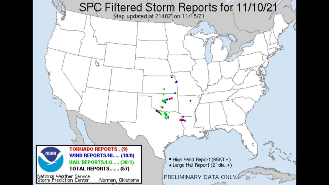

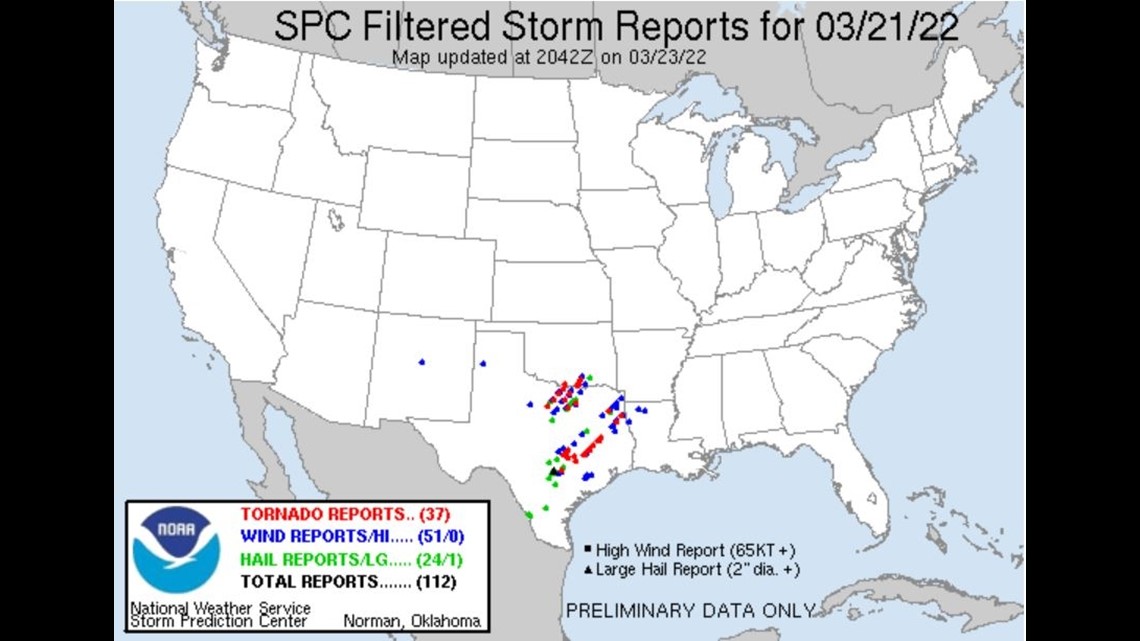
There are some seasonal differences with respect to the location of the jet stream that result in more of the storms being focused in Texas. But again, the overall location is remarkably similar.
Look for this part of the pattern to repeat between May 20 and 25. The upper level winds will be weakening and moving northward toward their summertime position. Texas may not see another tornado outbreak, but a severe weather set up in the central and southern plains will be possible.
Throughout the month of April, we'll see a repeat of storms that first formed in October and cycled with a similar weather pattern developed in December and again in February.
Here are the key time frames we've identified that have a higher chance for severe weather in April:
- April 4-6: Rain and thunderstorms. A severe set up is possible
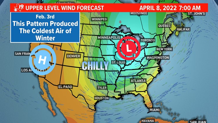
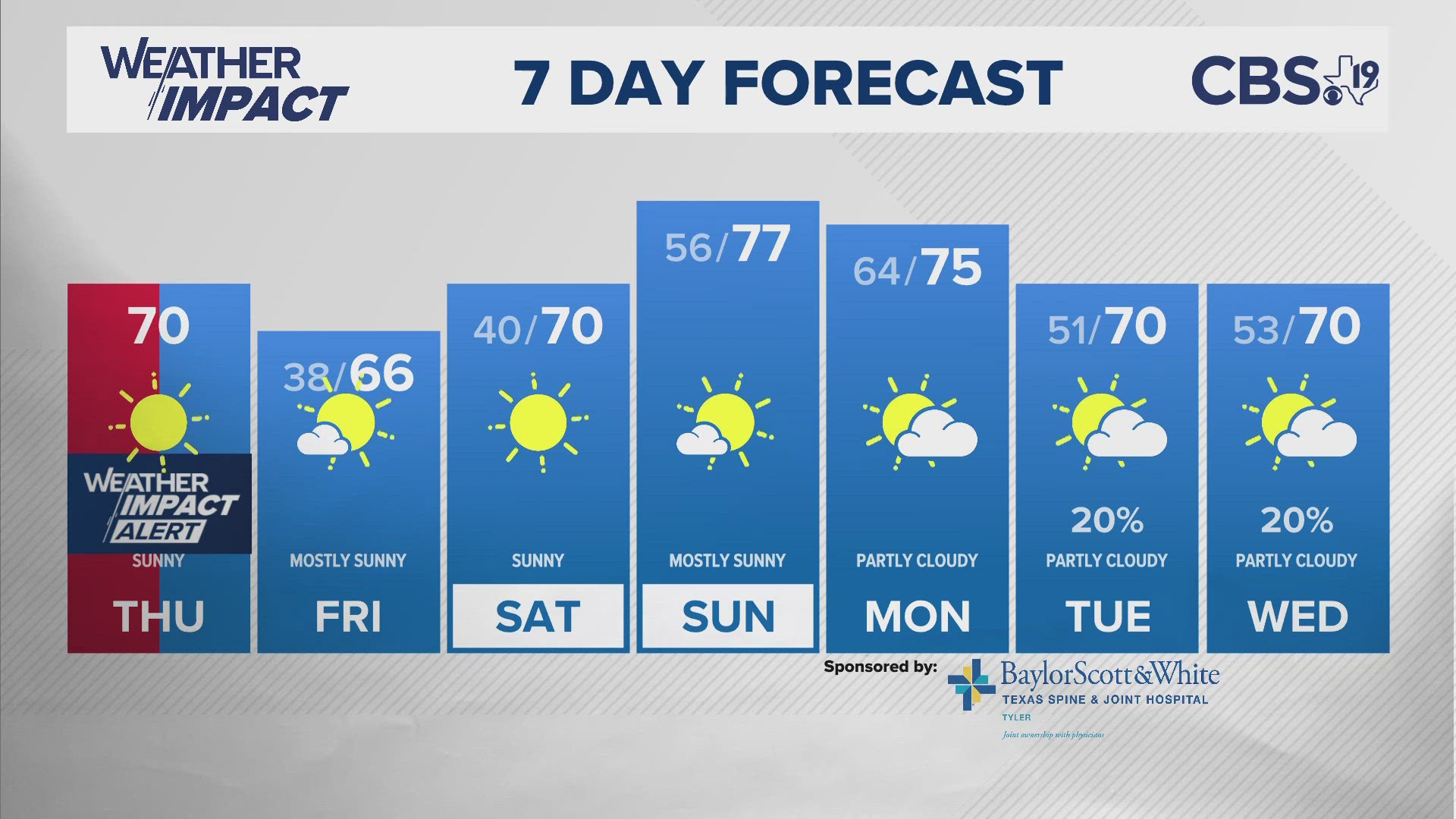
- April 8-9: In February, we had our coldest night of winter. Expect some very chilly mornings the weekend of the 9th.
- April 12-15: The previous two cycles produced rain in East Texas.
- April 23-25: Heavy rain fell back during the December part of this pattern. Could we see flash flooding and severe weather?
- April 27-May 1: This storm is a signature storm of this year's weather pattern. This should bring significant rain and possible severe weather.
We have higher confidence is a storm, perhaps a stronger storm at the end of the month because we've seen this signature storm repeat already. Take a look at the storm when it first showed up in late October.

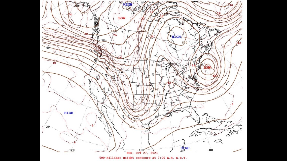
The weather pattern oscillated through the region again in late December. Here's a comparison of the December weather pattern.

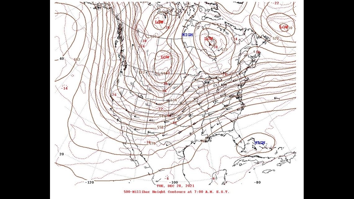
The trough is larger in the December version of the storm but again, seasonal jet stream strengths and position can account for the slightly dissimilar look. Still this is a deeper, upper level low pressure area that produced rain and thunderstorms in previous versions.
I have higher confidence a similar weather pattern will set up at the end of the month. This time with more moisture, daytime heating, and wind energy which we could be staring at a severe weather setup.
We will know more in the coming weeks but one thing looks certain for the upcoming month, there are sure to be plenty of April showers.


