CORPUS CHRISTI, Texas — This is an old tropical post. For the latest tropical updates, head to our tropical homepage.
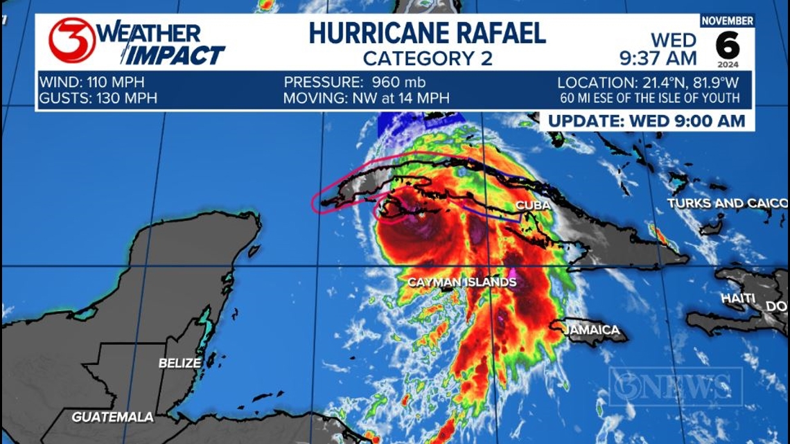
UPDATE: Hurricane Rafael was upgraded to a Category 3 hurricane shortly after noon Wednesday.
Rafael is now a category 2 hurricane in the Caribbean Sea and is set to make landfall across eastern Cuba today. Hurricane Warnings are posted.

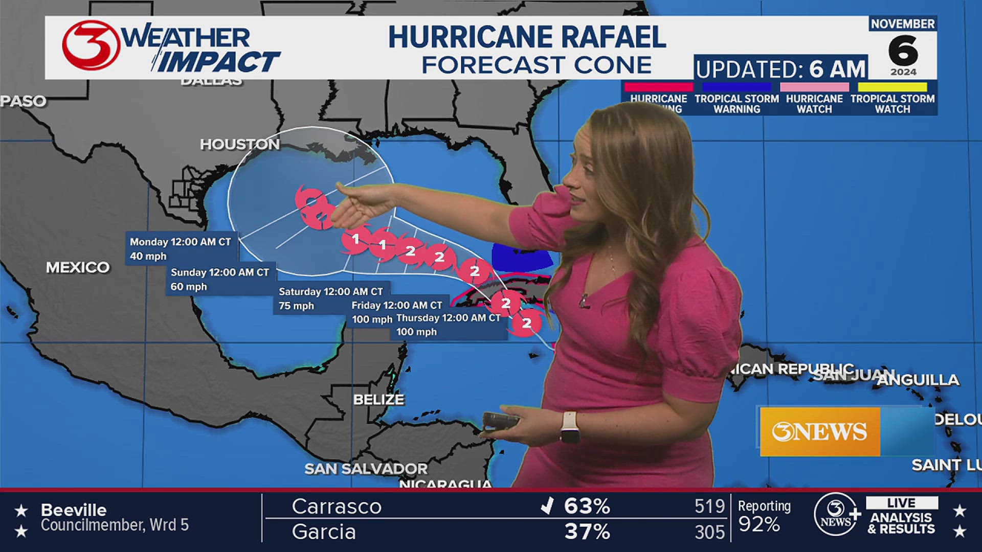
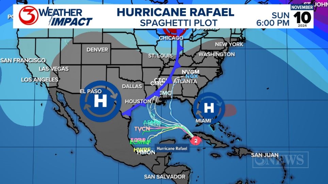
Rafael will likely strengthen as it continues to move north toward Cuba and a Category 3 hurricane is possible. It will weaken as it crosses the island but is expected to remain a category 2 hurricane in the Gulf of Mexico. The National Hurricane Center forecast cone is starting to show more of a westward movement across the Gulf of Mexico with the 9 AM update.

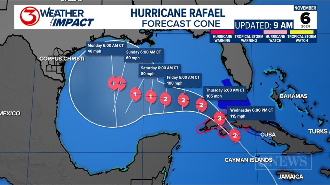
As Rafael drifts toward the Western Gulf of Mexico the environment will become hostile with a cold front moving across Texas. You can see the NHC cone showing the system down, and weakening between Friday and Monday morning.
In the Coastal Bend, we are expecting a cold front to move through on Saturday morning. That front should help deflect Rafael.

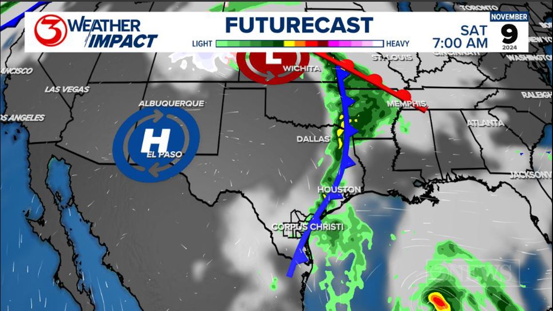
This cold front will create a lot of wind shear across the north and western Gulf of Mexico. So, even if something did try to move toward Texas, it would not be a problem in terms of anything hazardous happening.

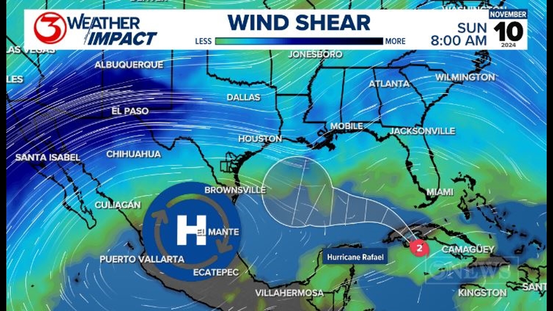
Something new in the forecast is this mid and upper-level high pressure. The steering currents around this high would bring Rafael into the Western Gulf of Mexico and push Rafael away from Texas. Rafael may still try to turn north toward the low-pressure trough seen over Louisiana. The Spaghetti plots are still very split.

Coastal Bend beaches will start to receive longer period swells and larger waves over the weekend because of Rafael. Remember, it'll be a hurricane on Thursday and Friday in the SE Gulf of Mexico, so it'll still churn up the waters.
---------------------------------------------------------------
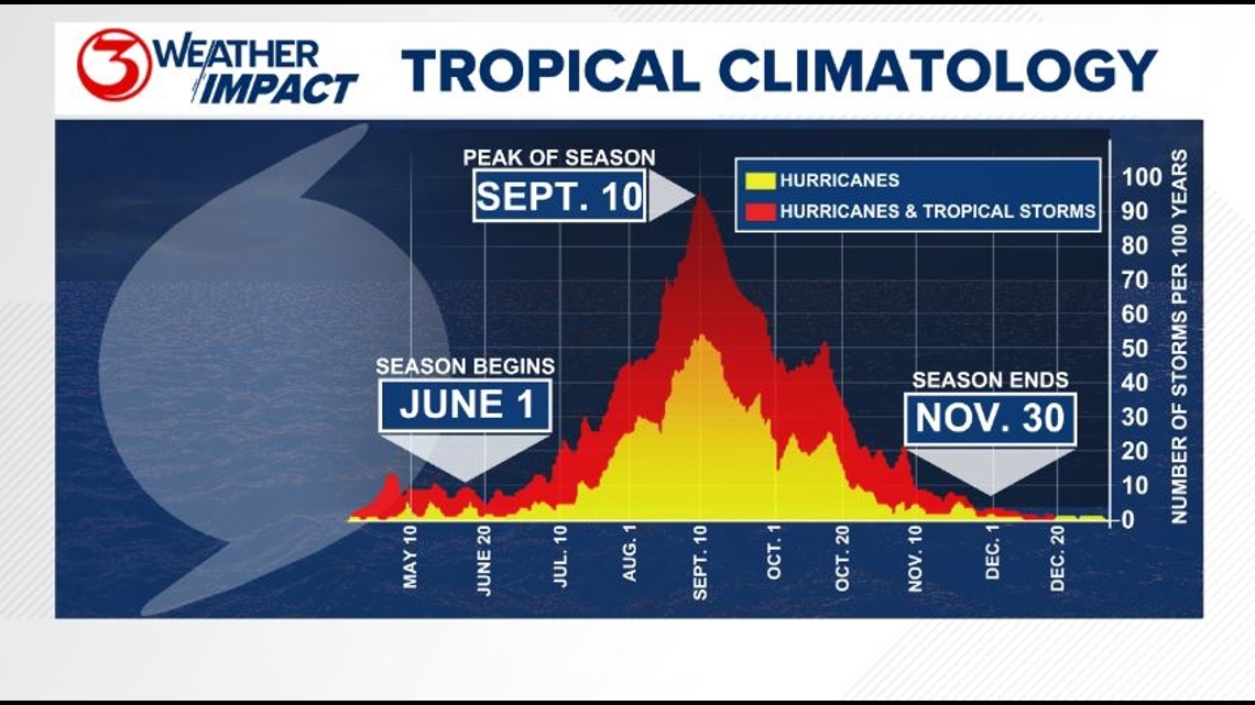
The Atlantic Hurricane Season runs from June 1 to November 30, with the peak of the climatological peak of the season happening on September 10.

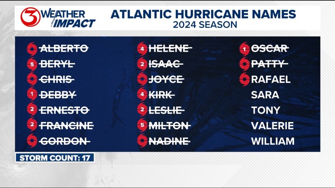
Here are the names for the 2024 Atlantic Hurricane Season. Names are given to tropical cyclones (tropical storms and hurricanes).

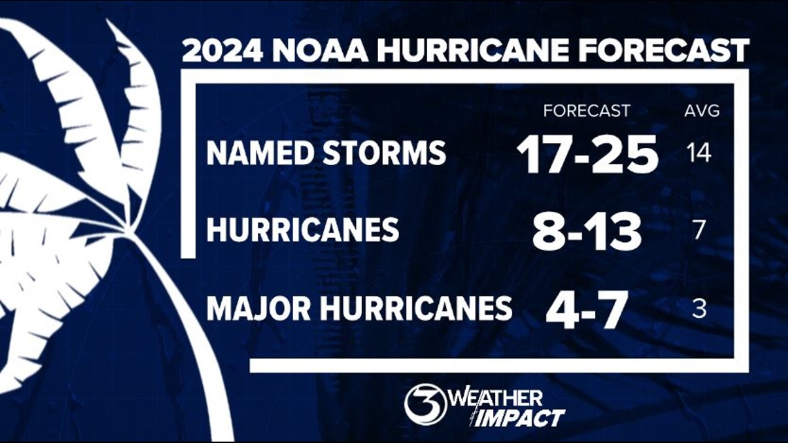
On May 23, NOAA released their forecast for the 2024 Atlantic Hurricane Season. They're predicting an above-average year, with 17-25 named storms. This is the highest pre-season forecast they've ever issued.
The high number of storms forecast is due to near-record sea surface temperatures and the return of La Nina, both of which favor tropical cyclone development. We talk more about those in our Hurricane Special, which you can watch here!

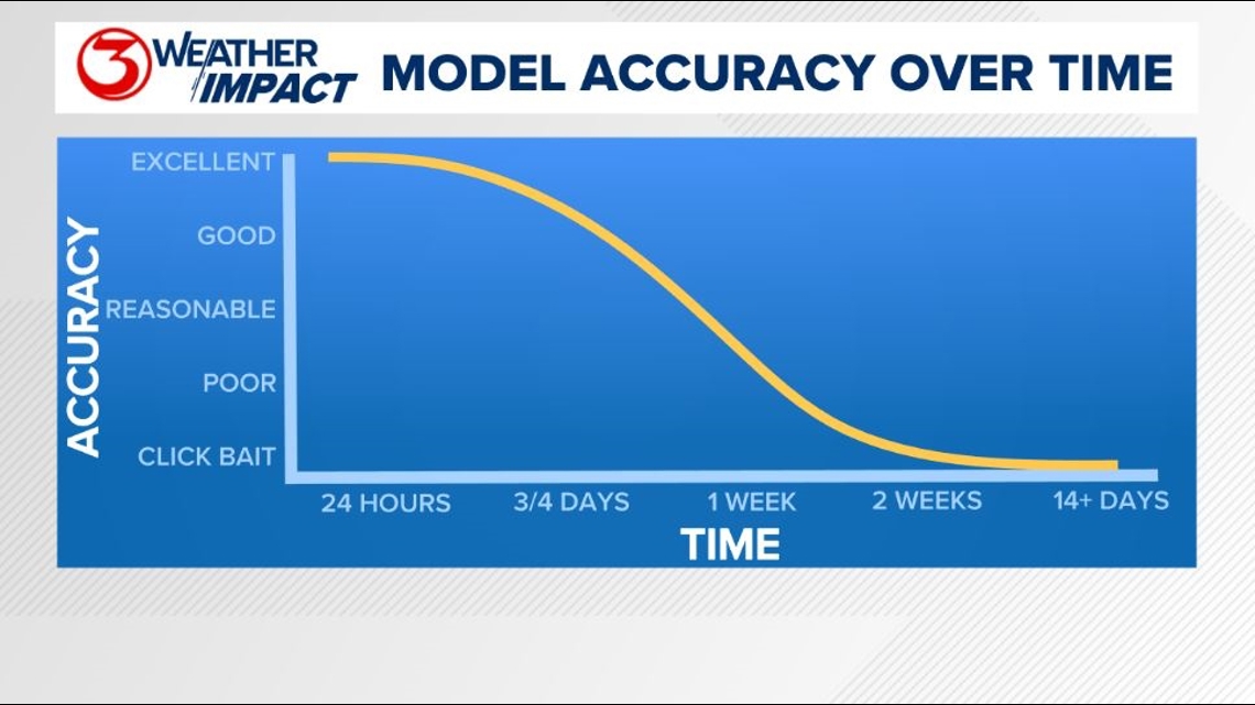
Remember to not "anchor" to the first forecast you see - forecasts change. Also, rely on a credible source for your tropical information and forecasts.