
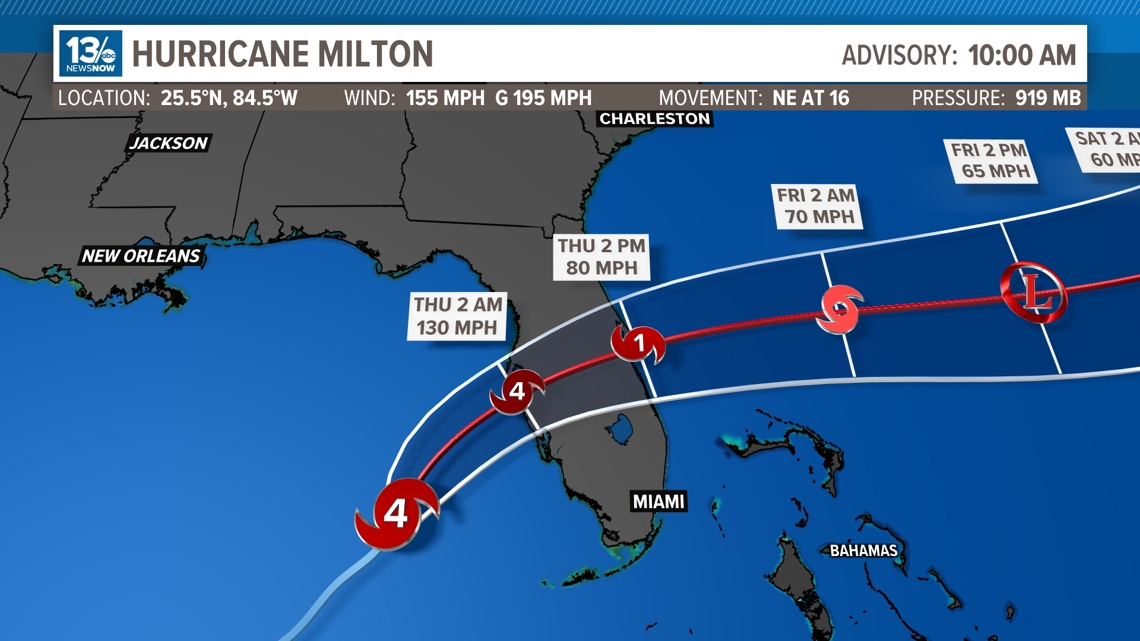
As of the 9 a.m. NHC advisory Milton has weakened slightly to a category 4 with sustained winds of 155 mph and gusts up to 195 mph. Milton has gained a bit of speed and is moving to the northeast at 16 mph.
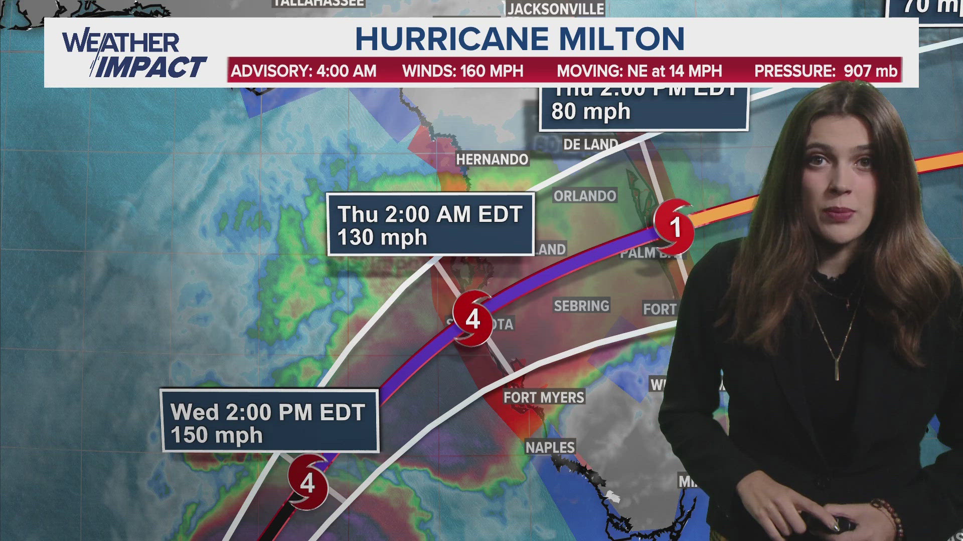
Milton is expected to continue to weaken slightly but will remain a major hurricane. It is expected to make landfall on Florida's west coast by late Wednesday into early Thursday morning as a Category 4 storm, which is stronger than anticipated. This will be Florida's third landfalling hurricane this season.
This hurricane will bring destructive winds, life-threatening storm surge, and flooding rain to Florida. Every single wobble or shift to the west or east Milton makes is crucial to who will see the worst of the storm surge and winds.
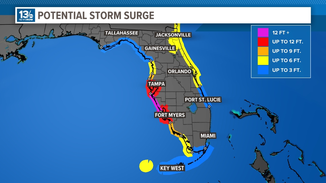
The flooding is especially an issue since Florida already has saturated soils from rain earlier this week with some areas expected some storm surge projections suggest that Milton could break storm surge records set by Hurricane Helene less than two weeks ago.
On Monday, Milton became the second Category 5 hurricane of the season, following Beryl.
Milton at one point was the strongest hurricane in the Gulf of Mexico since Hurricane Rita in 2005, when its central pressure dropped to 897 mb. Rita had winds of 180 mph and a pressure of 895 mb.
A cold front will cross the mid-Atlantic region and settle across the southeast United States keeping Milton to the south and eventually shooting off to the east-northeast and out to sea over the open Atlantic waters.
Hurricane Milton comes just weeks after Category 4 Hurricane Helene made landfall in the Big Bend just a few weeks ago, along with Hurricane Debby back in August.
The spaghetti models are in better agreement that Milton will make landfall closer to Tampa, Florida and cut through central Florida, including places like Orlando.

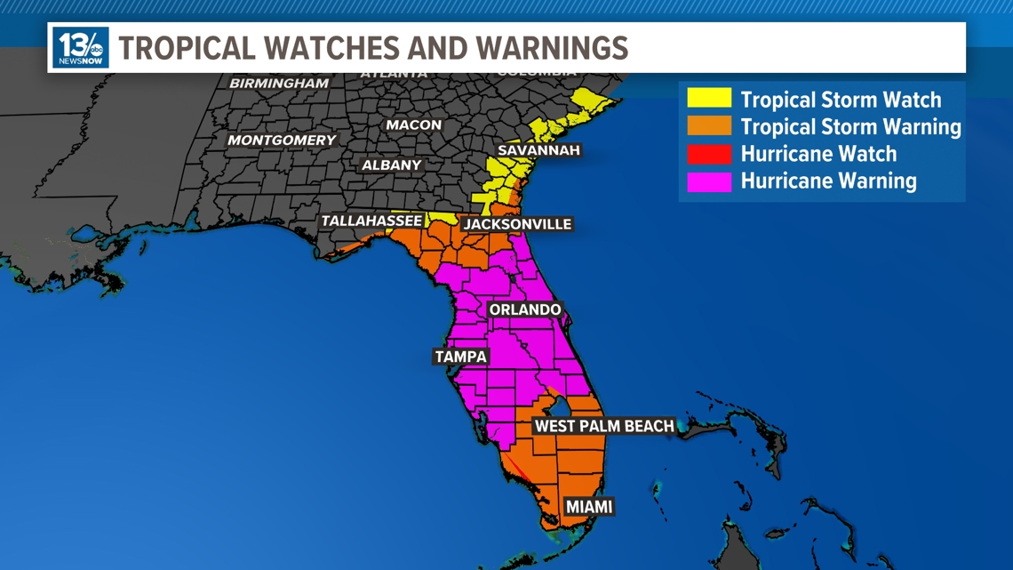
Hurricane Warnings are posted for much of Florida's west coast, inland central Florida, and the Yucatán Peninsula in Mexico. The majority of Florida is under some type of tropical watch or warning. Tropical Storm Watches also now stretch as far north as Charleston, South Carolina.

Milton is expected to bring storm surge, strong winds, and flooding concerns to portions of the west coast of Florida when it makes landfall Thursday. As of the latest updates, storm surge forecasts in areas around Tampa has gone down while areas south of Tampa including Sarasota, Venice and Fort Myers have a higher likelihood of seeing storm surge 12 FT and higher.

Milton will pass over the Florida peninsula, exiting the east coast of Florida Thursday, still as a Category 1 hurricane, a hybrid, or extratropical system if it merges with a frontal boundary pressing southward. As of now, Milton looks like it will stay far off the coast after that and head out to sea late Thursday and Friday.
Hampton Roads Impacts
The good news is, Hampton Roads and Eastern North Carolina should not see direct impacts from Milton. The cold front that pushes through on Monday will push Milton well south of the area. As Milton moves into the Atlantic, we can expect higher tides and strong rip currents at the beaches on Thursday and Friday.