
HOUSTON — Hurricane Helene made landfall Thursday night in northwestern Florida as a Category 4 storm as forecasters warned that the enormous system could create a “nightmare” storm surge and bring dangerous winds and rain across much of the southeastern U.S.
Helene prompted hurricane and flash flood warnings extending far beyond the coast up into northern Georgia and western North Carolina. Before it made landfall, strong winds had already cut power to nearly 900,000 homes and businesses in Florida, according to the tracking site poweroutage.us. The governors of Florida, Georgia, Alabama, the Carolinas and Virginia all declared emergencies in their states.

Three people were reported killed in a possible tornado in south Georgia as the storm approached.
Hurricane Helene Models
Travel affected by Helene
Hurricane Helene watches and warnings
Verbatim from the National Hurricane Center
A Storm Surge Warning is in effect for...
* Mexico Beach eastward and southward to Flamingo
* Tampa Bay
* Charlotte Harbor
A Hurricane Warning is in effect for...
* Anclote River to Mexico Beach
A Hurricane Watch is in effect for...
* Englewood to Anclote River, including Tampa Bay
A Tropical Storm Warning is in effect for...
* Florida Keys, including the Dry Tortugas
* Flamingo to Anclote River, including Tampa Bay
* West of Mexico Beach to the Okaloosa/Walton County Line
* Flamingo northward to Little River Inlet
* Lake Okeechobee
What is a Storm Surge Warning?
A Storm Surge Warning means there is a danger of life-threatening inundation, from rising water moving inland from the coastline, during the next 36 hours in the indicated locations. This is a life-threatening situation. Persons located within these areas should take all necessary actions to protect life and property from rising water and the potential for other dangerous conditions. Promptly follow evacuation and other instructions from local officials.
What is a Tropical Storm Warning?
A Tropical Storm Warning means that tropical storm conditions are expected somewhere within the warning area, in this case within the next 24 to 36 hours.
What is a Tropical Storm Watch?
A Tropical Storm Watch means that tropical storm conditions are possible within the watch area, generally within 48 hours.
What is a Hurricane Warning?
A Hurricane Warning means that hurricane conditions are expected somewhere within the warning area. A warning is typically issued 36 hours before the anticipated first occurrence of tropical storm-force winds, conditions that make outside preparations difficult or dangerous. Preparations to protect life and property should be rushed to completion.
What is a Hurricane Watch?
A Hurricane Watch means that hurricane conditions are possible within the watch area. A watch is typically issued 48 hours before the anticipated first occurrence of tropical-storm-force winds, conditions that make outside preparations difficult or dangerous.
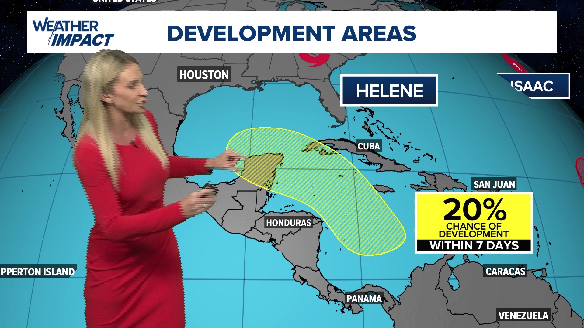
Check back multiple times a day as we continue to watch for potential development. You can also download the KHOU 11 app for updates sent to your phone.
What is a Storm Surge Watch
A Storm Surge Watch means there is a possibility of life-threatening inundation, from rising water moving inland from the coastline, in the indicated locations during the next 48 hours.