
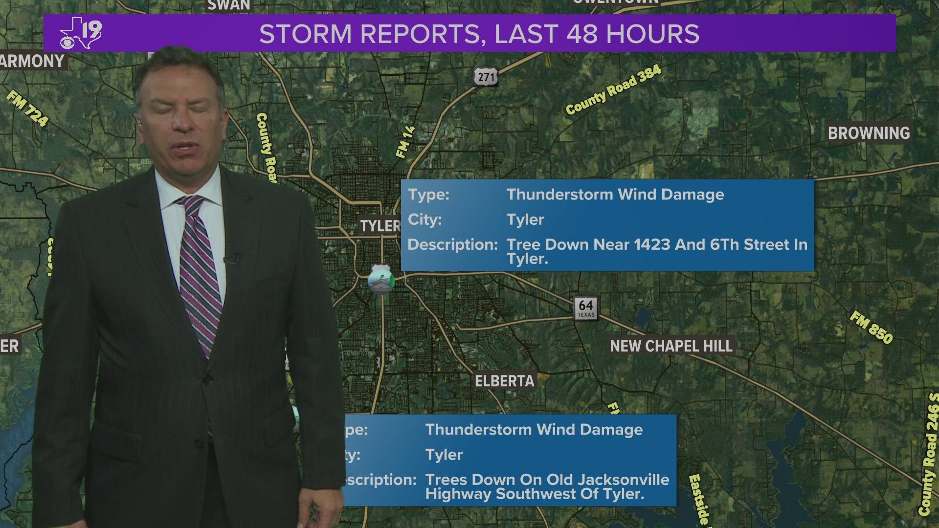
TYLER, Texas — National Weather Service survey teams say it was not a tornado that hit the Azalea District in Tyler Tuesday night. Instead, they are saying it was 100 mph straight-line winds.
National Weather Service-Shreveport, Warning Coordinator Charlie Woodrum says the powerful winds followed a circulation that passed over the same area. The circulation, however, did not spin up a tornado. According to Woodrum, damage in his assessment points toward 100 mph straight-line winds.
Below is a radar loop that the CBS19 weather team captured Tuesday night. This shows the cause of the weather system that the Azalea District experienced.
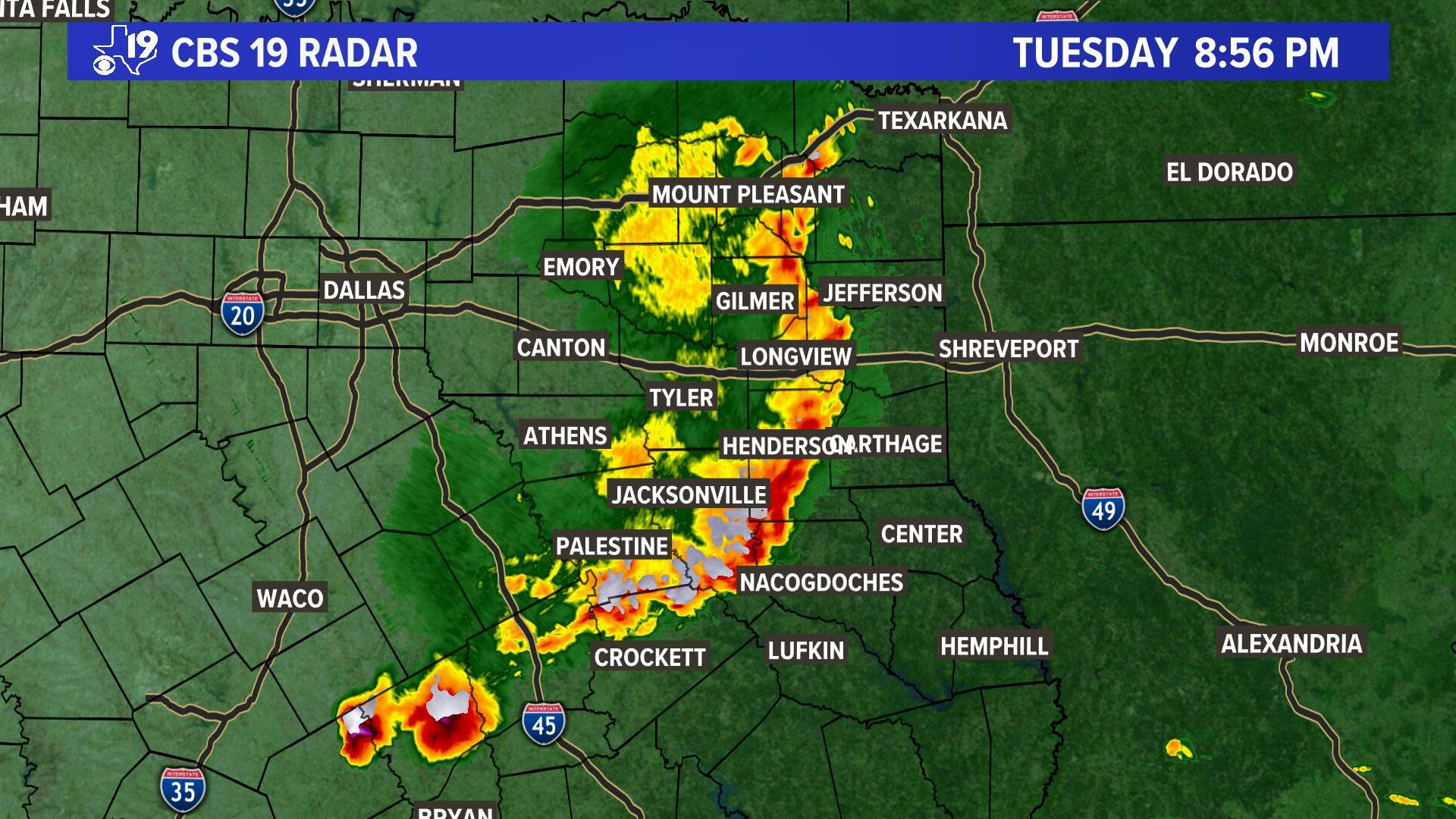
The technical term for this type of weather system is a "Quasi Linear Convective System." Quasi-Linear means that line was wavy; and Connective means that surface heating caused thunderstorms to form and these thunderstorms include upward atmospheric motion; and System because this complex of thunderstorms sustains itself over hundreds of miles. The exchange of heat and cold air within the complex make it work similar to how an engine works.
By looking at the animation and at the top of the thunderstorm complex, you will see a counter-clockwise swirl, which indicates an area of strong low pressure. Additionally, the area of rain-free air that follows the thunderstorms is an area of sinking air, or a small high-pressure area.
Wind is created by pressure differences and the greater the difference, the stronger the winds. In this case, the winds pushing the thunderstorms were very strong and about 5,000 feet off the surface. These winds were rapidly increasing and pushing through the thunderstorms, causing a bow-like structure to form. At some point, through momentum, the winds raced to the surface, causing the straight-line or microburst wind damage.
However, sometimes the winds racing to the surface can create swirls. Have you watched slow moving water suddenly increase and then begin to swirl, especially if it goes downhill? Since the atmosphere is a fluid, it's possible for the winds to suddenly increase in speed and create a swirling effect at the leading edge of the bow-echo.

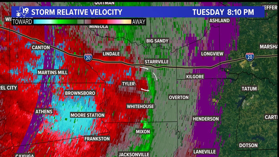
The above image is called a velocity image and it shows the direction the precipitation particles are moving within the thunderstorm which can also be used to assess which way the winds are blowing. In this case, we used the radar from Dallas-Fort Worth.
In the image, the green area is seen moving back toward DFW while the red area is moving away toward Kilgore. This rotational couplet, highlighted by the white arrows in the center of the image, may have been where a quick tornado spun up east of Tyler.
But not all rotations reach the ground, which was the case in the Azalea District. That area of rotation passed overhead but did not spin up a tornado. Instead, what was behind the circulation, the strong downburst winds, that did the damage.
The National Weather Service will send out more teams throughout East Texas to see if all our damage was from straight-line winds and whether one of these areas of rotation spun up a quick tornado. CBS19 will know those answers as soon as the report is published.