TEXAS, USA — A couple of weeks ago, the computer model guidance began showing a strong high-pressure system setting up near Greenland around Halloween. I knew there was a chance for our first freeze of the fall. Temperatures in northern Canada were in the single digits and teens, but the upper-level wind flow was keeping the cold air bottled up in Canada. The atmosphere needed something to make the jet stream buckle and push that colder air south. That's when the Greenland Block came into play.

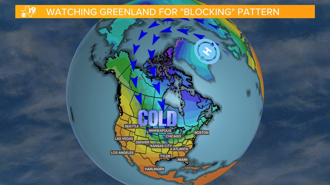
The Greenland Block happens when a strong high pressure builds near Greenland. Blocking weather patterns occur all the time. It was a blocking weather pattern that caused our two main heat waves this summer. In this case, when the high-pressure system blocks up the atmosphere the airflow is deflected south forcing the bitterly cold air in Canada to move, thus a cold front was on the move.
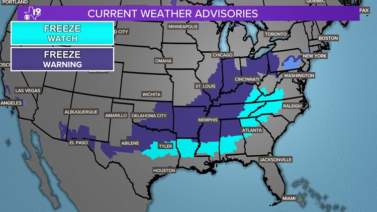
We are experiencing this front now as it has sparked our first cold snap of the year and our first freeze-watches and warnings.


This week's first taste of cold air may hold a clue to what lies ahead this winter. We know this year's winter and spring weather pattern is just setting up. It is every year between the start of October and the middle of November. When this pattern becomes established, it begins to cycle or repeat. Every year is different and we will soon know the cycle length and which storms will be signature storms of the new weather pattern. The National Oceanic and Atmospheric Administration released its winter forecast a couple of weeks ago and if we break that down and apply the Long Range Cycling Weather Pattern theory (L-R-C), we find a few possible signals of what the winter months hold. One of the biggest factors that may come into play this winter is El Nino. El Nino is when tropical Pacific ocean waters warm and disrupt the upper-level winds over the United States. When El Nino is strong, studies show Texas's average high temperatures can run colder than normal and get progressively colder as winter continues with February daily highs potentially running two to three degrees below average.

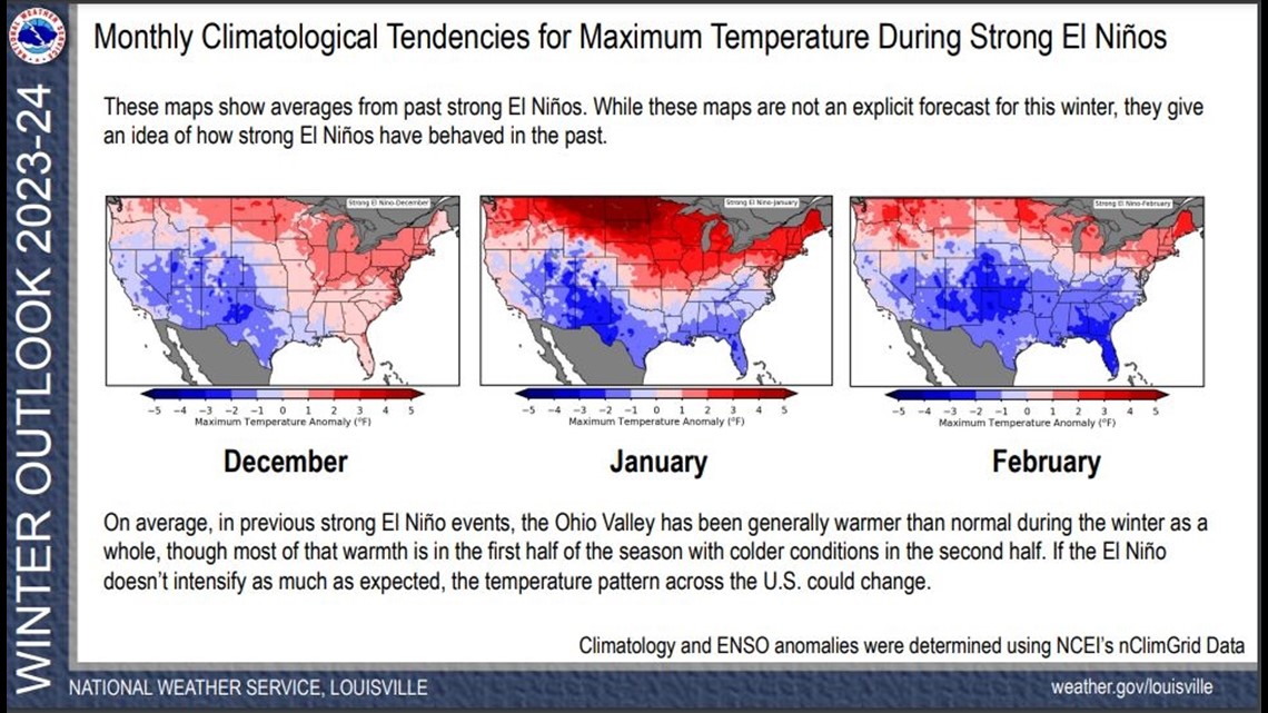
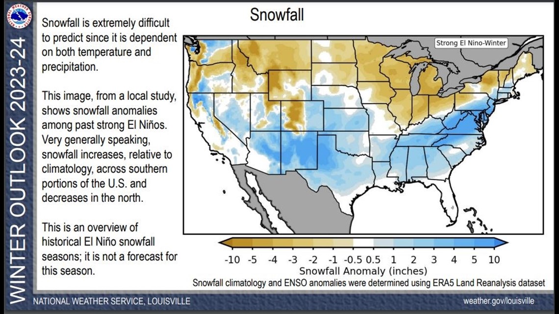
Climatology studies also reveal that El Nino creates a better chance than average for snow in East Texas. That would make sense given the increased chance of below-average daily high temperatures. This doesn't mean it will sno. But according to the National Weather Service, "snowfall increases, relative to climatology, across southern portions of the U.S. and decreases in the north."

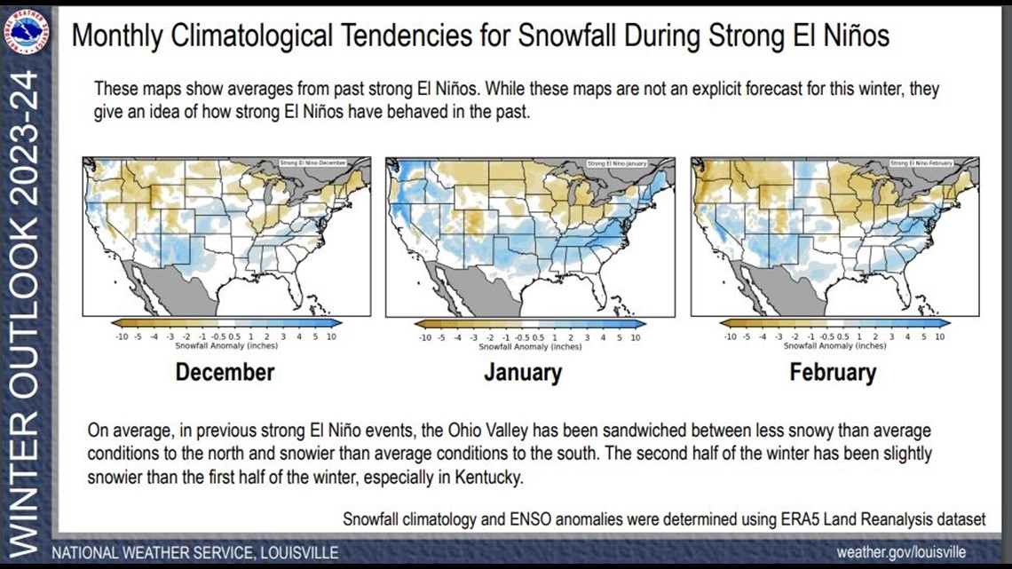
El Nino climatology also shows the tendency for better rain or snow chances in January and February. On average, the coldest time of the year in East Texas is between the end of December and the middle of January.

Given the potential for colder-than-average temperatures in January and a tendency for a better-than-average chance of snow, if East Texas is going to see snow this Winter, it may come in January. I'm not saying it's going to snow in January, but given past El Nino events, there is a higher chance of snow than normal. All of this is dependent on how strong this El Nino becomes. It is forecast by many to become a strong El Nino and last well into the spring. At this time, there is an 80-percent chance El Nino lasts into May.
The CBS19 Weather Experts will be watching El Nino closely as it will be factored into our winter forecast, which will be updated on winter weather special that airs in early January.