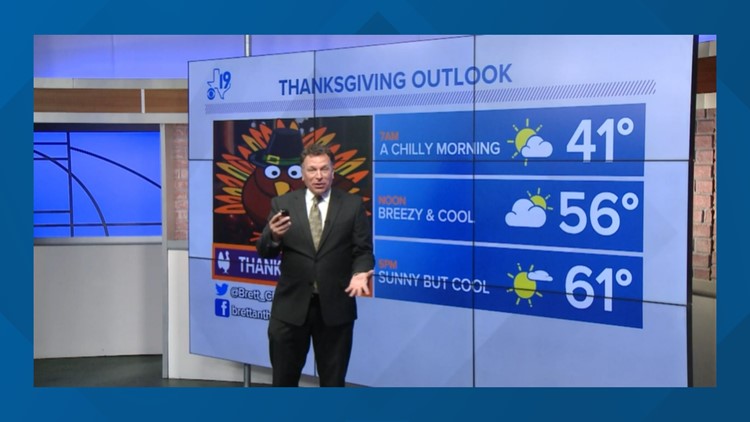
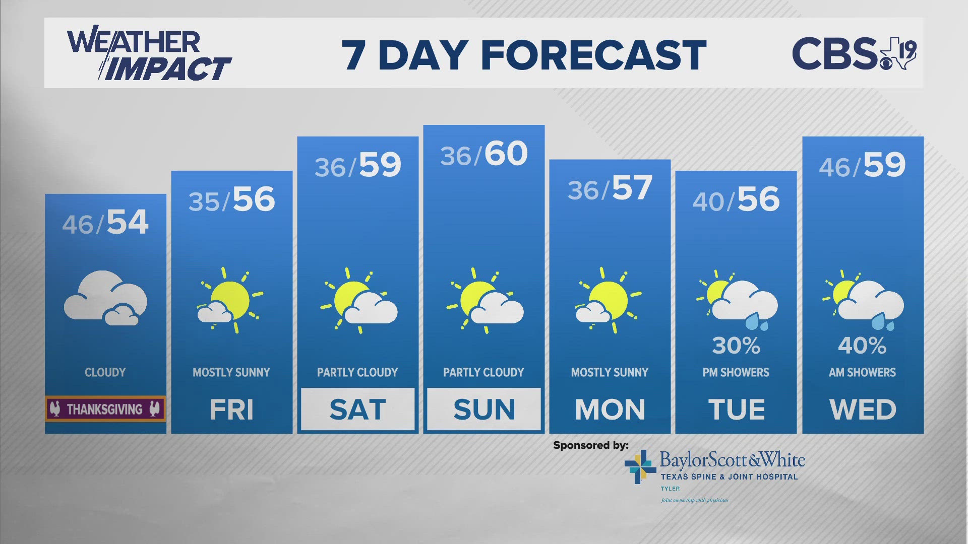
TEXAS, USA — For the rest of the week, the autumn warmth simmers like a friendly side dish. But as we head toward Thanksgiving and the second half of the month, temperatures tumble like a turkey's fate on Thanksgiving. Colder air is once again building near the Arctic Circle and single-digit temperatures are showing up in northern Canada.

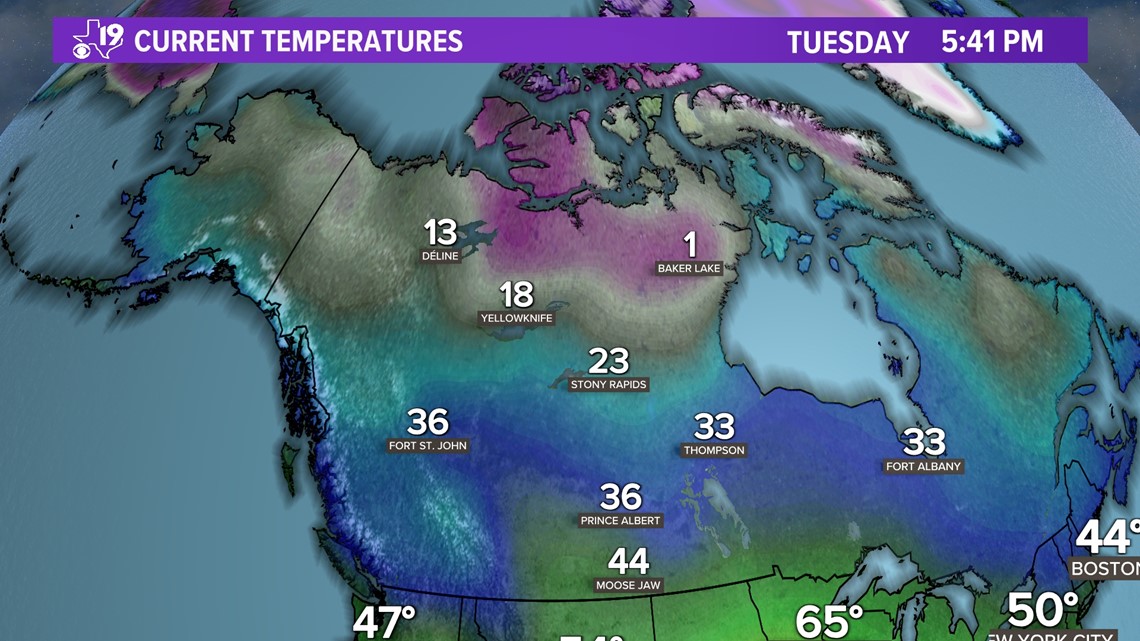
For the time being, that colder air remains bottled up. However, a weather pattern is showing signs of developing next week that could send some of the cold air surging toward Texas.
The weather pattern that could unlock the cold air and send it south is shown in the long-range forecast maps. It's a big area of high pressure that builds over the Pacific Ocean.

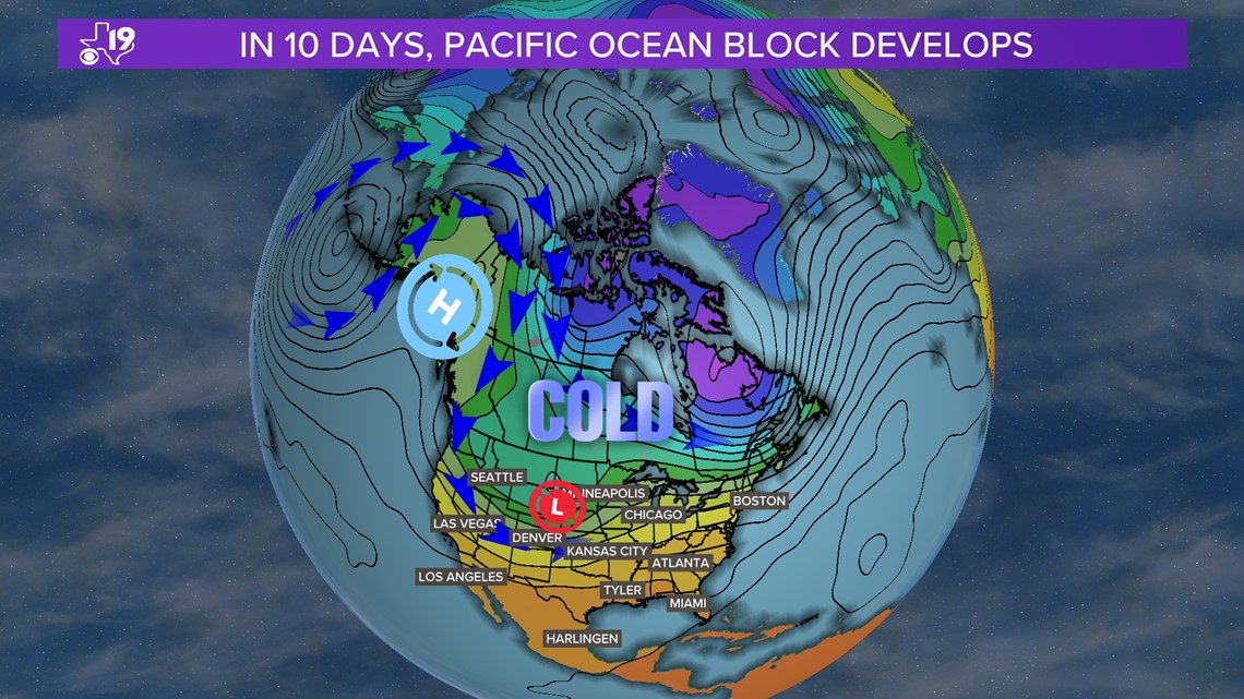
Why will it get colder in Texas? The high-pressure system near Alaska will block mild Pacific Ocean air from flowing into the western United States. Instead, cold air that is currently over Canada will follow the upper-level winds and spill into the central and southern U.S. This weather pattern is referred to as the Eastern Pacific Oscillation. Like other oscillations in the atmosphere, the EPO has a positive phase and a negative phase. When the EPO goes into the negative phase, colder-than-average temperatures can be felt over much of the U.S. This appears to be the case in the next six to 10 days.

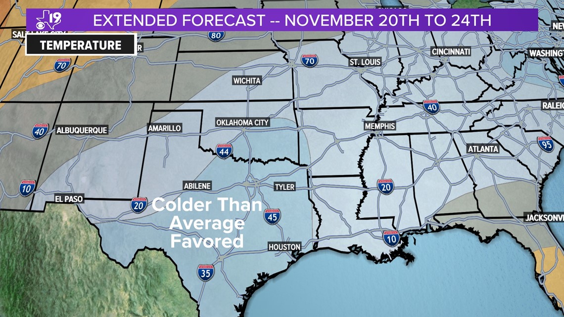
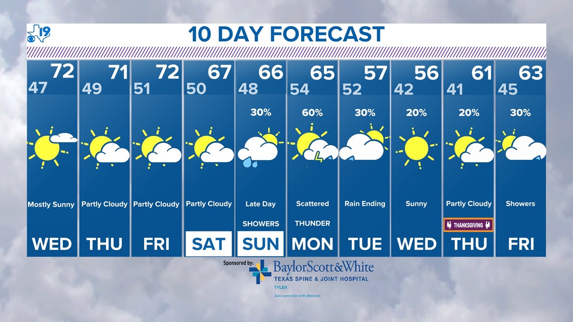
How cold will it get at night and during the day? The 10-day forecast has the answer. The below-average temperature forecast is tied to the last three days of the extended outlook. That's when another push of colder air is scheduled to arrive in East Texas. The cooler air also brings more energy to the region so there should be several rain chances beginning Sunday night.

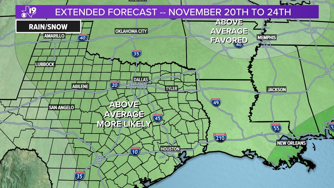
Colder air diving southward into the U.S. will cause the upper-level winds to become more wavy. This allows storms to form. Upper-level storms often create surface low-pressure areas which can drag cold fronts into regions of the central and southern plains. Where cool, dry air collides with warm, more humid air, rain and thunderstorms will form. This means we have a very good chance of seeing above-average rainfall through the end of the Thanksgiving holiday weekend.

There are signs of even colder air arriving between Nov. 22 to Nov. 27. Colder air is often drier so it stands to reason that in that same time period, we could be looking at below-average rainfall. This developing weather pattern is important because it provides another clue to the winter weather puzzle. We are working on our winter weather forecast and it relies on key features of the weather pattern repeating. We are getting closer to identifying the length of this year's weather cycle (The LRC) and this will help us with our long-range forecasting during the winter.
We will know when these cold air outbreaks will return and whether they will come with rain or if it will be cold enough to bring a chance for ice or snow. Stay tuned the winter weather ride is just getting started.


