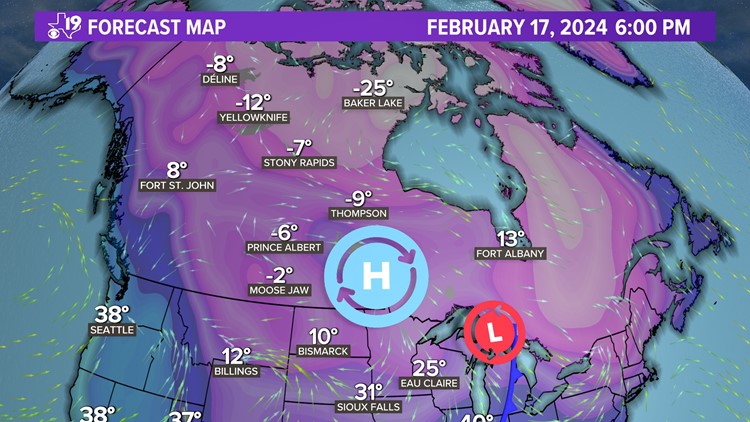
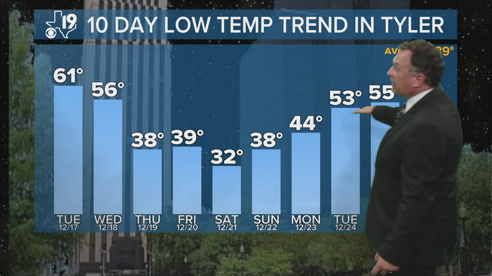
TYLER, Texas — Is another round of Arctic air headed our way?
Let's explore the possibility of another bitterly cold shot of air making it into East Texas. First of all, why do I think it's possible? A similar weather pattern developed in late November and returned in mid-January.

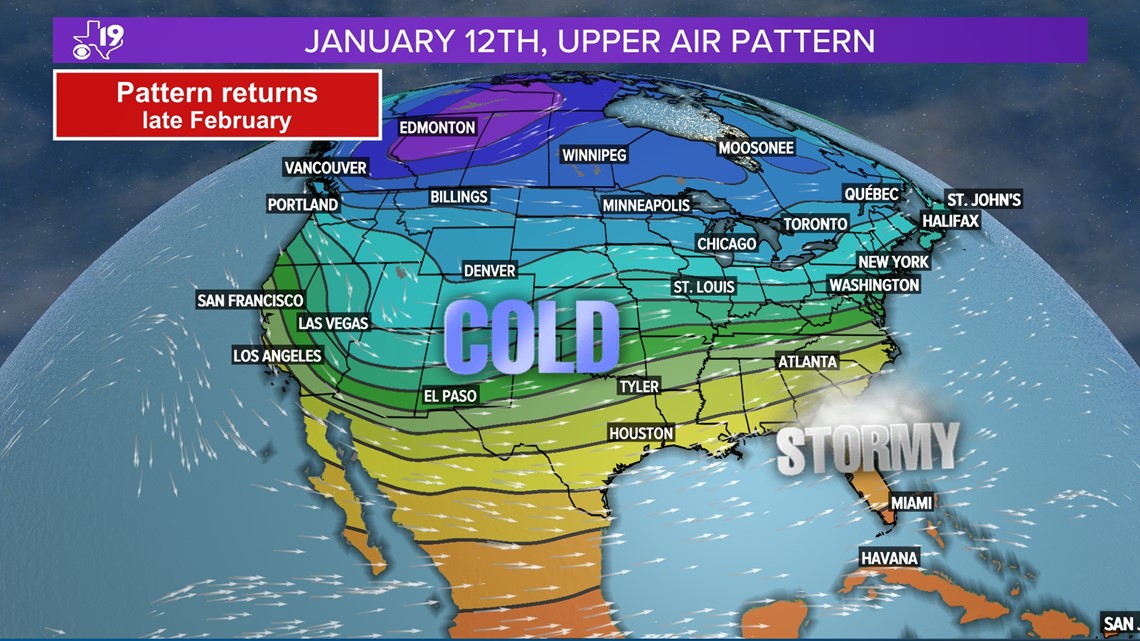
The Long Range Weather Pattern Cycling Theory or L-R-C shows us when key features within the global wind circulations will repeat. So, the weather pattern that produced our first real taste of cold air in late November and Arctic air in January should return toward the end of February.
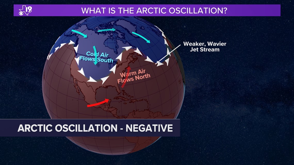
But how cold will it be this time? It's hard to imagine it getting as cold as January but it's not off the table. Why? Let's explore something called the Arctic Oscillation. The A-O index can be measured either negative or positive.
When the Arctic Oscillation is positive, strong west to east moving winds at around 20,000 feet keep the cold air bottled up over northern Canada.

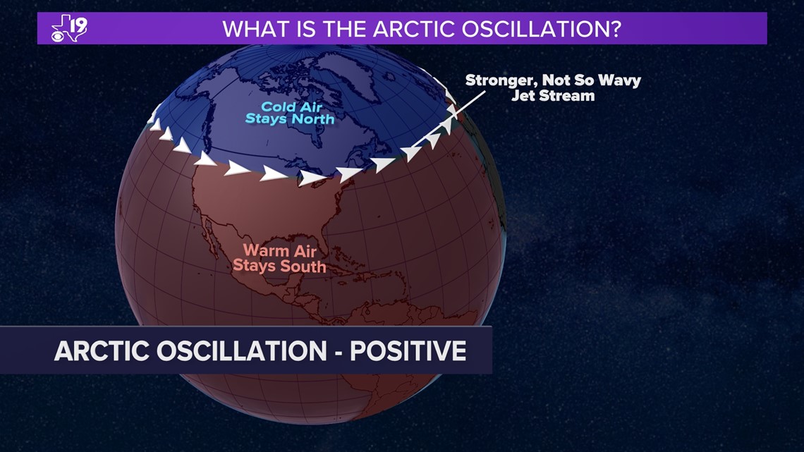
But when the A-O turns negative, the jet stream weakens and allows bitterly cold air to invade the United States.

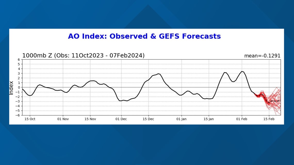
Where is the evidence this will happen again by the end of February? The Arctic Oscillation is following about the same cycle length as this year's Long Range Cycling Weather Pattern Theory.
We've seen the Arctic Oscillation go negative two previous times, with both times getting cold in East Texas. The forecast is projecting for this weather pattern to happen again around the third week of February.

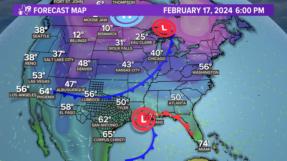
Remember our winter weather forecast that aired during our Winter Weather Special, "Ice Cold" on January 12th called for above average rainfall in February and another cold surge of air during the second half of the month.
This is the cold surge of air we were forecasting. Long range computer models are now starting to show the cold air surging into the Central and Southern Plains.

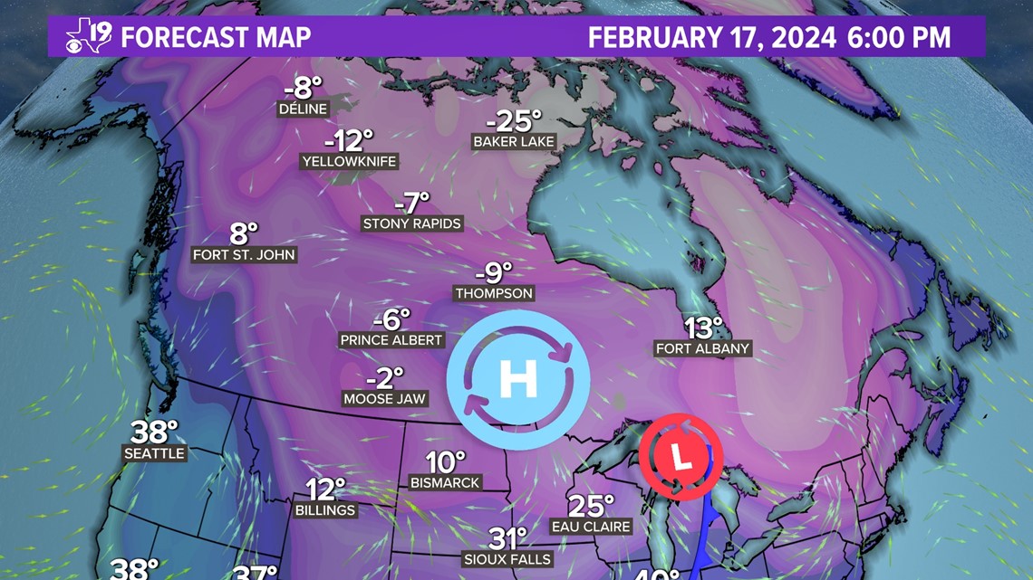
There is also a lot of cold air to work with by the middle of the month. Alaska has experienced bitterly cold air recently and Arctic air is forecasted to extend all the way into northern Canada by the middle of the month. This will make for an excellent source region of the arctic air once the Arctic Oscillation turns negative.

All of these factors suggest another surge of very cold air. However, there are a few things keeping this Arctic air invasion from being a slam dunk.
1) The lack snowpack over the United States. Only the inter-mountain west, the Rockies and the northeastern U.S. have significant snow on the ground. This is important because as cold air moves south it will tend to warm up as it moves away from its source region. A snowpack would keep that bitterly cold air chilled as it moved into the United States.
2) The upper level winds may end up unfavorable for cold air to surge all the way into South Texas. Instead we could see a wavy jet stream that would be conducive to generate a severe weather set-up by the end of the month. So, for now, let's leave it as an unofficial Arctic Air Watch and keep our eyes on these key factors.

