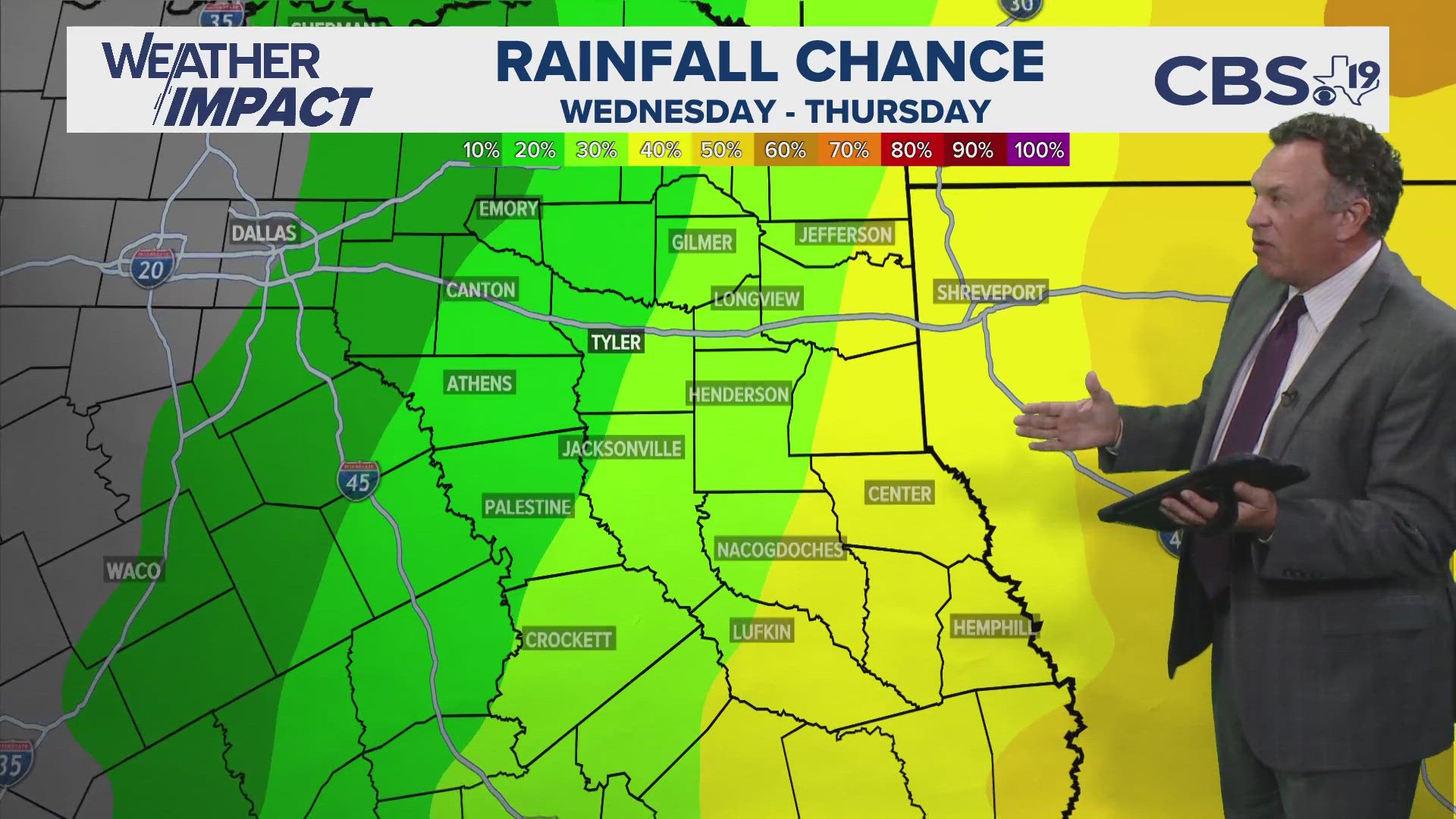
TYLER, Texas — Get the crockpots, soup bowls and coats ready!
There's much colder air on the way for the end of next week and it might just signal a longer, colder than average stretch that could last up until Thanksgiving.
This time of year, as the length of daylight shortens, the sun angle lowers and snow falls across northern Canada, temperatures start dropping. Observed temperatures in the northern Canada Tuesday night were in the single-digits.

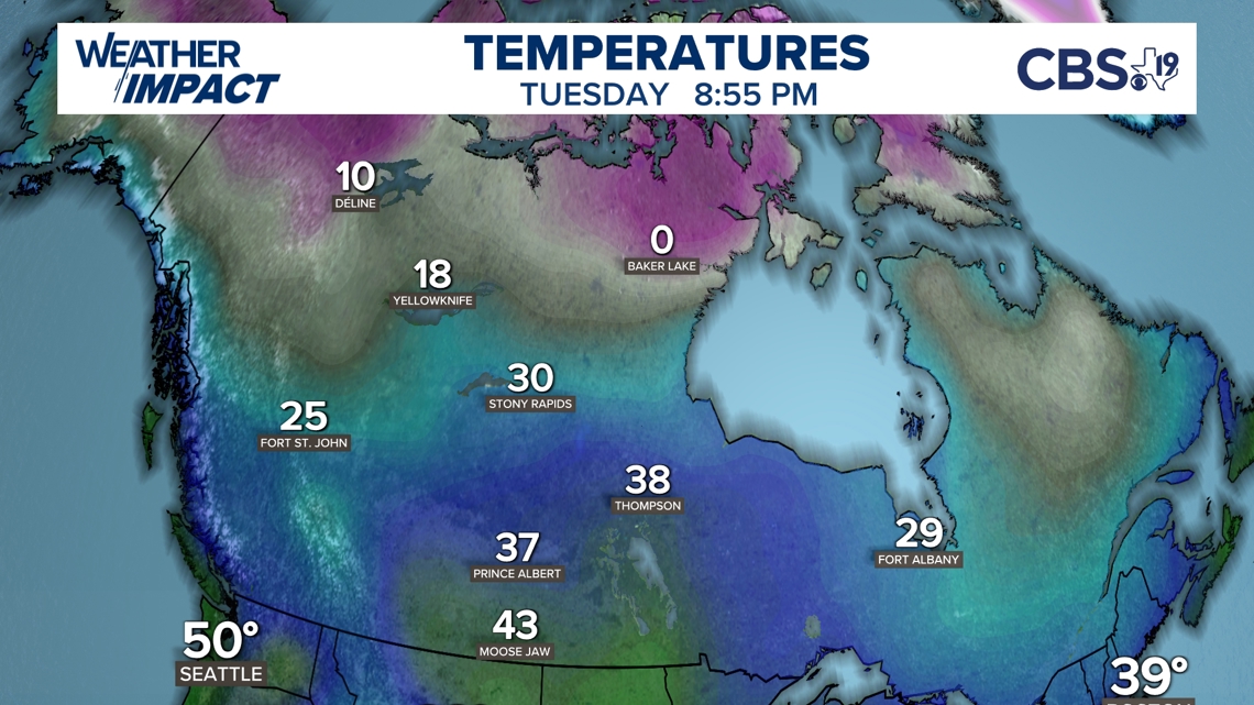
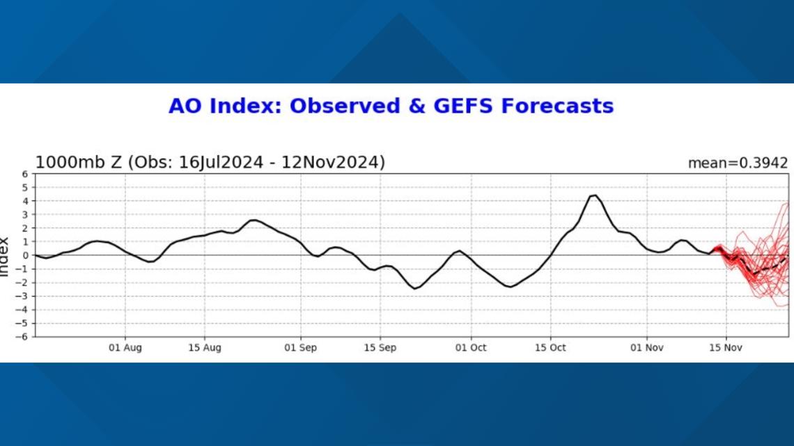
And if you're going to see colder temperatures in East Texas, you've got to have a source region of the cold air. And Canada is typically that region we toward. But we have to have a way to get that cold air to start moving south. What could cause that? We can look at something called the Arctic Oscillation as one of the causes. The Arctic Oscillation describes the movement of arctic air into the northern, central and even southern plains which includes East Texas. When the A-O goes into a negative phase, the arctic air tends to move south.

Upper level winds can direct help steer or direct the colder air away from the polar regions and into the United States. Sometimes, a large area of high pressure will develop near Greenland and this will block up the atmosphere so that upper level winds start blowing more north to south instead east to west, which is direction the winds have been doing for much of the last two months. The wavy upper air pattern that develops is called a meridional flow. It's often associated with storms, sometimes big upper lows and bursts of colder air into the U.S.

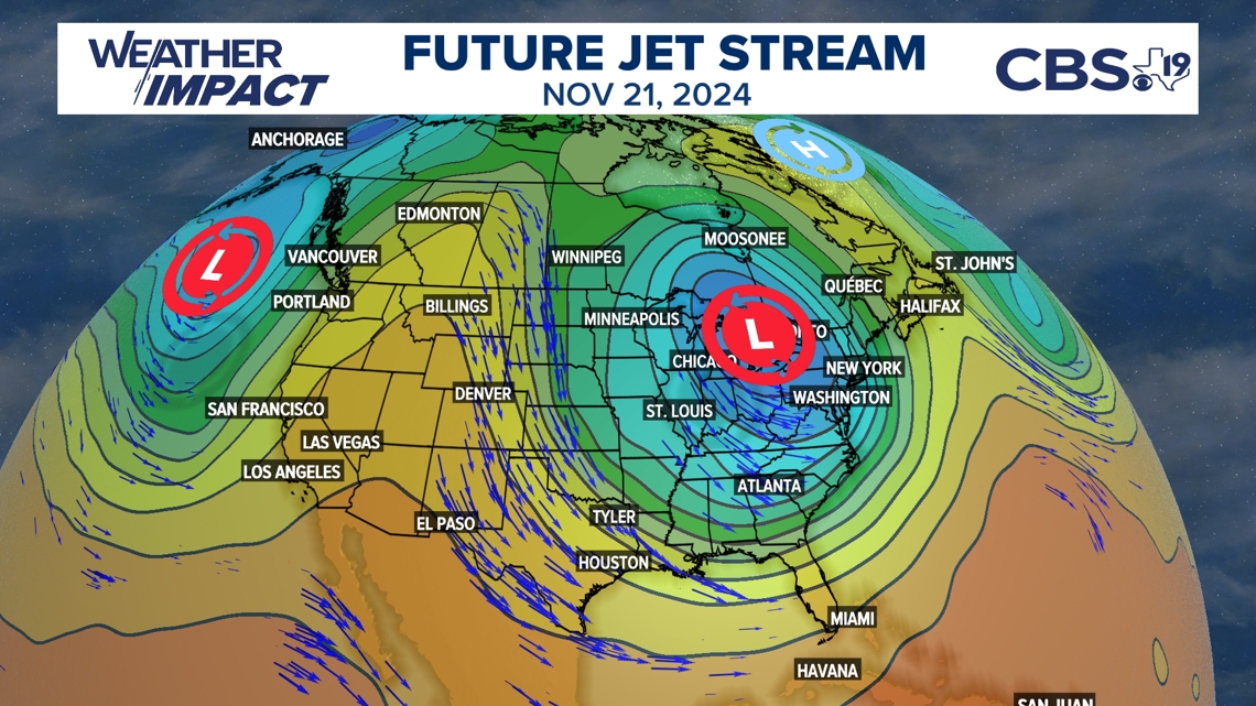
The winds aloft push the cold air south, sometimes all the way to Gulf Coast. Even though it's in the single digits in Canada it is highly unlikely we will see single digits in Texas next week. That's because, as the cold air travels south, it moves over warmer ground, changes shape and slows down. All these factors cause the air to become warmer than the region from where it came. A deep snow pack would help to refrigerate the air, but at this time, a deep snow pack over the northern U.S. is not expected.

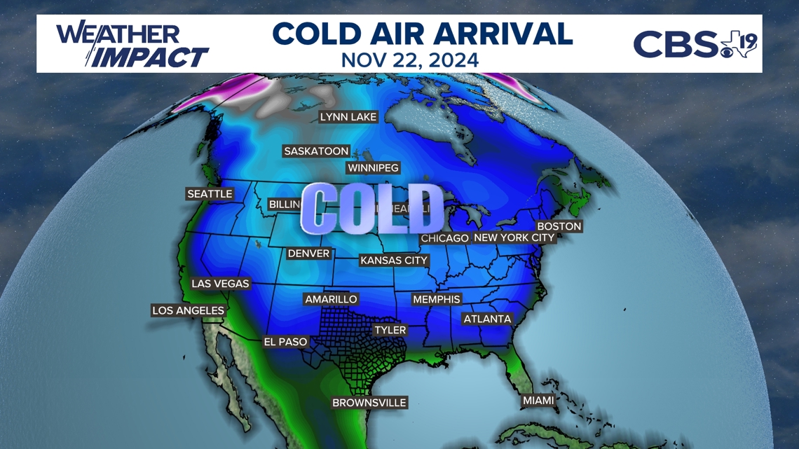
This chunk of polar air is expected to drop overnight temperatures next week into the upper 30s and low 40s. Daytime highs will be worth of sweatshirts and coats. Highs will only top out in the upper 50s and low 60s. The colder than average weather pattern is expected to last into the last full weekend of November. Temperatures are expected to warm back above average by Thanksgiving. But could still be closer to average meaning Thanksgiving leftovers could be perfect for the crockpots and soup bowls.


