TYLER, Texas — Are you ready for another round of severe weather?
There's no guarantee we see severe weather Friday, but the ingredients that make strong or severe thunderstorms is possible.
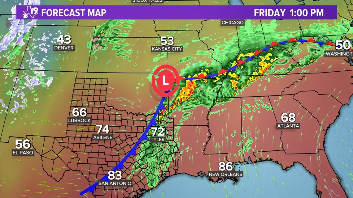
Let's start with the big picture. We have a very warm and humid air mass in place in East Texas.
Thunderstorms develop when something comes along to nudge the air upward. That could be a dryline, a cold front or an area of low pressure.
Most of Friday's thunderstorms will develop along the cold front that drifts into East Texas during the afternoon.


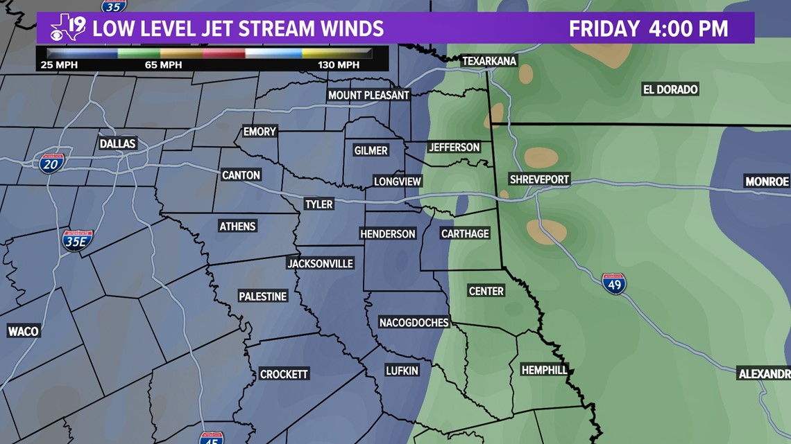
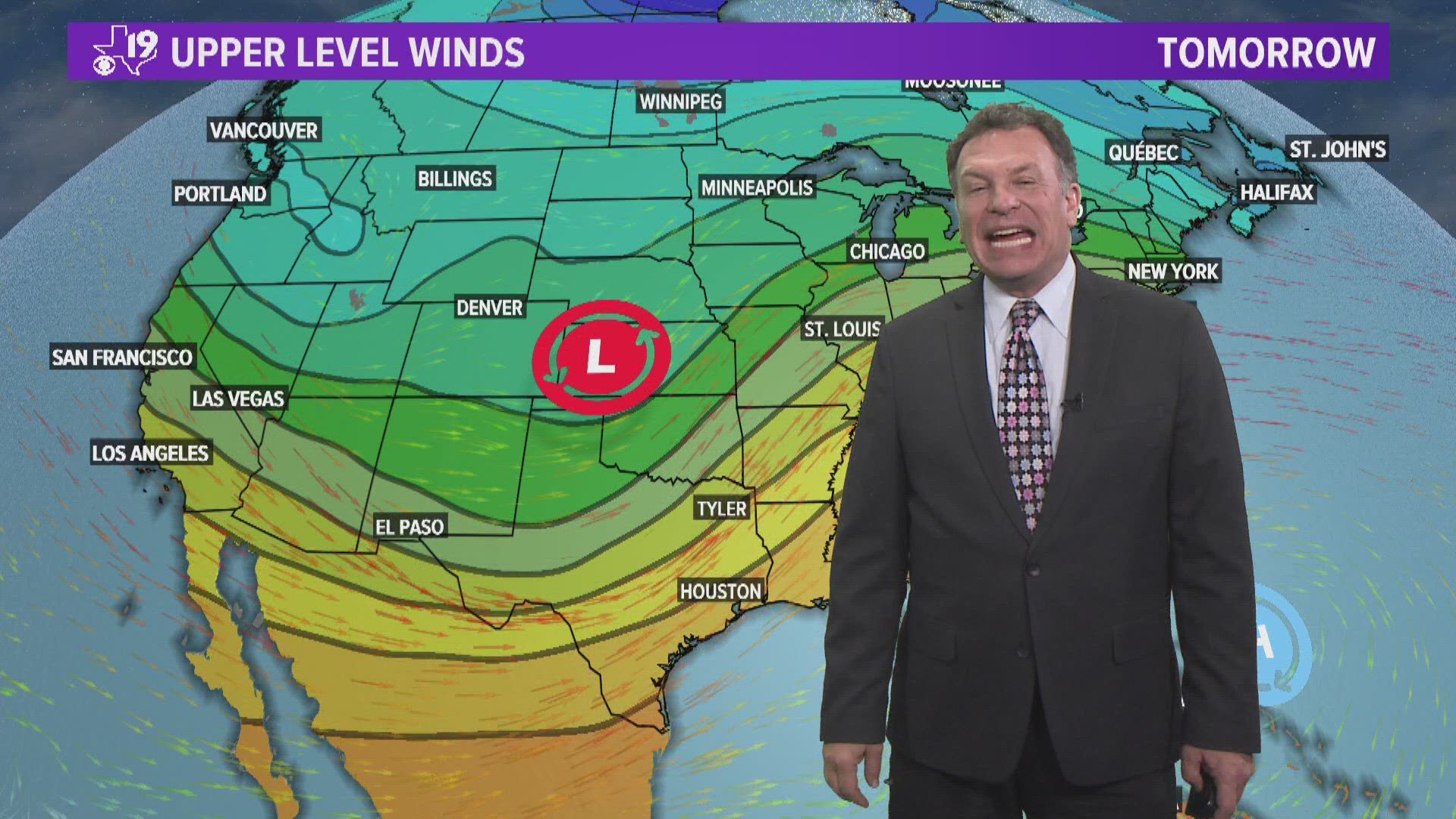
Thunderstorms Friday afternoon will have some added energy thanks to increased wind shear. Wind shear is created by either a change in direction or wind speed from the surface to several thousand feet in the atmosphere.
Friday afternoon, with plenty of moisture or fuel available for thunderstorms, low level shear will increase right along the Texas/Louisiana border. This should be enough shear to increase the tornado potential in this area.


The bullseye for severe weather is over the ArkLaMiss Friday evening. That is where there is "moderate" risk for severe weather.
In moderate risk areas, we often find the most intense thunderstorms and sometimes several tornadoes can occur.
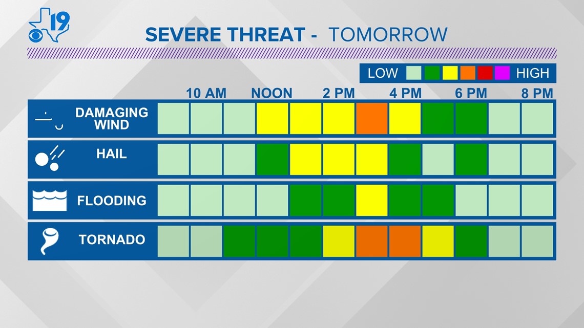
The threat might be smaller, but we could still see damaging wind gusts, some hail and even a tornado or two.
But we'll have to keep an eye on the weather even here in East Texas and that is why Friday has been designated a CBS 19 Eye on Weather Day.


You know the drill. Review your severe weather plan. Have more than two ways to get information about watches and warnings.
Download the CBS 19 App if you haven't already and plan to stick closer to home tomorrow afternoon.
The threat of severe weather is over by 6 p.m. so don't cancel any Friday night plans. Thanks for reading and watching the CBS 19 Weather Blog.

