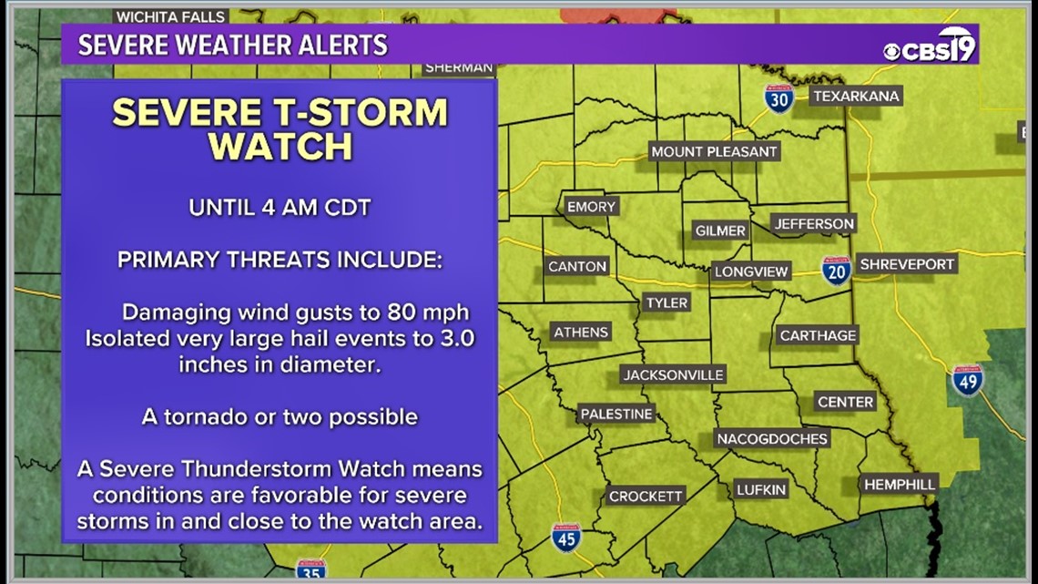
TYLER, Texas — A band of severe thunderstorms will surge southeastward to southward across East Texas tonight. Severe downdraft winds will be a distinct hazard, with isolated gusts near hurricane force possible.
A few storms also may produce large, damaging hail in parts of north Texas. A line-embedded tornado or two cannot be ruled out as well. Power outages and downed trees will be highly likely. Be sure to stay weather aware.

If you are in the pink area, there is a 45% chance you will encounter severe storm winds overnight.

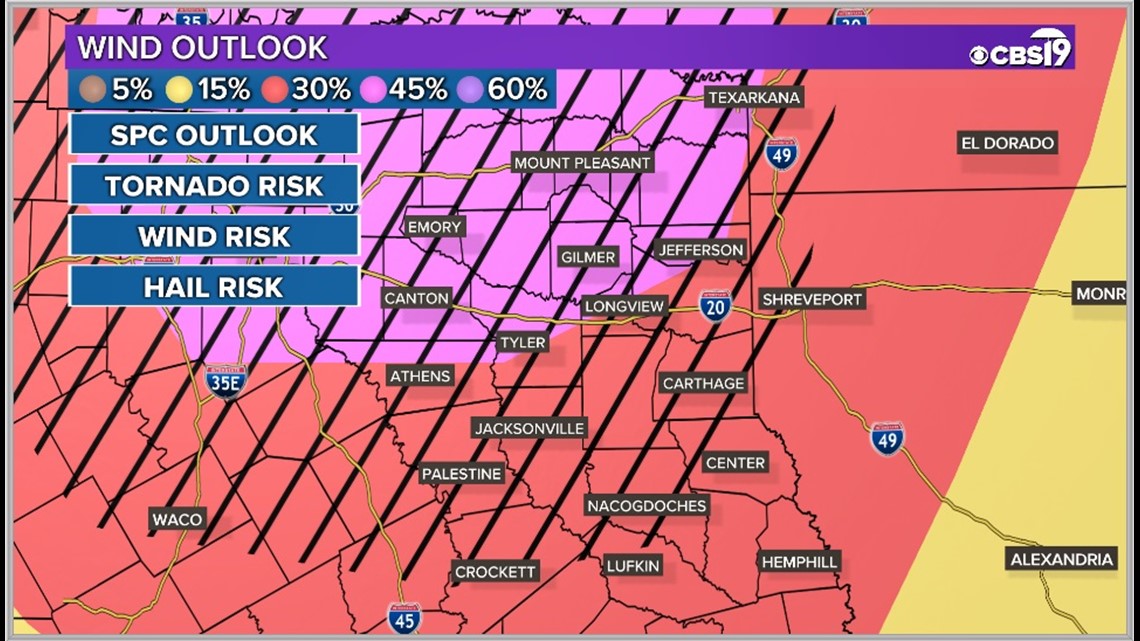
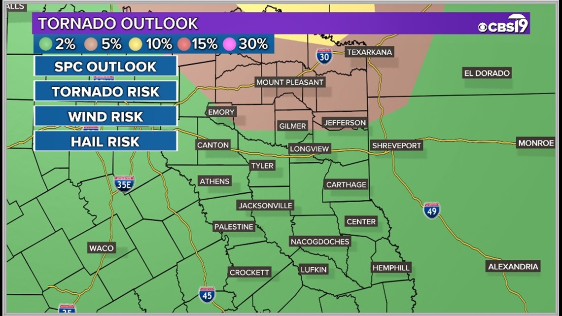
Tornadoes and large hail cannot be ruled out with a few storms overnight as well. There is a 5% chance you could see a tornado if you are in the brown area.

Here's the latest.
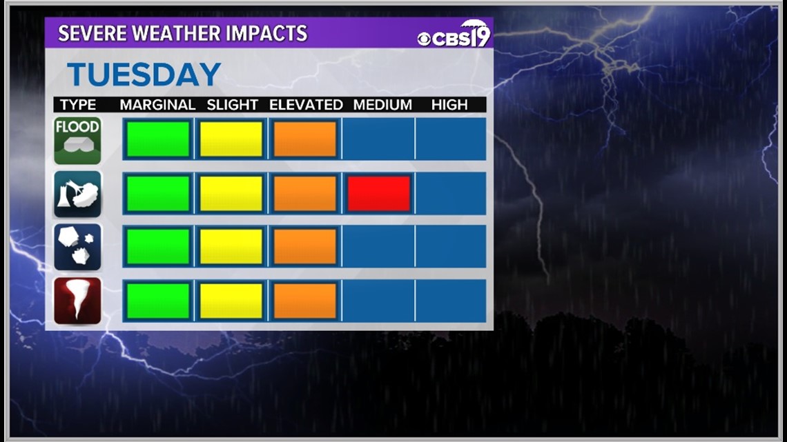
The Threat:
A cold front will approach from the northwest later in the day on Tuesday, every storm model is picking up on some strong storms to develop along the front after sunset.

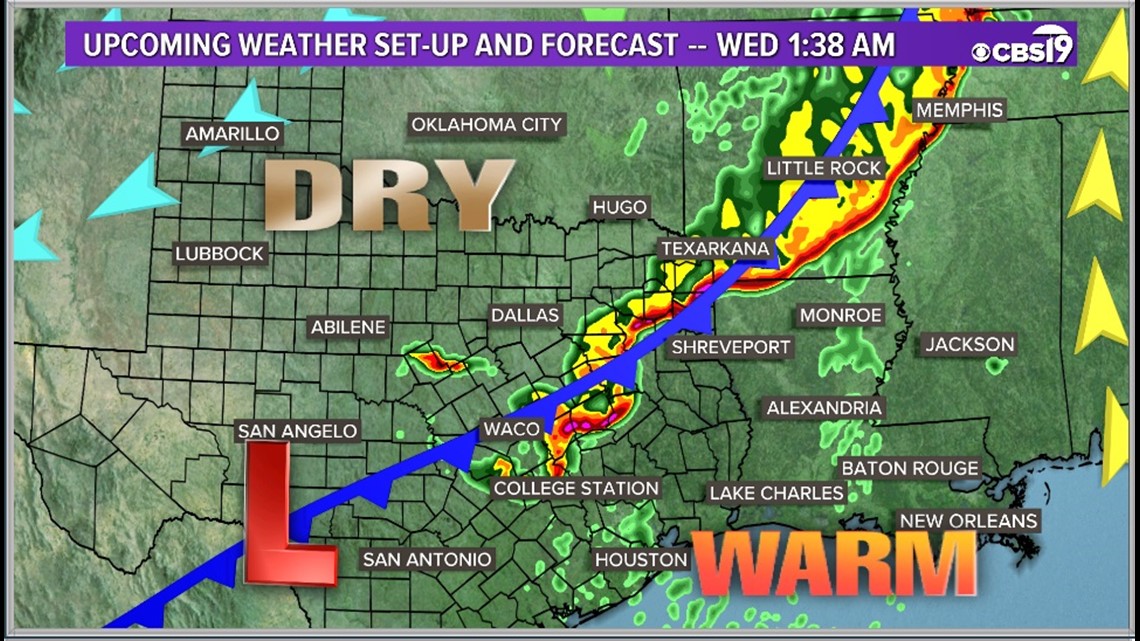
The threat exists from as far north as St. Louis, as far west as Abilene, as far south as Houston and as far east as Mississippi. The most likely place for tornadoes will be to the north of East Texas.

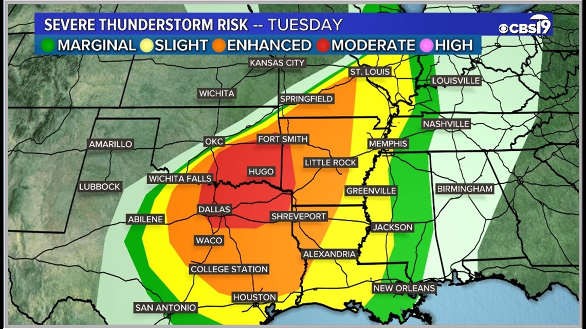
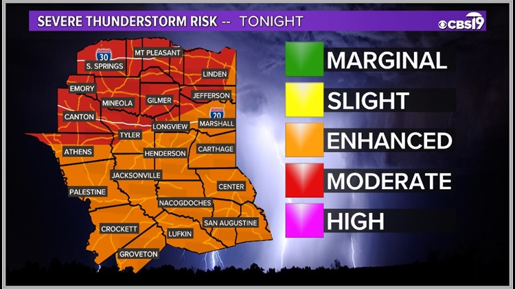
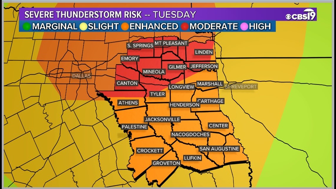
Areas north of Tyler and Longview are under a moderate risk for severe weather. Areas in the red are under the most significant threat for extreme storms.
The rest of East Texas is under an Enhanced Risk, or level 3 of 5, for severe weather on Tuesday night. However, those areas are also expected to be impacted by strong to severe storms as well.

All severe weather types are possible during Tuesday's storms. Most of us will be impacted by strong winds overnight though.

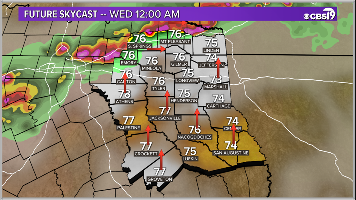
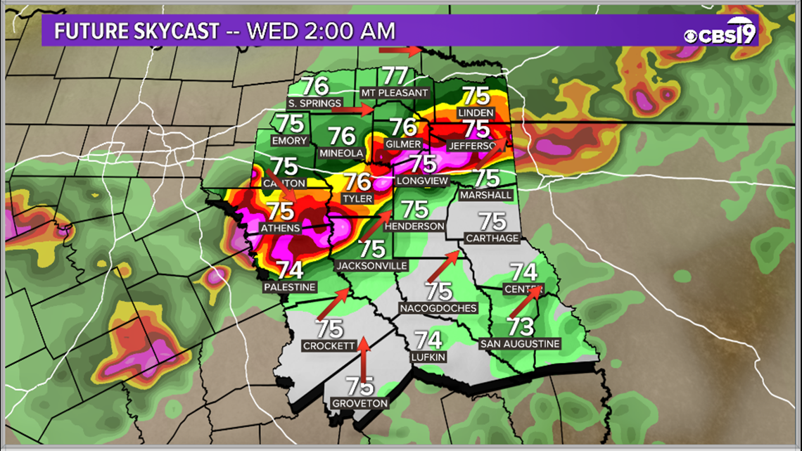
We could see a few rotating individual cells in the evening hours, but those will be widely scattered and difficult to forecast when and where they will be popping up. We are very confident about the line of storms coming by after sunset Tuesday and sticking around until sunrise Wednesday. Here is a look at the timing of those storms.
12 a.m. Wednesday

2 a.m. Wednesday

4 a.m. Wednesday

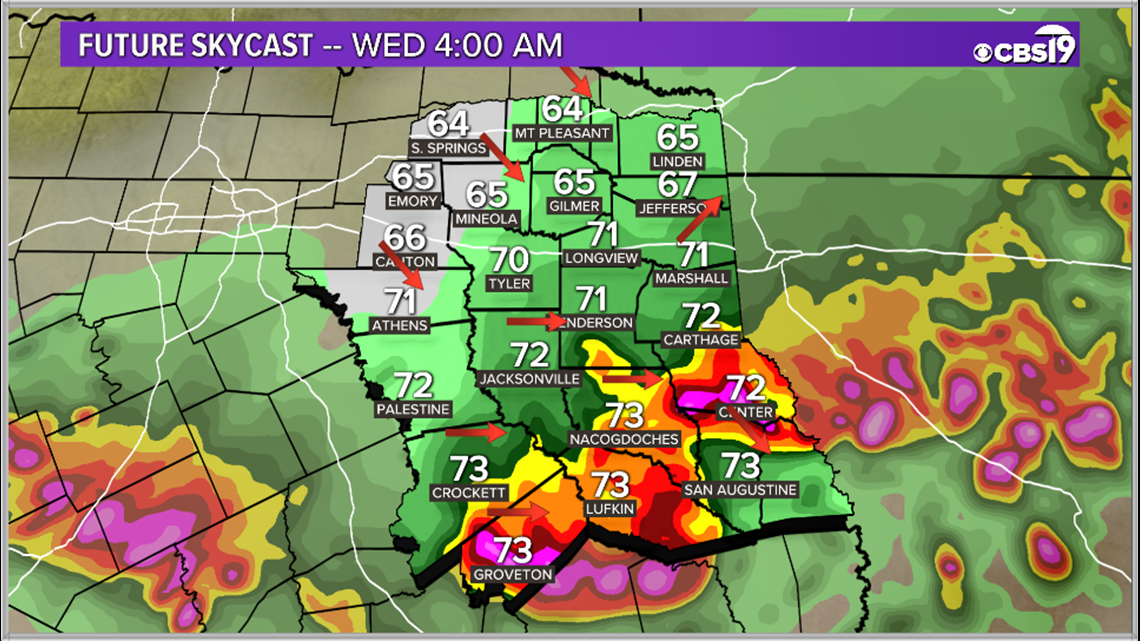
The storms are expected to clear out by the time the sun comes up on Wednesday.
Final Thought:
Power outages and downed trees are almost a guarantee across East Texas tonight, please keep your cell phones close by and ringers up to be alerted to any severe weather heading your way tonight.
You can get the latest alerts sent right to your pocket with the KYTX CBS 19 mobile apps!
Connect with CBS 19 Chief Meteorologist Joel Barnes on social media:
Do you have a weather report or pictures you would like to submit to the CBS 19 Weather team? You can email news@cbs19.tv and visit our Facebook or Twitter pages.
Keep up with the latest news, weather and sports by downloading the FREE CBS19 mobile app.
Click here to download the iPhone app.
Click here to download the iPad app.
Click here to download the Android app.