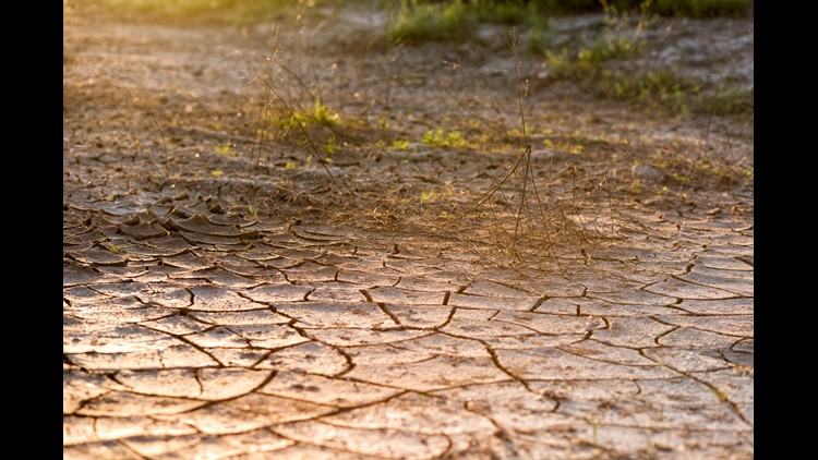
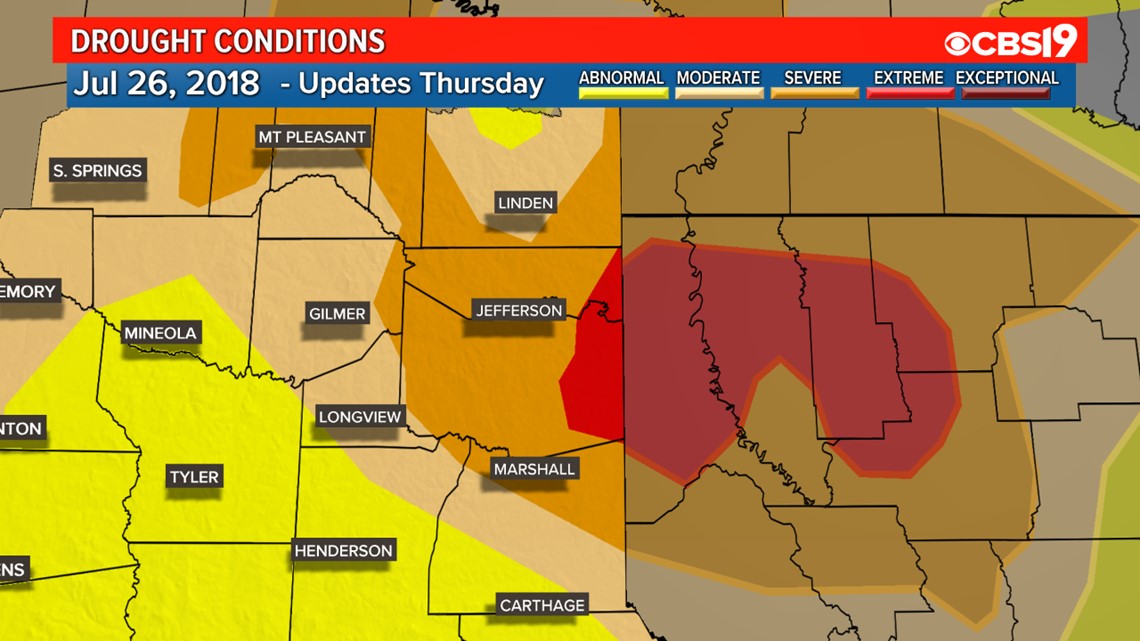
EAST TEXAS — The rain we had a few weeks back during the week of the Fourth of July led to a few weeks where drought conditions were improving across East Texas. That came to an end today. The latest Drought Monitor, a product of the National Oceanic and Atmospheric Administration (NOAA), the U.S. Department of Agriculture (USDA), and the National Drought Mitigation Center (NDMC), now shows Moderate Drought and Severe Drought expanding across East Texas, as did the area experiencing abnormally dry conditions. What is new, and showing up for the first time this year in East Texas, is Extreme Drought conditions, which is the second most severe classification in the Drought Monitor system.
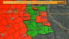
Last Week
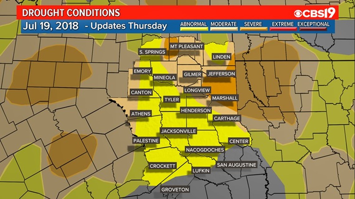
This Week
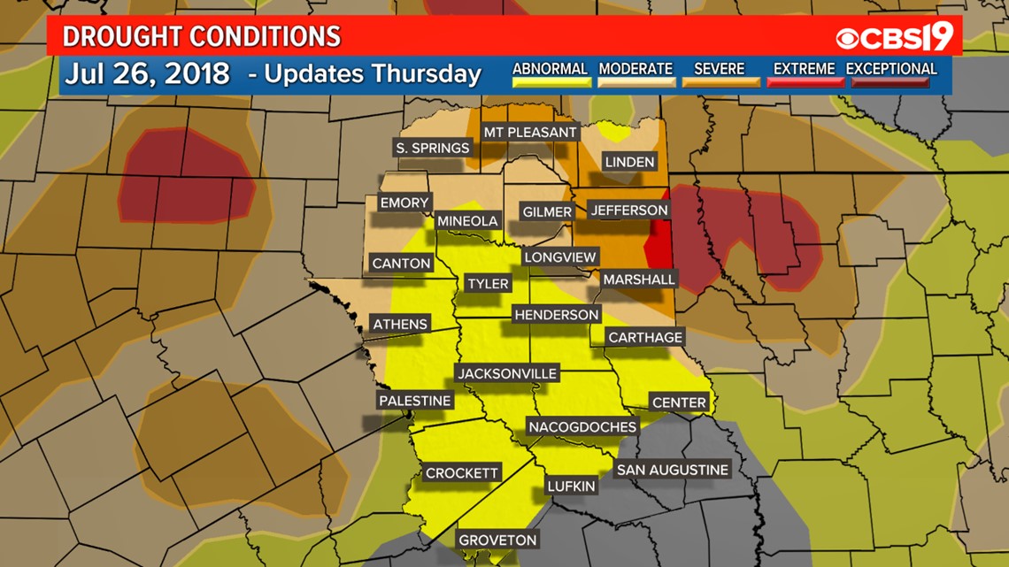
Area of East Texas now experiencing "Extreme Drought".
How Did We Get Here?
A year that started off rather wet has now been stuck in a dry pattern for the better part of the last few months. Looking at the weather data, we were heading in a positive direction for the start of the year. February ended up 4.08" above normal for Tyler and March was 0.47" above normal. That all started to change in April, when we ended the month 1.19" below normal. That was compounded by a month of May, where we usually see 4.59" of rain, but only picked up 0.92". June was right in line, falling 3.35" below normal, and thus far in July we stand 1.01" below normal. That brings our total for the year in Tyler to 6.64" below the normal value.
In fact all of East Texas was down. Longview, which at the end of May was up 4.17" for the year, is now only showing a net positive on the year of 0.36", thanks largely to flooding rains earlier in 2018. A similar story has played out in Lufkin. They ended May up on the year by 1.25". As of today, Lufkin is now 3.01" below normal for the year. While these are the only official numbers from the National Weather Service in East Texas, it is not hard to see that all of the region has been suffering from this period of extended dry weather.
Burn Bans:
With all that being said, it is no big surprise that Burn Bans continue to be issued for the region. Just yesterday we added Camp, Van Zandt, and Shelby Counties to the growing list of East Texas Burn Bans. The total as of noon today came to 8 counties in the CBS 19 viewing area. Adding to the list above are Panola, Harrison, Henderson, Rusk, and Franklin Counties.

The Forecast:
The forecast as of Thursday morning showed small chance for rain from Friday through the weekend, but nothing more than 30%. The best chance for rain, 60%, comes on Monday, but as of now, extended drought busting periods of rain are not in the forecast. While the rain Monday may add a decent total to our rain gauges, it will take more than one or two days of rainfall to break this dry pattern and bring relief to the overall drought conditions spreading around the region.
Connect with me on Social Media:
Make it easy to keep up to date with more stories like this. Download the KYTX CBS19 News and Weather Apps now.
Have a weather report or photos? Email news@cbs19.tv, visit our Facebook or Twitter pages.