

SABINE COUNTY, Texas — Teams from the National Weather Service confirmed nine tornadoes touched down across East Texas as Tropical Storm Beryl was moving through area Monday.
The tornadoes, which ranged in ratings from EF0 to EF2, were reported in Sabine, Nacogdoches, Rusk, Shelby, Panola, Harrison and Jasper counties.
SABINE COUNTY
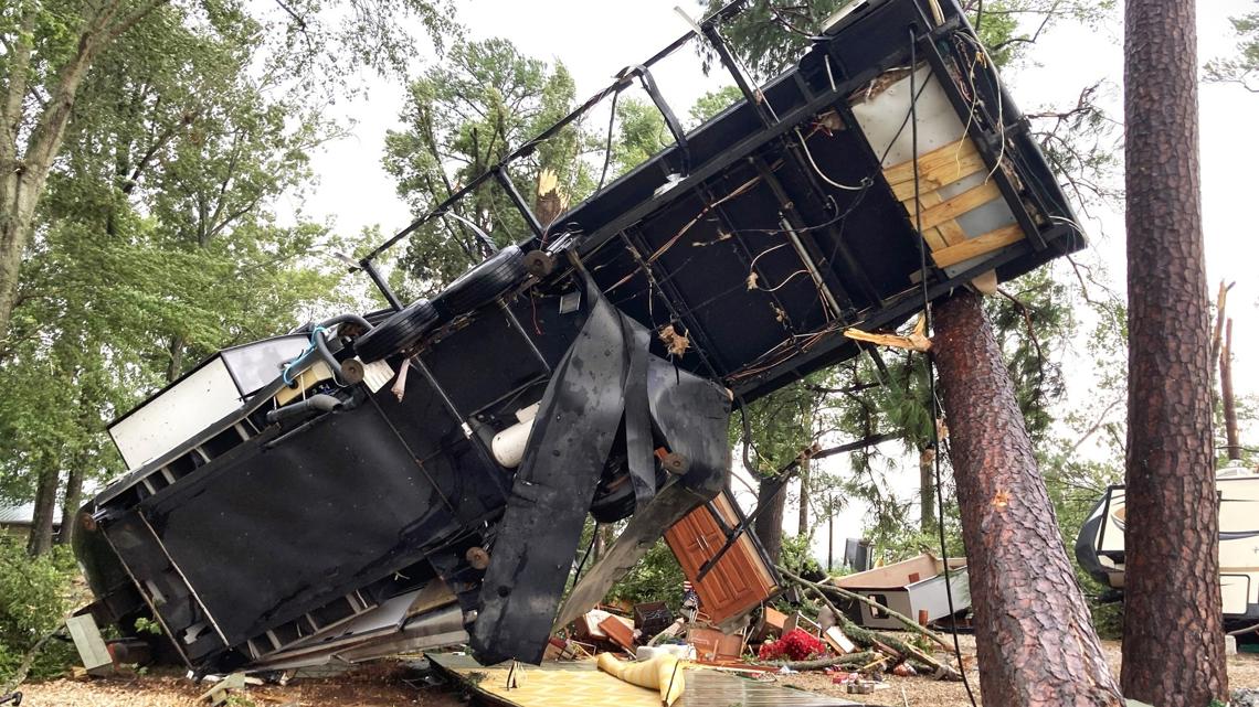
In Sabine County, NWS Shreveport said an EF1 tornado that produced winds up to 110 mph touched down in the western portion of Toledo Bend near Holly Park Marina. It originated from a supercell embedded within the outer rainbands of Tropical Storm Beryl.
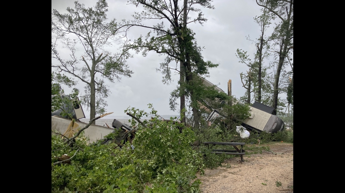
According to the weather service, this tornado may have started over the water on Toledo Bend and produced damage along the shoreline just south of the marina. The twister moved northwest, making brief contact with an RV park. A couple of RVs were overturned and tossed around, causing them to be destroyed.
Officials believe the tornado threw a few boats, ruined a boat dock, destroyed a small fish cleaning station and snapped large hardwood trees. NWS said the tornado then moved back out over the water before making contact with the shoreline south of Nine Mile Road.
According to NWS, surveyors reported several trees along East Hamilton Road northeastward onto some privately owned land, where the twister snapped and uprooted many trees. The tornado went over the water again and dissipated before causing more damage.
The tornado's path was 2.85 miles long and 440 yards wide, lasting about five minutes.


NACOGDOCHES COUNTY
In Nacogdoches County, an EF1 tornado spun up quickly and started producing damage around 1.5 miles to the southeast of Appleby on County Road 260. The tornado formed within one of the outer rainbands of Beryl. A path of minor tree damage continued as it moved northwest across the intersection of Appleby Sand Road and Cedar Bluff Road. The tornado strengthened to an EF1, uprooting and snapping the trucks of both hardwood and softwood trees.
NWS said the tornado crossed US Highway 59 North just to the southwest of Appleby and it might have lifted shortly. Surveyors found trees down and snapped on FM 2864, County Road 112 just west of FM 2864. They found significant damage to large trees on County Road 116. The twister tore the roof off of a single family home along with some damage to surrounding houses.
Tree damage was also reported on County Road 122 West just east of Highway 259, near County Road 915 and Highway 204 before the tornado lifted around County Road 814, NWS reported.
The tornado had peak wind of 110 mph. It was 7.09 miles long and 1208 yards wide. The twister lasted about eight minutes, according to NWS.


RUSK COUNTY
In Rusk County, an EF0 tornado with max winds of 85 mph first touched down and started producing damage along State Highway 259 around 9.5 miles north of Mount Enterprise. NWS said the tornado was on the ground around 3.5 miles as it tracked from Highway 259 to West County Road 377 before lifting shortly after. It was confined to both hardwood and softwood trees with a few uproots along the path.
This tornado was 3.73 miles long and 915 yards wide. It lasted roughly seven minutes, NWS said.
SHELBY COUNTY
Shelby County saw three EF1 tornadoes touch down in different parts of the county.
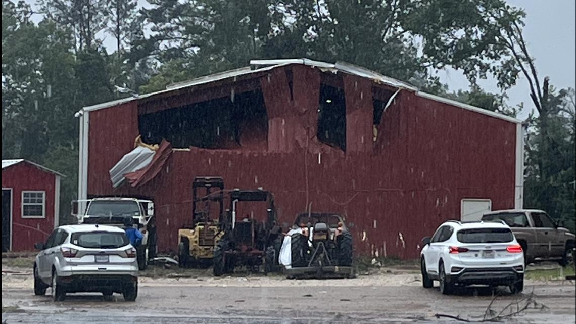
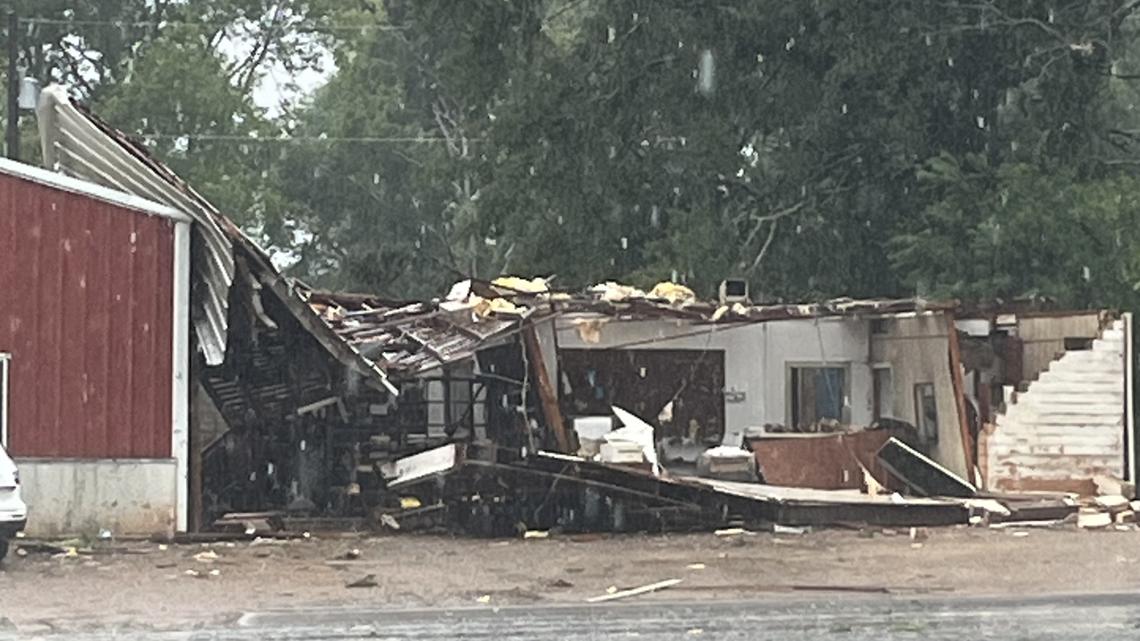
Tropical Storm Beryl created an EF1 tornado with estimated peak winds of 110 mph that started in Timpson. NWS said a business lost nearly half of its roof and an RV was destroyed. Several hardwood and softwood trees were left snapped. The twister moved northwest out of town remaining just north of Highway 84, snapping several trees again before lifting soon after crossing FM 1970 just north of County Road 4843, according to NWS.
The tornado was 2.57 miles long and 495 yards wide. It lasted for about three minutes, NWS said.
East of Center, another EF1 tornado also with a 110 mph max wind speed first touched down and started producing damage on County Road 2625 about 1.5 miles to the southeast of Shelbyville in Shelby County, NWS reported.
This tornado tracked northwest, crossing County Road 2100 and causing hardwood and softwood trees. Crews had difficulty spotting the track, but they found it again on FM 417 East about a half a mile east of Shelbyville. NWS found the track again when it entered neighborhood south of Sardis along and south of FM 414 on County Roads 3051, 3054 and 3057.
Several homes had damage to their roofs from both the wind and trees falling. NWS believes the twister tracked northwest, producing significant tree damage along County Road 3505 and County Road 3046 north of Sardis.
The tornado traveled to the northwest along County Road 3140 just northwest of James. Teams found tree damage continued along County Roads 3140, 3148, 3156 and 3129 before the tornado lifted near the Jericho Creek, according to the report.
This tornado was 10.39 miles long and 900 yards wide. It lasted about 14 minutes.
On the western shoreline of Toledo Bend near the East Hamilton area, an EF1 tornado with max winds of 110 mph touched down with damage first located along FM 2261 and County Road 2844, where a boat ramp and home were found.
Multiple trees were found snapped, blocking roadways. NWS believes that tornado started over the lake and moved over land across this area. It tracked well east of County Road 2799 through some
private roads that crews were unable to access. Crews found a small camp and smaller buildings significantly damaged.
This twister was 4.16 miles long and 530 yards wide. It lasted six minutes, NWS said.
NORTHEAST SHELBY/SOUTHEAST PANOLA COUNTIES
An EF1 tornado first touched down and caused damage along US Highway 84 East around 1.5 miles to the east of Paxton. It had max wind speed of 100 mph. The tornado moved northwest, snapping and uprooting trees along County Road 439 and County Road 430 about 1.5 miles to the east of FM 699. The twister then crossed County Road 430 again near County Road 4353.
Officials believe the tornado then lifted, leaving damage on County Road 437 just east of FM 699, where there were large branches down. The tornado was 5.13 miles and 800 yards wide, lasting about seven minutes. NWS said the twister ended around six miles north northeast on Tenaha in Panola County.
BETHANY, TEXAS AND LOUISIANA AND NORTHEAST PANOLA/SOUTHEAST HARRISON COUNTIES
A strong EF1 tornado started east of Longstreet in western DeSoto Parish, Louisiana and continued along north, northwest path, while uprooting and snapping numerous trees as well as downing powerlines and snapping power poles. The storm moved into DeSoto Parish and then Caddo Parish (causing extensive tree damage). It caused especially significant damage in Bethany, Louisiana, where the tornado was its strongest - close to an EF2.
Numerous structures were damaged by trees in Bethany, and the tornado moved to the northwest, entering northeast Panola County and southeast Harrison County. The storm ultimately lifted near the Waskom-Elysian Fields Road, NWS said.
Officials said the tornado had peak winds of 110 mph, and it was 26.1 miles long. The storm lasted 46 minutes.
A supercell embedded within the outer bands of Tropical Storm Beryl produced an additional EF1 tornado to the northeast of Tatum. It touched down around half a mile to the southeast of State Highway 43 along FM 959 and caused damage to several trees. Officials also confirmed that the tornado crossed County Road 3207 S and caused damage to trees in far northwest Rusk County. It then crossed into Harrison County around 7.5 miles south of Hallsville, and moved northwest and crossed W FM 2625. It finally lifted after crossing to W FM 968 to the west of S FM 450.
Officials said the tornado had peak winds of 110 mph and was 2.85 miles long. The storm lasted for 15 minutes.
JASPER COUNTY
On Tuesday, NWS Lake Charles confirmed an EF2 tornado moved through the Jasper area Monday as Tropical Storm Beryl moved through East Texas. According to our sister station in Beaumont KBMT, Highway 252 along County Road 356, just south of Jasper was hit especially hard.
GREGG COUNTY
A short-lived EF0 started south of Longview at 2:08 p.m., causing damage to the East Texas Regional Airport. It first produced minor tree damage on the north and south sides of Lake Cherokee on Lake Road and Post Oak Trail, continuing to the northwest towards the airport. The tornado moved through the southern portion of the airport, causing damage to a number of hangars and knocking down or twisting large hangar metal doors and ripping off side paneling to the hangars. Additional tree damage was reported on the west side of State Highway 322 across from the airport before lifting at 2:10 p.m.
Officials said the tornado had peak winds of 85 mph, and it was 3.1 miles long. It lasted for 2 minutes.
SOUTHWEST CASS COUNTY
This EF1 tornado likely touched down between County Road 2993 and County Road 2915 east of Hughes Springs. The tornado continued to the northwest, damaging wooded areas south of County Road 2911. Additional EF1 damage was reported across County Road 2910 before it headed west, following Highway 11. Damage was seen all the way to the Highway 49 intersection, ending with mostly small and large limbs near the highway.
Officials said the tornado had peak winds of 110 mph and was 4.24 miles long.
HARRISON COUNTY
Tropical Storm Beryl spawned an EF1 tornado beginning along FM 134 south of Leigh and travelling northwest. It traveled east of Bill Coleman Road, uprooting hardwood and softwood trees. It then turned north, crossing Marshall Leigh Road and travelling north again. Damage was inaccessible between Marshall Leigh Road and FM 2682 due to a lack of roads, but a consistent Tornado Debris Signature on the KSHV WSR-88D leads officials to believe the track was continuous. More damage was observed as the tornado crossed Highway 43 and moved along Peter Chapel Road, lifting near the intersection of Baldwin Road and Peter Chapel Road.
Officials said the tornado had peak winds of 107 mph and was 10.03 miles long.
BOWIE COUNTY
An EF1 tornado spun up between King and Celeste Avenues north of Highway 82 n Texarkana, damaging hardwood and softwood trees. Structural damage was reported from trees falling on buildings and automobiles, with a few instances of roofing lifted off of two homes and an older retail building along the edges of the main path of the tornado. The tornado then appeared to take an arcing motion to the west, continuing to damage trees along its path before lifting after entering Beverly Park.
Officials said the tornado had peak winds of 90 mph and was 0.22 miles long.