TYLER, Texas — Wednesday was the culmination of days of rainfall around East Texas, and it ended with a drenching. Heavy rain fell all around the region leaving many areas to deal with flooding as a result.
The major question left on many East Texan's minds, how much rain did you get?
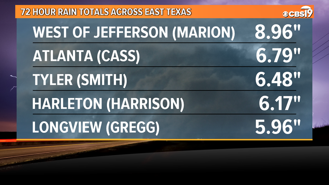
Below we have listed reports that have come into CBS 19. The are separated by counties, with totals running over the 72 hour period from Monday through Wednesday. Any 24 hour totals for locations provided to us for just the rainfall Wednesday will be listed in parenthesis.


Rainfall Reports: Location, Since Monday, (24 hours Wednesday):
Angelina County:
- Lufkin: 1.33"
- Lufkin: 0.95"
- 7.6 miles WSW of Lufkin: 1.24"
- 3 miles SW of Lufkin: 1.05"
- Zavalla: 0.87"
- Lufkin Airport: 0.85"
- 2 miles ESE of Zavalla 0.68"
Camp County:
- Pittsburg: (2.12")
Cass County:
- 2.7 miles SSW of Atlanta: 6.79" (3.89")
- Linden: 6.36"
- Linden: 5.53" (3.86")
- 1.5 miles SE of Douglassville: 4.69" (2.45")
- 0.3 miles E of Atlanta: 4.68" (1.95")
- 3.2 miles NE of Marietta: (1.91")
Cherokee County:
- 10.1 miles S of Cuney: 2.14" (1.98")
- Jacksonville: 1.99" (1.30")
- 3.3 miles W of New Summerfield: (1.50")
- 3.7 miles E of Bullard: (2.72")
Franklin County:
- 6.7 miles SW of Millers Cove: 6.12" (1.97")
- 2.3 miles NW of Talco: 3.67" (1.64")
- Mount Vernon: (1.87")
Gregg County:
- Longview: 2.75: (1.82")
- 3.4 miles NE of Longview: 5.96" (3.09")
- 0.9 miles E of Longview: 4.63: (3.29")
- 2.5 miles E of Longview: 4.52" (3.04")
Harrison County:
- 4.6 miles WSW of Harleton: 6.17" (3.86")
- 5.5 miles N of Hallsville: 3.87" (2.89")
- Caddo Lake: 3.77" (1.99")
- 3.5 miles S of Uncertain: 3.65" (1.88")
- 2.6 miles N of Karnack: 3.35"
- 3.1 miles E of Marshall: 2.50" (1.53")
- Marshall: 2.18" (1.20")
Marion County:
- 8.7 miles W of Jefferson: 8.96" (4.63")
- 6.6 miles S of Avinger: 6.15" (4.53")
- 15.4 miles ESE of Jefferson: 2.95" (1.85")
Nacogdoches County:
- Angelina River: 4.69"
- Lumberjack: 3.42"
- Nacogdoches: 1.39"
Panola County:
- Carthage: 3.89" (1.54")
- 8.2 miles NE of Carthage: 3.62"
Rusk County:
- Mount Enterprise: (1.30")
- 1.7 miles SSW of Kilgore: 3.29" (2.25")
- 4.8 miles N of Reklaw: 2.84" (1.20")
- 7 miles SSW of Henderson: 2.66" (1.71")
- 6.9 WNW of Henderson: 2.49" (2.05")
- Henderson: 2.44"
- 1.7 miles N of Henderson: 2.13" (1.67")
- Rusk County Airport: 2.10" (1.26")
Sabine County:
- Sabine South: 2.69"
Shelby County:
- Sabine North 2: 2.15"
- Center: 0.93"
Smith County:
- Noonday: (4.97")
- 1.9 miles SSW of Tyler: 6.48" (5.36")
- 3.4 miles SSE of Tyler: 6.39" (5.32")
- Tyler: 5.62" (3.84")
- 1.2 miles SW of Whitehouse: 4.36" (3.37")
- 2.9 miles N of Bullard: 4.11" (3.48")
- 2.2 miles NNE of Lindale: 3.75" (2.90")
Titus County:
- 4.0 miles NE of Rocky Mound: (0.26")
- Mount Pleasant: 5.25" (1.46")
- 5.1 miles E of Pittsburg: 3.99" (1.78")
- 2.8 miles S of Talco: 3.49"
Upshur County:
- Gilmer: 5.44" (3.59")
- Gilmer Airport: 3.98" (3.14")
- 3.9 miles E of Big Sandy: 4.82" (3.87")
Wood County:
- 0.6 miles E of Winnsboro: 5.40" (1.82")
- 6.9 miles N of Quitman: 4.84" (2.03")
- 4.1 miles W of Quitman: 4.56" (1.86")
- 2.6 miles N of Hawkins: 3.70" (3.05")
Van Zandt County:
- 7.4 miles NE of Eustace: 5.04" (3.04")
- 1.7 miles WNW of Ben Wheeler: 4.89" (3.20")
- 4.6 SSW of Canton: 4.78" (2.74")
- Wills Point: 4.48" (2.22")
- 6.1 miles W of Canton: 4.34" (3.08")
- 7.7 miles NNE of Murchison: 3.96" (3.27")
- 6.2 S of East Tawakoni: 3.78" (2.09")
Hopkins County:
- 9.7 miles E of Tira: (1.81")
- 4.3 miles E of Sulphur Springs: 3.27" (1.93")
- 1.5 miles N of Cumby: 2.95" (1.93")
- 5.6 miles SSE of Cumby: 2.74" (2.01")
- Sulphur Springs Airport: 1.80"
Henderson County:
- Tool: (3.30")
- 2.5 miles SW of Enchanted Oaks: (1.79:)
- Trinidad: 5.29" (3.93")
- 5 miles ENE of Athens: 4.87" (3.24")
- 1.9 miles NW of Gun Barrel City: 4.81" (3.52")
Anderson County:
- 4 miles ESE of Palestine: 2.88" (2.14")
- Palestine Airport: 2.85" (1.83")
- 4.8 miles W of Palestine: 2.84" (1.74")
- 1.8 miles ESE of Palestine: 2.46" (1.90")
- 5.6 miles NE of Oakwood: 2.22" (1.56")
Rains County:
- Emory: (2.19")
Houston County:
- Ratcliff: 2.97" (0.44")
- Crockett: 4.15" (0.95")
- Kennard: 4.47" (0.44")
Trinity County:
- Trinity: 0.40" (0.15")
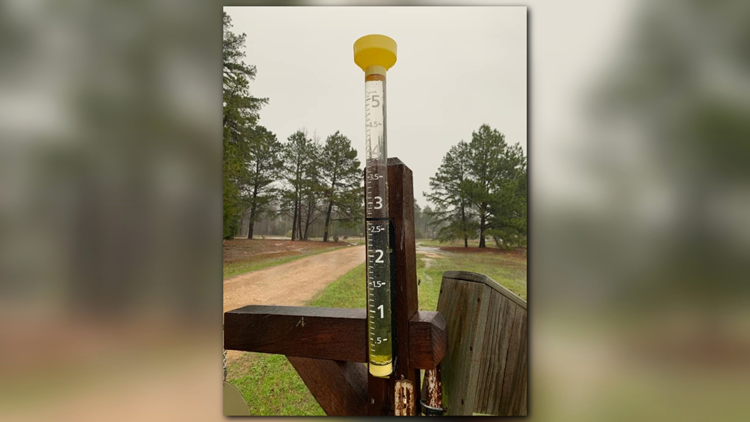
If you have any reports you would like us to add to this list please send them to weather@cbs19.tv. Any pictures of flooding or heavy rainfall around the region are welcome as well!
Connect with CBS 19 Meteorologist Michael Behrens on social media:
Do you have a weather report or pictures you would like to submit to the CBS19 Weather team? You can email news@cbs19.tv and visit our Facebook or Twitter pages.


